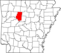
Caglesville, Arkansas

Last updated
Caglesville, Arkansas
Unincorporated community
USA Arkansas location map.svg
Red pog.svg
Caglesville, Arkansas
Caglesville's position in Arkansas.
Usa edcp location map.svg
Red pog.svg
Caglesville, Arkansas
Caglesville, Arkansas (the US)
Coordinates: 35°23′43″N92°57′53″W / 35.39528°N 92.96472°W / 35.39528; -92.96472 Coordinates: 35°23′43″N92°57′53″W / 35.39528°N 92.96472°W / 35.39528; -92.96472
Country Flag of the United States.svg  United States
State Flag of Arkansas.svg  Arkansas
County Pope County, Arkansas
Elevation 238 m (781 ft)
Time zone Central (CST) (UTC-6)
  Summer (DST) CDT (UTC-5)
GNIS feature ID 76492

Caglesville is an unincorporated community in Center Township, Pope County, Arkansas, United States. [1] The community was named for N. P. Cagle, a local mill operator. [2]

Unincorporated area Region of land not governed by own local government

In law, an unincorporated area is a region of land that is not governed by a local municipal corporation; similarly an unincorporated community is a settlement that is not governed by its own local municipal corporation, but rather is administered as part of larger administrative divisions, such as a township, parish, borough, county, city, canton, state, province or country. Occasionally, municipalities dissolve or disincorporate, which may happen if they become fiscally insolvent, and services become the responsibility of a higher administration. Widespread unincorporated communities and areas are a distinguishing feature of the United States and Canada. In most other countries of the world, there are either no unincorporated areas at all, or these are very rare; typically remote, outlying, sparsely populated or uninhabited areas.

Center Township, Pope County, Arkansas Township in Arkansas, United States

Center Township is one of nineteen current townships in Pope County, Arkansas, USA. As of the 2010 census, its unincorporated population was 523.

Pope County, Arkansas County in the United States

Pope County is a county in the U.S. state of Arkansas. As of the 2010 census, the population was 61,754. The county seat is Russellville. The county was formed on November 2, 1829, from a portion of Crawford County and named for John Pope, the third governor of the Arkansas Territory. It is an alcohol prohibition or dry county.

Related Research Articles

Arkansas State of the United States of America

Arkansas is a state in the southern region of the United States, home to over 3 million people as of 2018. Its name is of Siouan derivation from the language of the Osage denoting their related kin, the Quapaw Indians. The state's diverse geography ranges from the mountainous regions of the Ozark and the Ouachita Mountains, which make up the U.S. Interior Highlands, to the densely forested land in the south known as the Arkansas Timberlands, to the eastern lowlands along the Mississippi River and the Arkansas Delta.

Summers, Arkansas Unincorporated community in Arkansas, United States

Summers is an unincorporated community in far western Washington County, Arkansas, United States. The community has a postal designation and the population of the Summers zip code area was 942 at the 2000 census. It is part of the Fayetteville–Springdale–Rogers, Arkansas-Missouri Metropolitan Statistical Area.

Lost Corner, Arkansas Unincorporated community in Arkansas, United States

Lost Corner is an unincorporated community in Pope County, Arkansas, United States. The community changed its name from Okay to avoid confusion with a community in Howard County with the same name. Lost Corner was selected because of the backwoods location of the community.

Scottsville, Arkansas Unincorporated community in Arkansas, United States

Scottsville is an unincorporated community in Liberty Township, Pope County, Arkansas, United States. The community was named for the Scott family, and was named Rocky Point, The Level, and The Levey prior to Scottsville.

Combs, Arkansas Unincorporated community in Arkansas, United States

Combs is an unincorporated community in southern Madison County, Arkansas, United States. It is located on Arkansas Highway 16 at the southern terminus of AR 295. The community is within the Ozark-St. Francis National Forest and just south of the upper White River. The community of Brashears is about two miles east on route 16.

Floss, Arkansas Unincorporated community in Arkansas, United States

Floss is an unincorporated community in Boston Township in southwestern Washington County, Arkansas, United States. The community is located on Cove Creek. Odell is to the southwest and Strickler lies to the northeast.

Odell, Arkansas Unincorporated community in Arkansas, United States

Odell is an unincorporated community in Boston Township in southwestern Washington County, Arkansas, United States. The community is one mile north of the county line and the north boundary of the Ozark–St. Francis National Forest. Evansville is four miles west-northwest on Arkansas Highway 59 adjacent to the Arkansas - Oklahoma state line.

Blue Springs Village, Arkansas Unincorporated community in Arkansas, United States

Blue Springs Village is an unincorporated community in Brush Creek Township in northeastern Washington County, Arkansas, United States. The community is located east of Springdale, just north of U.S. Route 412 on the west bank of Beaver Lake.

Strickler, Arkansas Unincorporated community in Arkansas, United States

Strickler is an unincorporated community in Cove Creek Township, Washington County, Arkansas, United States. It is located on Arkansas Highway 265, northwest of Devil's Den State Park.

Treat, Arkansas Unincorporated community in Arkansas, United States

Treat is an unincorporated community in Pope County, Arkansas, United States.

Brentwood, Arkansas Unincorporated community in Arkansas, United States

Brentwood is an unincorporated community in Crawford Township in southeastern Washington County, Arkansas, United States. It is located on U.S. Route 71 between West Fork and Winslow. The West Fork of the White River flows past the southwest side of the community.

Woolsey, Arkansas Unincorporated community in Arkansas, United States

Woolsey, Arkansas is an unincorporated community in Crawford Township, Washington County, Arkansas, United States. It is located on U.S. Route 71 between West Fork and Winslow. The community contains the Woolsey Cemetery and Brown Bluff (3WA10), and is the namesake of the Woolsey Bridge, all on the National Register of Historic Places.

Sexton, Arkansas Ghost town in Arkansas, United States

Sexton is a former community in Dutch Mills Township, Washington County, Arkansas, United States.

Evansville, Arkansas Unincorporated community in Arkansas, United States

Evansville is an unincorporated community in southwest Washington County, Arkansas, United States. It is located on Arkansas Highway 59 near the Oklahoma state line.

Arnett, Arkansas Unincorporated community in Arkansas, United States

Arnett is an unincorporated community in White River Township, Washington County, Arkansas, United States. It is located on Arkansas Highway 74.

Morrow, Arkansas Unincorporated community in Arkansas, United States

Morrow is an unincorporated community in Washington County, Arkansas, United States. Morrow is 6.5 miles (10.5 km) south of Lincoln. Morrow has a post office with ZIP code 72749.

White Rock, Washington County, Arkansas Unincorporated community in Arkansas, United States

White Rock is an unincorporated community in Fayetteville Township, Washington County, Arkansas, United States. It is located about three miles west of Fayetteville on Arkansas Highway 16. Goose Creek is just south of the community.

Rhea, Arkansas Unincorporated community in Arkansas, United States

Rhea is an unincorporated community in Rhea's Mill Township, Washington County, Arkansas, United States. It is located on a county road north of Lincoln and Lincoln Lake. Weddington Mountain is just to the west.

Sulphur City, Arkansas Unincorporated community in Arkansas, United States

Sulphur City is an unincorporated community in White River Township, Washington County, Arkansas, United States. It is located at the intersection of Black Oak Road and Whitehouse Road (CR 43).

Tolu, Arkansas Unincorporated community in Arkansas, United States

Tolu is an unincorporated community in Vineyard Township in western Washington County, Arkansas, United States. It is located at the intersection of Highway 59 and Bellamy Road about one half mile from the Arkansas - Oklahoma border. The community of Evansville lies approximately 1.3 miles to the south, across Evansville Creek.

References

  1. "Feature Detail Report for: Caglesville, Arkansas." USGS. Profile. Retrieved June 23, 2010.
  2. Deane, Ernie (1986). Arkansas Place Names. Branson, Missouri: The Ozarks Mountaineer. p. 139.