Ashland Junction, Wisconsin | |
---|---|
Coordinates: 46°34′26″N90°58′17″W / 46.57389°N 90.97139°W | |
Country | United States |
State | Wisconsin |
County | Bayfield |
Town | Eileen |
Elevation | 199 m (653 ft) |
Time zone | UTC-6 (Central (CST)) |
• Summer (DST) | UTC-5 (CDT) |
Area codes | 715 and 534 |
GNIS feature ID | 1577496 [1] |
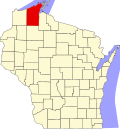
Ashland Junction is an unincorporated community located in the town of Eileen, Bayfield County, Wisconsin, United States. [1]
Ashland Junction was founded in 1883. [2] The community was named from its location at a rail junction outside of Ashland. [2] This junction was between lines of the Omaha Road (later Chicago and North Western Railroad, or C&NW), and the Northern Pacific Railroad. [3] The right-of-way of the east-west lines are now used for a rail trail known as the Tri-County Corridor.
A post office called Ashland Junction was established in 1890, and remained in operation until it was discontinued in 1910. [4]
Preceding station | Chicago and North Western Railway | Following station | ||
---|---|---|---|---|
Benoit toward Minneapolis | Minneapolis – Ashland | Ashland Terminus | ||
Barksdale toward Bayfield | Bayfield – Ashland | |||
Preceding station | Northern Pacific Railway | Following station | ||
Moquah toward Duluth | Duluth – Ashland | Ashland Terminus |
Eileen is a town in Bayfield County, Wisconsin, United States. The population was 681 at the 2010 census. The unincorporated community of Ashland Junction is located in the town.
Wyeville is a village in Monroe County, Wisconsin, United States. It is located on Wisconsin Highway 21. The population was 147 at the 2010 census.
The Chicago and North Western was a Class I railroad in the Midwestern United States. It was also known as the "North Western". The railroad operated more than 5,000 miles (8,000 km) of track at the turn of the 20th century, and over 12,000 miles (19,000 km) of track in seven states before retrenchment in the late 1970s. Until 1972, when the employees purchased the company, it was named the Chicago and North Western Railway.
The Chicago, St. Paul, Minneapolis and Omaha Railway or Omaha Road was a railroad in the U.S. states of Nebraska, Iowa, Minnesota, Wisconsin and South Dakota. It was incorporated in 1880 as a consolidation of the Chicago, St. Paul and Minneapolis Railway and the North Wisconsin Railway. The Chicago and North Western Railway (C&NW) gained control in 1882. The C&NW leased the Omaha Road in 1957 and merged the company into itself in 1972. Portions of the C. St. P. M. and O. are part of the Union Pacific Railroad network. This includes main lines from Wyeville, Wisconsin, to St. Paul, Minnesota, and St. Paul to Sioux City, Iowa.
Benoit is an unincorporated community in the towns of Keystone and Mason, Bayfield County, Wisconsin, United States. It is along County Highway F. Benoit is 13 miles southwest of the city of Ashland. Nearby is the junction of U.S. Highway 2 and U.S. Highway 63.
Forest Junction is an unincorporated census-designated place in the town of Brillion, Calumet County, Wisconsin, United States. As of the 2010 census, its population was 616.
Grand View is an unincorporated, census-designated place located in the town of Grandview, Bayfield County, Wisconsin, United States.
Salmo is an unincorporated community in Bayfield County, Wisconsin, United States.
Drummond is an unincorporated, census-designated place located in the town of Drummond, Bayfield County, Wisconsin, United States.
Marshland is an unincorporated community located in the town of Buffalo, in Buffalo County, Wisconsin, United States. Marshland is located on Wisconsin Highway 35 and Wisconsin Highway 54 8.5 miles (13.7 km) east-southeast of Fountain City.
Minnesota Junction is an unincorporated community located, in the town of Oak Grove, in Dodge County, Wisconsin, United States. Minnesota Junction is located on Wisconsin Highway 26. It is located at latitude 43.452 and longitude -88.697 at 925 feet above mean sea level.
Van Buskirk is an unincorporated community located in the town of Oma, Iron County, Wisconsin, United States.
Valley Junction is an unincorporated community located in the Town of Byron in Monroe County, Wisconsin, United States. It is located at the intersection of Wisconsin Highway 173, Monroe County Trunk Highway G, and Monroe County Highway N.
Sioux is an unincorporated community located in the town of Bayview, Bayfield County, Wisconsin, United States.
Barksdale is an unincorporated community in the town of Barksdale, Bayfield County, Wisconsin, United States. Barksdale is located on Wisconsin Highway 13 4 miles (6.4 km) south-southwest of Washburn.
Earl is an unincorporated community located in the town of Springbrook, Washburn County, Wisconsin, United States. Earl is located at the junction of U.S. Route 63 and County Highway E 8.5 miles (13.7 km) northeast of Spooner; the Wisconsin Great Northern Railroad runs through the community.
Stiles Junction is an unincorporated community located in the town of Stiles, Oconto County, Wisconsin, United States.
Leonards is an unincorporated community located in the town of Cable, Bayfield County, Wisconsin, United States.
Northline is an unincorporated community located in the town of Hudson, St. Croix County, Wisconsin, United States.
Medary (also Winona Junction) is an unincorporated community located in the town of Medary, La Crosse County, Wisconsin, United States. The Great River State Trail has its trailhead located here.