
Champawat is a town and a Nagar Palika Parishad in Champawat district in the state of Uttarakhand, India. It is the administrative headquarters of Champawat district. The town was the former capital of the Kumaon Kingdom.

Baberu is a town and a nagar panchayat in Banda district in the state of Uttar Pradesh, India. It is one of four tehsils (subdistricts) of the Banda district.

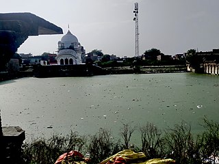
Banda district is a district of Uttar Pradesh state of India, and Banda is the district headquarters. It is a part of Chitrakoot Division.
Bhatpar Rani is a town and tehsil in Deoria District in the state of Uttar Pradesh in India. It belongs to Gorakhpur Division. It is located 48 km towards East from District headquarters Deoria.The Member of Legislative Council of Bhatpar Rani Constituency is Shri. Sabhakunwar Kushwaha In Bhatpar Rani, the block number of village is 127. The biggest village in this tehsil is Sarayan. Khan Sir(Teacher), Shilpi Raj(Singer) were born here.

Chakeri is a census town in Kanpur metropolitan area, situated about 16 kilometres east of Kanpur city in the state of Uttar Pradesh, India. It is an industrial town with textiles and food products as its major productions. Chakeri Airforce Station, North India's second-largest air force base is situated here. Chakeri is home to reputed educational institutions and colleges. Central Leather Research Institute, the only government leather research institute in North India is situated here. The Grand Trunk Road made by emperor Sher Shah Suri passes through Chakeri. The town is enlisted as a town area of the Kanpur metropolitan area.

Ganj Muradabad is a town and nagar panchayat in Bangarmau tehsil of Unnao district, Uttar Pradesh, India. It also serves as the headquarters of a community development block containing 86 rural villages. Handicrafts are a major industry here. As of 2011, Ganj Moradabad has a population of 10,957, in 1,723 households.
Gursarai is a city and municipal board in the Jhansi district of the Indian state of Uttar Pradesh. Gursarai is situated in the Garautha Tehsil. An emerging city in Jhansi District With having an old and established market, it's a lifeline for the nearby village people who come and sell their farm produces.
Kabrai is a city and a Nagar Panchayat, And a combination of 5 villages. POORANCHANDRA KUSWAHA is chairman of Kabrai nagar panchayat in Mahoba district in the Indian state of Uttar Pradesh in Bundelkhand Region. Kabrai is a City where stone mining is leading business. It is also known as stone city of uttar pradesh. There are around 350 stone crushers in and around the town. Most of city's revenue comes from mining. Due to this, place also has mining mafias. Kabrai is known for major business firms some of the name includes, Siddh Gopal Sahu,kamlesh soni ,Dheerendra pratap singh, Jaywant Singh Ankit Tripathi, Mahesh PAPPU YADAV JI Tiwari,Bapu g gurudev BIP, A.K. Tripathi, Sankar Pratap Tiwari. Kabrai is situated between Banda and Mahoba and well connected by NH 86 and NH 76 Kanpur Kabrai Road. Kabrai has a well known temple by the name of Kalshaha Baba, panch pahadi behind the name there us story that one a person was trekking on hill and there was Kalash filled with gold rolling towards him and told him to collect it and also do some good work for poor people from that day temple name is called Kalshah Baba. Kabrai is well also Connected with Railway Network. One can board trains from Kabrai Railway Station.
Kora Jahanabad is a town in Fatehpur district in the Indian state of Uttar Pradesh. It is located on Kora Road, about 6 km east of Jahanabad, about 43 km south of Kanpur, about 78 km west by northwest of Fatehpur, and 480 km southeast of Delhi. Local people also call it "Jahanabad".
Maholi is a town and a nagar panchayat in Sitapur district in the Indian state of Uttar Pradesh. It is now one of the 7 Tehsils in District Sitapur being carved out in 2013 from Misrikh.
Maudaha is a city and a Municipal Board in Hamirpur district, Uttar Pradesh, India.

Musafirkhana is a town and tehsil in Amethi district in Indian state of Uttar Pradesh. The word "Musafirkhana" means "Sarai," or "Dharamshala". Musafirkhana is located 32 km northwest of district headquarters Amethi.

Sambhal is a city located in the Sambhal district of Uttar Pradesh, India. The city lies approximately 158 km (98 mi) east of New Delhi and 355 km (220 mi) north-west of the state capital Lucknow. It also falls within the Rohilkhand region in the Moradabad division of the state, being approximately 32 km (20 miles) from the city of Moradabad. The city is considered significant by Hindus as the prophesized birthplace of Kalki, the tenth avatar of Vishnu, as mentioned in scriptures like Mahabharata, Skanda Purana, Bhavishya Purana & later Kalki Purana.
Shivli or Sheoli is a town and a nagar panchayat in Kanpur Dehat district in the Indian state of Uttar Pradesh. It is located at 26°37′0″N80°3′0″E and has an average elevation of 128 meters (423 feet).

Tundla is a town and a municipal board in Firozabad district in the Indian state of Uttar Pradesh. It is an important railway junction between the Delhi-Kanpur main line and the Agra branch line. Tundla is a railway town that sprang up when the railway was built in the late 1800s. It is served by Tundla Junction railway station. As of 2011, Tundla has a population of 50,423 people, in 8,744 households.
Kanpur Dehat district is a district in Uttar Pradesh state in northern India. The administrative headquarters of the district are at Mati-Akbarpur. This district is part of Kanpur division. Kanpur was formerly spelled Cawnpore.
Walidpur is a village in Mau district in the Indian state of Uttar Pradesh.
Ait is a small town located in Jalaun district of Uttar Pradesh.
Bhadon is a village and Gram Panchayat located in Martinganj tehsil of the Azamgarh District in the Indian state of Uttar Pradesh, near the border with Jaunpur District. It is 37.7 kilometres (23.4 mi) north-east of the district headquarters in Azamgarh and 229.9 kilometres (142.9 mi) from the state capital of Lucknow.
Manauri is a Census Town of Prayagraj, Uttar Pradesh state of India. It is a market, 4km away from Prayagraj Metropolitan Area 18 km west of Prayagraj city headquarter. It lies on the border of Prayagraj and Kaushambi district of Uttar Pradesh. On this town, a Railway Station lying nearby on the New Delhi - Howrah main line and an Air Force Station nearby on NH-2 is also named. Due to proximity of the Town with main Railway line and National highway, it has developed into a local trade market. The town has a huge population of more than 15 thousand, both of Hindus and Muslims. The main occupation is grains, vegetable and fruits agriculture along with traditional works like metal works, blacksmith, carpenter, glass works, and construction labours.

