
The Horse Block is a sea stack of the Falkland Islands. It is situated off the southwest coast of Weddell Island, 1.8 km southwest of Pillar Bluff.

Race Point is the point on the north side of Smylie Channel forming the south extremity of Weddell Island in the Falkland Islands. The point is located at 51°59′22″S61°00′00″W, which is 26.7 km south-southwest of Swan Point, 3.5 km west-northwest of neighbouring Dyke Island, 1.8 km north of West Island and 4 km north-northeast of Orford Hill, West Falkland.
Swan Point is the point on the southwest side of the entrance to Queen Charlotte Bay, forming the northeast extremity of Weddell Island in the Falkland Islands.
Weddell Settlement is the only settlement on Weddell Island in the Falkland Islands, situated on the east coast of the island at the head of the sheltered Gull Harbour, part of Queen Charlotte Bay. It is located 12.15 kilometres (7.55 mi) northeast of Race Point, 15 kilometres (9.3 mi) south by west of Swan Point, 212 kilometres (132 mi) west-southwest of Stanley and 56.6 kilometres (35.2 mi) west of Fox Bay on West Falkland.
Mount Weddell is the summit of Weddell Island in the Falkland Islands. The mountain rises to 383 metres (1,257 ft) and is situated 8 km northeast of Race Point, 9.8 km east of Pillar Bluff, 4.35 km southwest of Weddell Settlement and 4.6 km west-northwest of Circum Peak.
Pillar Bluff is a headland projecting 1.1 km from the southwest coast of Weddell Island in the Falkland Islands and forming the west side of the entrance to Pillar Cove. It is located at 51°55′47″S61°05′44″W, which is 9.3 km northwest of Race Point, 1.8 km northeast of Horse Block, 4 km southeast of Weddell Point and 9.8 km west of Mount Weddell.
Chatham Harbour is the large bay indenting the central part of Weddell Island in the Falkland Islands. It is entered east of Beacon Point and west of Loop Head. The 3 km wide bay extends 5 km in southeast direction, this part of the feature forming an anchorage named Bald Road, and north of Clay Point turning for 10 km in southwest direction. Chatham Harbour is centred at 51°50′16″S60°57′32″W.
French Harbour is the 500 m wide bay indenting for 3.1 km the west coast of Weddell Island in the Falkland Islands. It is entered 5.5 km north of Weddell Point, and centred at 51°51′03″S61°06′50″W.
Weddell Point is the point on the east side of Tea Island Passage forming the south side of the entrance to Skull Bay on the west coast of Weddell Island in the Falkland Islands. The point is located at 51°54′10″S61°08′03″W, which is 13.2 km northwest of Race Point, 1.1 km southeast of Tea Island and 1.5 km south of Skull Bay Island.
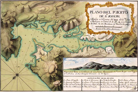
Gull Harbour is the 1.3 km wide bay indenting for 2.8 km the east coast of Weddell Island in the Falkland Islands. It is entered north of Gull Point and south of Mark Point, and is centred at 51°53′56″S60°53′20″W. The principal settlement of the island, Weddell Settlement, is situated at the head of the bay. Until the mid-nineteenth century Gull Harbour was known as Great Harbour.
Penn Island is an uninhabited island of the Weddell Island Group in the Falkland Islands. It lies north of Weddell Island, northeast of Beaver Island and west of Barclay Island.
Barclay Island is an uninhabited island of the Weddell Island Group in the Falkland Islands. It lies north of Weddell Island, east of Penn Island and west of Quaker Island.
Quaker Island is an uninhabited island of the Weddell Island Group in the Falkland Islands. It lies north of Weddell Island and east of Barclay Island.
Sea Dog Island is an uninhabited island lying off West Falkland in the Falkland Islands. It lies west by south of Race Point on Weddell Island and northwest of Cape Orford on West Falkland. The island is a designated National Nature Reserve.
Quaker Harbour is the irregularly shaped bay indenting for 3.7 km the north coast of Weddell Island in the Falkland Islands. It is centred at 51°49′00″S61°04′35″W, and has its head fed by Pitt Creek. The bay takes its name from nearby Quaker Island.
Loop Head is the point on the east side of the entrance to Chatham Harbour in Weddell Island, Falkland Islands. It is located at 51°45′48″S60°53′49″W, which is 2.4 kilometres (1.5 mi) west of Swan Point and 5.5 kilometres (3.4 mi) east-northeast of Beacon Point.
New Year Cove is the 1.7 km wide bay indenting for 2.45 km the southeast coast of Weddell Island in the Falkland Islands. It is entered north of Hadassah Point and south of Circum Point and centred at 51°56′30″S60°54′30″W.
Smylie Channel is the 1.4 kilometres (0.76 nmi) wide and 16 kilometres (8.6 nmi) long sea passage in the Falkland Islands between Weddell Island to the north and West Falkland and Dyke Island to the south. It is centred at 51°59′04″S61°03′48″W.
Hotham Heights occupy the western interior of Weddell Island in the Falkland Islands. The feature extends 9 km (5.6 mi) in southwest–northeast direction and 6 km (3.7 mi) in southeast–northwest direction, rising to 236 m (774 ft) at Chatham Hill. Hotham Heights are centred at 51°52′10″S61°04′30″W.
Circum Peak is a hill rising to 198 m (650 ft) in the southeast part of Weddell Island in the Falkland Islands. It is located at, which is 2.12 km (1.32 mi) southeast of Mount Weddell, and surmounts New Year Cove to the southeast and Gull Harbour to the northeast.

