The history of the Falkland Islands goes back at least five hundred years, with active exploration and colonisation only taking place in the 18th century. Nonetheless, the Falkland Islands have been a matter of controversy, as they have been claimed by the French, British, Spaniards and Argentines at various points.

The Falkland Islands are located in the South Atlantic Ocean between 51°S and 53°S on a projection of the Patagonian Shelf, part of the South American continental shelf. In ancient geological time this shelf was part of Gondwana, and around 400 million years ago split from what is now Africa and drifted westwards from it. Today the islands are subjected to the Roaring Forties, winds that shape both their geography and climate.

SMS Scharnhorst was an armored cruiser of the Imperial German Navy, built at the Blohm & Voss shipyard in Hamburg, Germany. She was the lead ship of her class, which included SMS Gneisenau. Scharnhorst and her sister were enlarged versions of the preceding Roon class; they were equipped with a greater number of main guns and were capable of a higher top speed. The ship was named after the Prussian military reformer General Gerhard von Scharnhorst and commissioned into service on 24 October 1907.

ARA Santa Fe was an Argentine Balao-class submarine that was lost during the Falklands War. Built by the US during the Second World War, the ship operated in the United States Navy as USS Catfish (SS-339) until 1971 when she was transferred to the Argentine Navy. She served until 1982 when she was captured by the British at South Georgia after being seriously damaged and subsequently sank along a pier, with just her conning tower (sail) visible above the waterline. The submarine was raised, towed out of the bay and scuttled in deep water in 1985.

Bleaker Island is one of the Falkland Islands, lying off south east Lafonia. The name is a corruption of "Breaker Island" due to the waves that break on it. It was also known as "Long Island" at one point.

Carcass Island is the largest of the West Point Island Group of the Falkland Islands.

Saunders Island is the fourth largest of the Falkland Islands, lying north west of West Falkland. The island is run as a sheep farm.

Pebble Island is one of the Falkland Islands, situated north of West Falkland. It is possibly named after the peculiarly spherical pebbles found at its western tip.

New Island is one of the Falkland Islands, lying north of Beaver Island. It is 238 km (148 mi) from Stanley and is 13 km (8.1 mi) long with an average width of 750 m (820 yd). The highest point is 226 metres (741 ft). The northern and eastern coasts have high cliffs but the eastern coasts are lower lying, with rocky shores and sandy bays. There are several smaller offshore islands in the group; North Island and Saddle Island have high cliffs but Ship Island and Cliff Knob Island are lower lying.

The Falkland Sound is a sea strait in the Falkland Islands. Running southwest-northeast, it separates West and East Falkland.

Port San Carlos is located on the northern bank of the inlet known as Port San Carlos, off San Carlos Water on the Western coast of East Falkland, in the Falkland Islands. It is sometimes nicknamed "KC" after former owner Keith Cameron.

Port Stanley Airport, also merely known as Stanley Airport, is a small civil airport in the Falkland Islands, located two miles from the capital, Stanley. This airport is the only civilian airport in the islands with a paved runway. However, the military airbase at RAF Mount Pleasant, located to the west of Stanley, functions as the islands' main international airport, because it has a long runway capable of handling wide-body aircraft, and allows civilian flights by prior permission from the UK Ministry of Defence (MoD). Port Stanley Airport is owned by the Government of the Falkland Islands, operated by the Falkland Islands Government Air Service, and is used for internal flights between the islands and flights between the Falklands and Antarctica. It has two asphalt-paved runways; its main runway 09/27 is 918 by 19 metres, and its secondary runway 18/36 is 338 metres long.

Port Egmont was the first British settlement in the Falkland Islands, on Saunders Island off West Falkland, and is named after John Perceval, 2nd Earl of Egmont, who was First Lord of the Admiralty at the time of its founding.

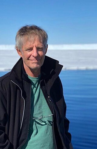
Mensun Bound is a British maritime archaeologist born in Stanley, Falkland Islands. He is best known as director of exploration for two expeditions to the Weddell Sea which led to the rediscovery of the Endurance, in which Sir Ernest Shackleton and a crew of 27 men sailed for the Antarctic on the 1914–1917 Imperial Trans-Antarctic Expedition. The ship sank after being crushed by the ice on 21 November 1915. It was rediscovered by the Endurance22 expedition on 5 March 2022.

Fox Bay is the second largest settlement on West Falkland in the Falkland Islands. It is located on a bay of the same name, and is on the south east coast of the island. It is often divided into Fox Bay East ("FBE") and Fox Bay West ("FBW") making it two settlements: combined, these make the largest settlement on West Falkland, but if separated, Port Howard is the largest. Fox Bay takes its name, like the Warrah River, from the Falkland fox, an animal locally called the warrah and now extinct.

Volunteer Point is a headland on the east coast of East Falkland, in the Falkland Islands, north-northeast of Stanley, and east of Johnson's Harbour and Berkeley Sound. It lies at the end of a narrow peninsula, which protects Volunteer Lagoon. It received its name in 1815, when the sealing ship Volunteer left a boat's crew there to collect seal skins while it went in search of opportunities elsewhere. Four years later, on 13 February 1820, the French research vessel L'Uranie struck a submerged rock just off the point but stayed afloat long enough to be beached in Berkeley Sound. All on board survived, including the Captain's wife, Rose de Freycinet, who recorded the incident in her diary.
Cape Pembroke is the easternmost point of the Falkland Islands, and is on East Falkland. There is an automated lighthouse here.
Great Island is one of the Falkland Islands. It lies to the west of East Falkland in Falkland Sound. To its north are the Tyssen Islands and to its south Ruggles Island.
Bird Island is one of the Falkland Islands. It lies due south of West Falkland, near Port Stephens and Calm Head. It has been identified as an Important Bird Area (IBA) by BirdLife International.
The islands of Africa are a major geographical sub-region of Africa, and represent a distinct demographic and historical cultural sphere of influence on the continent.


