South Georgia and the South Sandwich Islands (SGSSI) is a British Overseas Territory in the southern Atlantic Ocean. It is a remote and inhospitable collection of islands, consisting of South Georgia and a chain of smaller islands known as the South Sandwich Islands. South Georgia is 165 kilometres (103 mi) long and 35 kilometres (22 mi) wide and is by far the largest island in the territory. The South Sandwich Islands lie about 700 kilometres (430 mi) southeast of South Georgia. The territory's total land area is 3,903 km2 (1,507 sq mi). The Falkland Islands are about 1,300 kilometres (810 mi) west from its nearest point.

West Falkland is the second largest of the Falkland Islands in the South Atlantic. It is a hilly island, separated from East Falkland by the Falkland Sound. Its area is 4,532 square kilometres, 37% of the total area of the islands. Its coastline is 1,258.7 kilometres long.

East Falkland is the largest island of the Falklands in the South Atlantic, having an area of 6,605 km2 or 54% of the total area of the Falklands. The island consists of two main land masses, of which the more southerly is known as Lafonia; it is joined by a narrow isthmus where the settlement of Goose Green is located, and it was the scene of the Battle of Goose Green during the Falklands War.

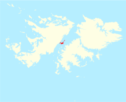
Weddell Island is one of the Falkland Islands in the South Atlantic, lying off the southwest extremity of West Falkland. It is situated 1,545 km (960 mi) west-northwest of South Georgia Island, 1,165 km (724 mi) north of Livingston Island, 606 km (377 mi) northeast of Cape Horn, 358 km (222 mi) northeast of Isla de los Estados, and 510 km (320 mi) east of the Atlantic entrance to Magellan Strait.

Speedwell Island is one of the Falkland Islands, lying in the Falkland Sound, southwest of Lafonia, East Falkland.

Carcass Island is the largest of the West Point Island Group of the Falkland Islands.
Saunders Island is the fourth largest of the Falkland Islands, lying north west of West Falkland. The island is run as a sheep farm.

The Jason Islands are an archipelago in the Falkland Islands, lying to the far north-west of West Falkland. Three of the islands, Steeple Jason, Grand Jason and Clarke's Islet, are private nature reserves owned by the Wildlife Conservation Society of New York City. Other islands in the group are National Nature Reserves owned by the Falkland Islands Government.

Pebble Island is one of the Falkland Islands, situated north of West Falkland. It is possibly named after the peculiarly spherical pebbles found at its western tip.
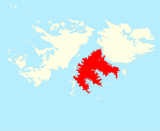
Lafonia is a peninsula forming the southern part of East Falkland, the largest of the Falkland Islands.

The Falkland Sound is a sea strait in the Falkland Islands. Running southwest-northeast, it separates West and East Falkland.

The Passage Islands are a group of four islands in the Falkland Islands of the South Atlantic Ocean. They lie off Dunnose Head, West Falkland, at the mouth of King George Bay.

Sedge Island is one of the islands of the Falkland archipelago. Something of an outlier, it is due north of the large island of West Falkland and to the east of the Jason Islands. It is north east of Carcass Island and north west of Saunders Island. It is low-lying and covered in grass and tussock, including the sedges which give it its name.
The Terra Firma Islands are a small group of islands lying 8 nautical miles north of Cape Berteaux, off the west coast of Graham Land in West Antarctica.

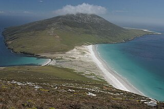
Swan Point is the point on the southwest side of the entrance to Queen Charlotte Bay, forming the northeast extremity of Weddell Island in the Falkland Islands.
Weddell Settlement is the only settlement on Weddell Island in the Falkland Islands, situated on the east coast of the island at the head of the sheltered Gull Harbour, part of Queen Charlotte Bay. It is located 12.15 kilometres (7.55 mi) northeast of Race Point, 15 kilometres (9.3 mi) south by west of Swan Point, 212 kilometres (132 mi) west-southwest of Stanley and 56.6 kilometres (35.2 mi) west of Fox Bay on West Falkland.
Chatham Harbour is the large bay indenting the central part of Weddell Island in the Falkland Islands. It is entered east of Beacon Point and west of Loop Head. The 3 km wide bay extends 5 km in southeast direction, this part of the feature forming an anchorage named Bald Road, and north of Clay Point turning for 10 km in southwest direction. Chatham Harbour is centred at 51°50′16″S60°57′32″W.
Gull Harbour is the 1.3 km wide bay indenting for 2.8 km the east coast of Weddell Island in the Falkland Islands. It is entered north of Gull Point and south of Mark Point, and is centred at 51°53′56″S60°53′20″W. The principal settlement of the island, Weddell Settlement, is situated at the head of the bay. Until the mid-nineteenth century Gull Harbour was known as Great Harbour.
Barclay Island is an uninhabited island of the Weddell Island Group in the Falkland Islands. It lies north of Weddell Island, east of Penn Island and west of Quaker Island.