Bell Buckle, Tennessee

Last updated

Bell Buckle, Tennessee
Bell-Buckle-downtown-tn1.jpg
Downtown Bell Buckle
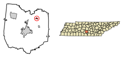
Bedford County Tennessee Incorporated and Unincorporated areas Bell Buckle Highlighted 4704460.svg
Location of Bell Buckle in Bedford County, Tennessee.
Coordinates: 35°35′27″N86°21′15″W / 35.59083°N 86.35417°W / 35.59083; -86.35417
Country United States
State Tennessee
County Bedford
Government
Area
[1]
  Total0.51 sq mi (1.32 km2)
  Land0.51 sq mi (1.32 km2)
  Water0.00 sq mi (0.00 km2)
Elevation
856 ft (261 m)
Population
 (2020) [2]
  Total410
  Density803.92/sq mi (310.61/km2)
Time zone UTC-6 (Central (CST))
  Summer (DST) UTC-5 (CDT)
ZIP code
37020
Area code 931
FIPS code 47-04460 [3]
GNIS feature ID1276910 [4]
Website townofbellbuckle.com

Bell Buckle is a town in Bedford County, Tennessee, United States. The population was 410 at the 2020 census. [5] The downtown area is listed on the National Register of Historic Places as the Bell Buckle Historic District.

Contents

Geography

Bell Buckle is located in northeastern Bedford County at 35°35′27″N86°21′15″W / 35.59083°N 86.35417°W / 35.59083; -86.35417 (35.590749, -86.354047). [6] Tennessee State Routes 82 and 269 cross at the town's center. TN 82 leads east 8 miles (13 km) to Beechgrove and Interstate 24, and west 5 miles (8 km) to U.S. Route 231 at a point 7 miles (11 km) north of Shelbyville, the county seat. TN 269 leads south 5 miles (8 km) to Wartrace and north 11 miles (18 km) to U.S. 231 near Christiana.

According to the United States Census Bureau, Bell Buckle has a total area of 0.58 square miles (1.5 km2), all land. [5]

Demographics

Historical population
CensusPop.Note
1880 298
1890 715139.9%
1900 665−7.0%
1910 466−29.9%
1920 4711.1%
1930 378−19.7%
1940 355−6.1%
1950 341−3.9%
1960 318−6.7%
1970 39323.6%
1980 45014.5%
1990 326−27.6%
2000 39119.9%
2010 50027.9%
2020 410−18.0%
Sources: [7] [8] [2]

As of the census [3] of 2000, there were 391 people, 167 households, and 105 families residing in the town. The population density was 813.6 inhabitants per square mile (314.1/km2). There were 183 housing units at an average density of 380.8 per square mile (147.0/km2). The racial makeup of the town was 97.95% White and 2.05% African American.

There were 167 households, out of which 25.7% had children under the age of 18 living with them, 50.9% were married couples living together, 9.0% had a female householder with no husband present, and 37.1% were non-families. 35.3% of all households were made up of individuals, and 13.2% had someone living alone who was 65 years of age or older. The average household size was 2.24 and the average family size was 2.91.

In the town, the population was spread out, with 19.7% under the age of 18, 9.5% from 18 to 24, 26.1% from 25 to 44, 28.1% from 45 to 64, and 16.6% who were 65 years of age or older. The median age was 42 years. For every 100 females, there were 109.1 males. For every 100 females age 18 and over, there were 107.9 males.

The median income for a household in the town was $27,188, and the median income for a family was $40,000. Males had a median income of $30,417 versus $15,556 for females. The per capita income for the town was $16,235. About 8.2% of families and 15.6% of the population were below the poverty line, including 3.4% of those under age 18 and 18.3% of those age 65 or over.

2010 census

The 2010 census showed the population of Bell Buckle to have risen to 500 people, with a total population growth of 27.9%. The census documented 62.8% of the population as being 18 years of age or above, and 37.2% as under 18. The racial makeup of the town was 84.8% White, 8.2% Asian, 3.2% Hispanic, 2.8% African American and 1% from two or more races.

The 2010 census documented 164 housing units, 87.2% of which were occupied, and 12.8% were vacant.

History

The origin of the town's unusual name is not known. According to the local chamber of commerce, one story says that one of the first white men to travel through the area found a tree with carvings of a cowbell and a buckle, possibly carved by Indians to warn white settlers away, or possibly carved by surveyors to mark the area as good pasture. Another form of the legend holds that a bell and buckle were tied around a tree. In any case, the nearby creek was named Bell Buckle Creek, and the town later took the name of the creek. [9]

The Bell Buckle area was settled in the early 19th century. A bustling town grew up after the Nashville and Chattanooga Railroad came through the area in 1852. A railroad depot was built in 1853, and the town was incorporated in 1856. Bell Buckle had its period of greatest prosperity after about 1870, becoming the major stockyard between Nashville and Chattanooga and growing to a population of more than 1,000. [9]

The town name was spelled Belle Buckle until the early 1900s, as that was the spelling by the post office and on cancellation devices (1896), by the Nashville, Chattanooga and St. Louis Railway on its 1903 route map, [10] and on the sign on an undated photo of the train station. It is not known exactly when the spelling was changed to Bell Buckle, but it was sometime before 1935 when Tennessee started issuing delayed birth certificates for residents who needed them to apply for Social Security.

In June 1940, US Army maneuvers centered on the area. A tank of General George S. Patton's Second Armored Division ran into the two-story town hall, bringing the building down. [11]

Sightseeing and tourism

Bell Buckle is noted for the many preserved and restored Victorian homes, shops, and churches located in and around downtown. Bell Buckle is a center for antiques, quilts, and various handmade crafts. The town hosts two yearly festivals: the RC Cola & Moon Pie festival [12] and the Webb School Arts & Crafts Fair.

A member of Tennessee Backroads, Bell Buckle has the distinction of being the smallest town in Tennessee to be a Tree City USA. Bell Buckle is the home of The Webb School (which relocated from Culleoka in 1886), a college preparatory boarding and day school which plays an integral part in the ambience of the town.

Notable residents

Related Research Articles

<span class="mw-page-title-main">Cheatham County, Tennessee</span> County in Tennessee, United States

Cheatham County is a county located in the U.S. state of Tennessee. As of the 2020 census, the population was 41,072. Its county seat is Ashland City. Cheatham County is located in Middle Tennessee, and is part of the Nashville-Davidson–Murfreesboro–Franklin, TN Metropolitan Statistical Area.

<span class="mw-page-title-main">Bedford County, Tennessee</span> County in Tennessee, United States

Bedford County is a county located in the U.S. state of Tennessee. As of the 2020 census, the population was 50,237. Its county seat is Shelbyville. Bedford County comprises the Shelbyville, TN Micropolitan Statistical Area, which is also included in the Nashville-Davidson-Murfreesboro, TN Combined Statistical Area.

<span class="mw-page-title-main">Littleville, Alabama</span> Town in Alabama, United States

Littleville is a town located on the southern border of Colbert County, Alabama, United States, and extends into Franklin County. It is part of the Florence - Muscle Shoals Metropolitan Statistical Area known as "The Shoals". As of the 2010 census, the population of the town was 1,011.

<span class="mw-page-title-main">Langston, Alabama</span> Town in Alabama, United States

Langston is a town in Jackson County, Alabama, United States, and is included in the Chattanooga-Cleveland-Dalton, TN-GA-AL Combined Statistical Area. In the 2010 census, the population was 270, up from 254. It initially incorporated in 1899. At some point after 1920 it disincorporated, then reincorporated in 1980. Its peak population was 500, in 1920.

Mechanicsville is a former census-designated place (CDP) in Montour County, Pennsylvania, United States. The population was 3,099 at the 2000 census. It is part of the Bloomsburg-Berwick micropolitan area. As of the 2010 census, Mechanicsville was not listed as a CDP or as any populated place.

<span class="mw-page-title-main">Normandy, Tennessee</span> Town in Tennessee, United States

Normandy is a town in Bedford County, Tennessee. The population was 108 at the 2020 census. Normandy Dam is located just northeast of the town. The town is listed on the National Register of Historic Places as the Normandy Historic District. The historic Beech Hall is also located near Normandy.

<span class="mw-page-title-main">Wartrace, Tennessee</span> Town in Tennessee, United States

Wartrace is a town in Bedford County, Tennessee. The population was 653 at the 2020 census. It is located northeast of Shelbyville. The downtown area is listed on the National Register of Historic Places as the Wartrace Historic District.

<span class="mw-page-title-main">Woodbury, Tennessee</span> Town in Tennessee, United States

Woodbury is a town in Cannon County, Tennessee, United States. Woodbury is part of the Nashville Metropolitan Statistical Area and is located 55 miles (89 km) southeast of downtown Nashville. The population of Woodbury was 2,680 at the 2010 census. It is the county seat of Cannon County.

<span class="mw-page-title-main">Manchester, Tennessee</span> City in Tennessee, United States

Manchester is a city in Coffee County, Tennessee, United States. The population was 12,213 at the 2020 census. It is the county seat of Coffee County. The city is located halfway between Nashville and Chattanooga on Interstate 24.

<span class="mw-page-title-main">Alexandria, Tennessee</span> Town in Tennessee, United States

Alexandria is a town in DeKalb County, Tennessee, United States. The population was 966 at the 2010 census.

<span class="mw-page-title-main">Cowan, Tennessee</span> City in Tennessee, United States

Cowan is a city in Franklin County, Tennessee, United States. The population was 1,737 at the 2010 census. It is part of the Tullahoma, Tennessee Micropolitan Statistical Area.

<span class="mw-page-title-main">Decherd, Tennessee</span> City in Tennessee, United States

Decherd is a city in Franklin County, Tennessee, United States. The population was 2,379 at the 2020 census and 2,361 at the 2010 census.

<span class="mw-page-title-main">Signal Mountain, Tennessee</span> Town in Tennessee, United States

Signal Mountain is a town in Hamilton County, Tennessee, United States. The town is a suburb of Chattanooga and is located on Walden Ridge. "Signal Mountain" is used as a colloquial name for the part of Walden Ridge close to the town. The town population was 8,852 as of the 2020 census and estimated to be 8,567 in 2018.

<span class="mw-page-title-main">Hohenwald, Tennessee</span> City in Tennessee, United States

Hohenwald is a city in and the county seat of Lewis County, Tennessee. The population was 3,757 at the 2010 census. The name "Hohenwald" derives from German meaning “High Forest".

<span class="mw-page-title-main">Kimball, Tennessee</span> Town in Tennessee, United States

Kimball is a town in Marion County, Tennessee, United States. The population was 1,545 at the 2020 census and 1,395 in 2010. It is part of the Chattanooga, TN–GA Metropolitan Statistical Area.

<span class="mw-page-title-main">South Pittsburg, Tennessee</span> City in Tennessee, United States

South Pittsburg is a city in Marion County, Tennessee, United States. It is part of the Chattanooga, TN–GA Metropolitan Statistical Area. The population was 3,106 at the 2020 census. South Pittsburg is home to the National Cornbread Festival.

<span class="mw-page-title-main">Chapel Hill, Tennessee</span> Town in Tennessee, United States

Chapel Hill is a town in northeastern Marshall County, Tennessee, United States. The town was named after Chapel Hill, North Carolina, by settlers from that area. The population was 1,717 as of the 2020 census.

<span class="mw-page-title-main">Nesbitt, Texas</span> Unincorporated community in Texas, United States

Nesbitt is an unincorporated community in Harrison County, Texas, United States. Nesbitt's town government was disestablished on January 1, 2000, but it was still listed as a town at the 2010 census, with a population of 281.

<span class="mw-page-title-main">Monteagle, Tennessee</span> Town in Tennessee, United States

Monteagle is a town in Franklin, Grundy, and Marion counties in the U.S. state of Tennessee, in the Cumberland Plateau region of the southeastern part of the state. The population was 1,238 at the 2000 census – 804 of the town's 1,238 residents (64.9%) lived in Grundy County, 428 (34.6%) in Marion County, and 6 (0.5%) in Franklin County. The population at the 2020 census was 1,393.

Buchanan Valley Township is a former township in Emmons County, North Dakota. Its population as of the 2000 Census was 40. The township was dissolved on March 23, 2009, and added to the census-designated North Emmons Unorganized Territory.

References

  1. "ArcGIS REST Services Directory". United States Census Bureau. Retrieved October 15, 2022.
  2. 1 2 "Census Population API". United States Census Bureau. Retrieved October 15, 2022.
  3. 1 2 "U.S. Census website". United States Census Bureau . Retrieved January 31, 2008.
  4. "US Board on Geographic Names". United States Geological Survey. October 25, 2007. Retrieved January 31, 2008.
  5. 1 2 "Geographic Identifiers: 2010 Demographic Profile Data (G001): Bell Buckle town, Tennessee". U.S. Census Bureau, American Factfinder. Archived from the original on February 12, 2020. Retrieved April 8, 2014.
  6. "US Gazetteer files: 2010, 2000, and 1990". United States Census Bureau. February 12, 2011. Retrieved April 23, 2011.
  7. "Census of Population and Housing: Decennial Censuses". United States Census Bureau . Retrieved March 4, 2012.
  8. "Incorporated Places and Minor Civil Divisions Datasets: Subcounty Resident Population Estimates: April 1, 2010 to July 1, 2012". Population Estimates. U.S. Census Bureau. Archived from the original on June 11, 2013. Retrieved December 11, 2013.
  9. 1 2 Local History Archived January 13, 2008, at the Wayback Machine and Bell Buckle Past and Present Archived November 15, 2007, at the Wayback Machine on Bell Buckle Chamber of Commerce website (accessed December 19, 2007).
  10. Nashville, Chattanooga and St. Louis Railway/History, accessed September 5, 2022
  11. Dickson, Paul (July 7, 2020). The Rise of the G.I. Army, 1940-1941: The Forgotten Story of How America Forged a Powerful Army Before Pearl Harbor (Kindle ed.). 2809: Atlantic Monthly Press. ISBN   978-0802147677.{{cite book}}: CS1 maint: location (link)
  12. "RC Cola and Moon Pie Festival". Bell Buckle Chamber of Commerce. Archived from the original on November 19, 2007. Retrieved November 21, 2007.
  13. Hee Haw Season 6 Episode 18
  14. Gintzler, Ariella. "Meet Lazarus Lake, the Man Behind the Barkley Marathons". outsideonline.com/.
  15. Holly Finley #51277 | Professional Disc Golf Association. https://www.pdga.com/player/51277/

35°35′27″N86°21′15″W / 35.590749°N 86.354047°W / 35.590749; -86.354047