Boron Air Force Station

Last updated

Boron Air Force Station
Air Defense Command.svg
Part of Air Defense Command (ADC)
USA California location map.svg
Red pog.svg
Boron AFS
Location of Boron AFS, California
Coordinates 35°04′54.1″N117°34′58.4″W / 35.081694°N 117.582889°W / 35.081694; -117.582889 (Boron AFS P-59) [1]
TypeAir Force Station
CodeADC ID: P-59, NORAD ID: Z-59
Site information
Controlled byFlag of the United States Air Force.svg  United States Air Force
Site history
Built1952
In use1952–1975
Garrison information
Garrison
  • 750th Radar Squadron (SAGE)
  • 750th Aircraft Control and Warning Squadron

Boron Air Force Station is a closed United States Air Force General Surveillance Radar station. It is located 6.8 miles (10.9 km) northeast of Boron, California. It was closed by the Air Force in 1975 and turned over to the Federal Aviation Administration (FAA). The radar site is still operated by the FAA as part of the Joint Surveillance System (JSS).

Contents

History

Boron Air Force Station was one of twenty-eight stations built as part of the second segment of the Air Defense Command permanent radar network. Prompted by the start of the Korean War, Secretary of the Air Force Thomas K. Finletter asked Secretary of Defense Louis A. Johnson on 11 July 1950 for approval to expedite construction of the permanent network. Receiving approval 10 days later, the Air Force directed the Army Corps of Engineers to proceed with construction.[ citation needed ]

The 750th Aircraft Control and Warning Squadron was assigned to Atolia, California, on 28 January 1952. It assumed coverage responsibilities formerly held by the temporary Lashup Radar Network site at Edwards Air Force Base (L-40). It operated two AN/FPS-10 radars and initially functioned as a ground-controlled interception (GCI) and warning station. As a GCI station, the squadron's role was to guide interceptor aircraft toward unidentified intruders. Atolia AFS was renamed Boron Air Force Station on 1 December 1953.

The AN/FPS-10 search radar at Boron remained until 1959. In 1958 an AN/FPS-6 replaced the AN/FPS-10 height finder radar. A second height finder radar (an AN/FPS-6A) was installed in 1959.[ clarification needed ]

During 1961 Boron AFS joined the Semi-Automatic Ground Environment (SAGE) system, feeding data to DC-17 at Norton Air Force Base, California. After joining, the squadron was redesignated as the 750th Radar Squadron (SAGE) on 1 May 1961. The radar squadron provided continuous information to the SAGE Direction Center, where it was analyzed to determine range, direction, altitude, speed, and whether aircraft were friendly or hostile.

A separate Ground Air Transmit Receive (GATR) site was located 3.5 miles NNW of the main site to provide some isolation from the high-powered RF energy from the search radar systems for the GATR's HF/VHF/UHF voice and data air-to-ground communications. GATR sites used voice communications via AN/GRT-3 [2] transmitters and AN/GRR-7 [3] receivers to guide F-106 Delta Dart and other suitably-equipped intercept aircraft to airborne targets. AN/GRC-27 [4] backup transceivers were used to cover frequencies that were lost due to outages of the main transmitters and receivers. In addition to these, an AN/GKA-5 Time Division Data Link (TDDL) system [5] [6] was used to digitally provide the vectoring data to the intercept aircraft.

In addition to the defense mission, Boron AFS became a joint-use facility with the Federal Aviation Administration (FAA) for use in tracking aircraft in the Los Angeles sector. By this time the AN/FPS-10 had been replaced by an AN/FPS-20 search radar. However, this radar was soon replaced by an AN/FPS-35 frequency diversity radar. By 1963 this radar operated with AN/FPS-26A and AN/FPS-90 height-finder radars. Boron AFS was re-designated as NORAD ID Z-59 on 31 July 1963.

In 1968 the AN/FPS-90 was deactivated. In 1969 the AN/FPS-35 was removed, and was replaced by an AN/FPS-67 on the same tower (and with a radome); it became operational in 1970.

In addition to the main facility, Boron operated these AN/FPS-14 gap-filler sites:

Over the years, the equipment at the station was upgraded or modified to improve the efficiency and accuracy of the information gathered by the radars. The 750th Radar Squadron was inactivated on 30 June 1975. The FAA retained the AN/FPS-67, and continues to operate it today as part of the Joint Surveillance System (JSS).

In 1979, Boron AFS was converted into Federal Prison Camp, Boron, a minimum-security federal prison for male inmates that was closed in 2000. The prison site and housing area have been completely demolished. The U.S. Department of Justice is currently investigating trespass activity at FPC Boron. All identified instances of trespass are logged, and trespassers may be subject to federal and state prosecution including imprisonment and/or fines. [8]

Air Force units and assignments

Emblem of the 750th Radar Squadron 750th Radar Squadron - Emblem.png
Emblem of the 750th Radar Squadron

Units

Activated at Edwards AFB, California on 8 October 1950 [9]
Moved to Atolia, California on 28 January 1952 [10]
Site redesignated Boron Air Force Station, 1 December 1953
Redesignated 750th Radar Squadron (SAGE) on 1 May 1961
Redesignated 750th Radar Squadron on 1 February 1974
Inactivated on 30 June 1975

Assignments

See also

Related Research Articles

Point Arena Air Force Station is a closed United States Air Force General Surveillance Radar station. It is located 3.7 miles (6.0 km) east of Point Arena, California. It was closed in 1998 by the Air Force, and turned over to the Federal Aviation Administration (FAA).

Empire Air Force Station is a former United States Air Force Aerospace Defense Command (ADC) long range radar site located 0.7 miles (1.1 km) south-southeast of Empire, Michigan, in Empire Township. It was closed in 1978 by the Air Force, and turned over to the Federal Aviation Administration (FAA).

<span class="mw-page-title-main">Ground Equipment Facility J-33</span> Federal Aviation Administration (FAA) radar station

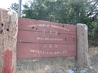
Ground Equipment Facility J-33 is a Federal Aviation Administration (FAA) radar station of the Joint Surveillance System's Western Air Defense Sector (WADS) with an Air Route Surveillance Radar (ARSR-4). The facility was previously a USAF general surveillance radar station during the Cold War.

<span class="mw-page-title-main">Fortuna Air Force Station</span> North Dakota, an abandoned Air Force Long Range radar site

Fortuna Air Force Station is a closed United States Air Force General Surveillance Radar station. It is located 4.2 miles (6.8 km) west of Fortuna, North Dakota. It was closed in 1979 as a radar station, remaining as a Long-Range Radar (LRR) facility until 1984.

<span class="mw-page-title-main">Finley Air Force Station</span> Former US Air Force radar station

Finley Air Force Station is a closed United States Air Force General Surveillance Radar station. It is located 1.5 miles (2.4 km) west-northwest of Finley, North Dakota. It was closed in 1979 by the Air Force, and turned over to the Federal Aviation Administration (FAA).

Thomasville Air Force Station is a closed United States Air Force General Surveillance Radar station. It is located 1.9 miles (3.1 km) north-northwest of Thomasville, Alabama. It was closed in 1969.

<span class="mw-page-title-main">Tonopah Air Force Station</span> Radar station in Nevada, US 1956–1970

Tonopah Air Force Station is a closed United States Air Force General Surveillance Radar station. It is located 1.1 miles (1.8 km) south of Tonopah, Nevada. It was closed in 1970.

Bedford Air Force Station is a closed United States Air Force General Surveillance Radar station. It is located 12.7 miles (20.4 km) north of Bedford, Virginia. It was closed in 1975.

North Charleston Air Force Station is a closed United States Air Force General Surveillance Radar station. It is located in the City of North Charleston, South Carolina. It was closed in 1980.

<span class="mw-page-title-main">Kirksville Air Force Station</span> Former US Air Force radar station in Missouri

Kirksville Air Force Station is a closed United States Air Force General Surveillance Radar station. It is located 7.1 miles (11.4 km) north of Kirksville, Missouri. It was closed by the Air Force in 1968. Today the radar site is used by the Federal Aviation Administration (FAA) as a Joint Surveillance System (JSS) site.

Dauphin Island Air Force Station is a closed United States Air Force General Surveillance Radar station. It is located 1.9 miles (3.1 km) east of Dauphin Island, Alabama, near historic Fort Gaines (Alabama). It was closed in 1980.

<span class="mw-page-title-main">Eufaula Air Force Station</span>

Eufaula Air Force Station is a closed United States Air Force General Surveillance Radar station. It is located 6.4 miles (10.3 km) west of Eufaula, Alabama. It was closed in 1968.

Omaha Air Force Station is a closed United States Air Force General Surveillance Radar station. It is located 7.5 miles (12.1 km) north of Omaha, Nebraska. It was closed in 1968.

<span class="mw-page-title-main">Finland Air Force Station</span> Radar station in Minnesota, US 1950–1980

Finland Air Force Station is a closed United States Air Force General Surveillance Radar station. It is located 2.8 miles (4.5 km) north of Finland, Minnesota. It was closed in 1980.

Olathe Air Force Station is a former United States Air Force radar station that was located in Gardner, Kansas. It was located next to Naval Air Station Olathe, now the grounds of New Century AirCenter.

<span class="mw-page-title-main">Ajo Air Force Station</span> Closed USAF surveillance radar site

Ajo Air Force Station is a closed United States Air Force General Surveillance Radar station. It is located 6.4 miles (10.3 km) northwest of Ajo, Arizona. It was closed in 1969 by the Air Force, and the radar site turned over to the Federal Aviation Administration (FAA).

<span class="mw-page-title-main">Mount Lemmon Air Force Station</span> Closed US Air Force surveillance radar station

Mount Lemmon Air Force Station is a closed United States Air Force General Surveillance Radar station. It is located 17.2 miles (27.7 km) north-northeast of Tucson, Arizona. It was closed in 1969.

Mica Peak Air Force Station is a closed United States Air Force General Surveillance Radar station. It is located atop Mica Peak, 6.3 miles (10.1 km) east-northeast of Mica, Washington. It was closed in 1975 by the Air Force, and turned over to the Federal Aviation Administration (FAA).

<span class="mw-page-title-main">Blaine Air Force Station</span> Closed United States Air Force General Surveillance Radar station

Blaine Air Force Station is a closed United States Air Force General Surveillance Radar station. It is located 5.5 miles (8.9 km) south of Blaine, Washington. It was closed in 1979.

Makah Air Force Station is a closed United States Air Force General Surveillance Radar station. It is located 2.4 miles (3.9 km) south of Neah Bay, Washington. It was closed in 1988 by the Air Force, and turned over to the Federal Aviation Administration (FAA).

References

PD-icon.svg This article incorporates public domain material from the Air Force Historical Research Agency

  1. U.S. Geological Survey Geographic Names Information System: Boron Air Force Station (historical)
  2. "Radio Transmitting Set AN/GRT-3 Military MILITARY U.S." Radiomuseum. Retrieved 17 March 2022.
  3. "TO-31R2-2GRR7-2" (PDF). radionerds.com.
  4. "AN/GRC-27 - RadioNerds". RadioNerds. 17 May 2018. Retrieved 17 March 2022.
  5. "AN/GKA-5 TDDL". Radomes.org. Retrieved 17 March 2022.
  6. "MA-1 SAGE : F-106 Delta Dart : Ultimate Interceptor : Century Series Fighter : Convair". Archived from the original on 28 March 2016. Retrieved 17 March 2022.
  7. "ULS License - Other Indust/Land Transp. 896-901/935-940 MHz, Trunked License - WNVW900 - SOUTHERN CALIFORNIA EDISON COMPANY - Locations Summary". FCC . 2 August 2018. Retrieved 17 March 2022.
  8. "FPC Boron - No Trespassing Warning". Federal Bureau of Prisons . Retrieved 18 March 2022.
  9. Mueller, Robert, Air Force Bases, Vol. I, p. 127
  10. Ibid.