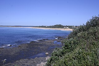
A seaside resort is a town, village, or hotel that serves as a vacation resort and is located on a coast. Sometimes the concept includes an aspect of official accreditation based on the satisfaction of certain requirements, such as in the German Seebad. Where a beach is the primary focus for tourists, it may be called a beach resort.

The Mornington Peninsula is a peninsula located south of Melbourne, Victoria, Australia. It is surrounded by Port Phillip to the west, Western Port to the east and Bass Strait to the south, and is connected to the mainland in the north. Geographically, the peninsula begins its protrusion from the mainland in the area between Pearcedale and an area north of Frankston. The area was originally home to the Mayone-bulluk and Boonwurrung-Balluk clans and formed part of the Boonwurrung nation's territory prior to European settlement.

Byron Bay is a beachside town located in the far-northeastern corner of the state of New South Wales, Australia on Bundjalung Country. It is located 772 kilometres (480 mi) north of Sydney and 165 kilometres (103 mi) south of Brisbane. Cape Byron, a headland adjacent to the town, is the easternmost point of mainland Australia. At the 2016 census, the town had a permanent population of 9,246. It is the largest town of Byron Shire, though not the shire's administrative centre.

Ballina is a town in the Northern Rivers region of New South Wales, Australia, and the seat of the Ballina Shire local government area. Ballina's urban population at June 2018 was 26,381. The town lies on the Richmond River and serves as a gateway to Byron Bay.

Torquay is a seaside resort in Victoria, Australia, which faces Bass Strait, 21 km south of Geelong and is the gateway to the Great Ocean Road. It is bordered on the west by Spring Creek and its coastal features include Point Danger and Zeally Bay. At the 2016 Census, Torquay had a population of 13,258.

The Tweed River is a river situated in the Northern Rivers district of New South Wales, Australia. From the middle reaches of its course, the state boundary between New South Wales and Queensland is located approximately 10 kilometres (6.2 mi) north.

Uki is a village situated near Mount Warning in the Tweed Valley of far northern New South Wales, Australia in the Tweed Shire. At the 2011 census, Uki had a population of 765 people. Its name may have come from an aboriginal word for "small water plant with a yellow flower and edible root".

Mullumbimby is an Australian town in the Byron Shire in the Northern Rivers region of New South Wales. It promotes itself as "The Biggest Little Town in Australia". The town lies at the foot of Mount Chincogan in the Brunswick Valley about 9 kilometres by road from the coast. At the 2016 census, Mullumbimby and the surrounding area had a population of 3,596 people.

Wye River is a small town in Victoria, Australia. It is also the name given to the waterway which flows through the town and into the sea at this point. Situated some 155 km west of Melbourne, on the Otway Coast part of the scenic Great Ocean Road, the Wye River township is a popular tourist destination about 15 km west of the resort town of Lorne, Victoria. It became a popular place for Melburnians to holiday after the Great Ocean Road was officially opened in 1932. The postcode of Wye River is 3234. At the 2016 census, Wye River had a permanent population of 66 although its holiday population is ten times that number.

Suffolk Park is a suburb in the Byron Shire of the Northern Rivers region in New South Wales, Australia. It is 5 km south of Byron Bay. At the 2016 Census, its population was 3,750.

Culburra Beach, commonly referred to as Culburra, is a town located in the South Coast region of New South Wales, Australia. Located within the Shoalhaven local government area, the town is 18 kilometres (11 mi) east-southeast of Nowra on Jerrinja Wandi Wandian Aboriginal Country. At the 2016 census, the town had a population of 2,874 and is the regional centre for the coastal villages of Currarong, Callala Beach, Callala Bay and Orient Point.

Lennox Head is a seaside village in the Northern Rivers region of New South Wales, Australia, situated on the stretch of coast between Byron Bay and Ballina in Ballina Shire local government area. It had a population of 7,741 in the 2016.

Forster is a coastal town in the Mid North Coast region of New South Wales, Australia, in the Mid-Coast Council LGA, about 308 km north-north-east of Sydney. It is immediately adjacent to its twin, Tuncurry, which is the smaller of the two towns. Forster is known for its stunning waters and Manning Valley beauty.

Ocean Shores is a coastal town in the Northern Rivers region of New South Wales, Australia. Established in 1969, Ocean Shores was originally a land holding owned by Wendell West of Washington with backing from American singer Pat Boone, and was named after Boone's residence in Ocean Shores, Washington. It is located in the Brunswick Valley – a valley including the towns of Mullumbimby and Brunswick Heads. The town has a local shopping complex and a large golf course. At the 2016 census, Ocean Shores had a population of 5,137 people.

Shoalhaven Heads is a town in Shoalhaven, New South Wales, Australia. At the 2016 census, Shoalhaven Heads had a population of 3,059 people. It has a fine surfing beach, access to the Shoalhaven River and is surrounded by wineries.

Brunswick River is an open mature wave dominated barrier estuary, located in the Northern Rivers region of New South Wales, Australia.

Green Head is a small Australian coastal town in the Shire of Coorow. The town is situated between Geraldton and Perth in the Mid West region of Western Australia along Indian Ocean Drive. Its beaches and lifestyle provide a relaxed holiday atmosphere. It is the home of what was a significant, but now declining, rock lobster industry.

Gerroa is a coastal town in the Municipality of Kiama, in the Illawarra region of New South Wales, Australia 133 kilometres south of Sydney. It is considered to be the southernmost town in the Illawarra region. Nearby towns are Gerringong, Kiama and Berry.

Broken Head is a coastal feature (promontory/headland) and suburb located in the Northern Rivers region of New South Wales, Australia, approximately 9 km south of Cape Byron, the easternmost point of Australia, the closest town being Byron Bay. Immediately adjacent is the 98-hectare (240-acre) Broken Head Nature Reserve which contains an intact segment of littoral rainforest. The suburb of Broken Head contained a population of 225 at the 2011 national census, and in addition supports some tourist accommodation and a campsite. The area is noted for its Aboriginal culture, rainforest walks, whale watching and fishing from pristine beaches, and it is also highly regarded as a surfing locality. The Broken Head Holiday Park is currently administered by the indigenous Arakwal people, having been passed to their control by the New South Wales Crown Lands Department in 2009.

Brunswick Valley Heritage Park, also known as Mullumbimby Heritage Park, is a rainforest arboretum and recreation park located on the banks of the Brunswick River in Mullumbimby, north-eastern New South Wales, Australia. Established in 1980, the arboretum has 300 species of local rainforest trees grown from seeds and cuttings collected from the surrounding forests. It is open every day of the year and access is free.


