Evans Head, New South Wales

Last updated

Evans Head
New South Wales
Storm On The Horizon.jpg
Storm on the horizon, Evans Head, 2017
Australia New South Wales location map blank.svg
Red pog.svg
Evans Head
Coordinates 29°07′S153°26′E / 29.117°S 153.433°E / -29.117; 153.433
Population2,907 (2021 census) [1]
Postcode(s) 2473
Elevation6 m (20 ft)
Location
LGA(s) Richmond Valley Council
County Richmond
State electorate(s) Clarence
Federal division(s) Page

Evans Head is a town in Richmond Valley Council of the Northern Rivers region of New South Wales, Australia. At the 2016 census, Evans Head had a population of 2,843 people. [1] It is 726 kilometres north of Sydney, and 11 kilometres east off the Pacific Highway from Woodburn.

Contents

History

Evans Head is situated on the traditional lands of the Bandjalang clan of the Bundjalung people. [2]

Evans Head is named after a marine surveyor, Lt Evans, RN who carried out the first marine survey of the coastline in the area. [3]

The Evans Head Air Weapons Range is located near the town. It has been used by the Royal Australian Air Force since 13 July 1949. [4]

Heritage listings

Evans Head has a number of heritage-listed sites, including:

Native title

In late April 2021, the Federal Court of Australia convened at Evans Head, where a native title determination was made over 7.2 square kilometres (2.8 sq mi) of land, consisting of 52 separate areas of land. The application had been launched in 1996, and the first determination made in 2013. Included in the land is a bora ring of great cultural significance near Coraki. [6]

Population

According to the 2016 census of Population, there were 2,843 people in Evans Head.

Historical population
YearPop.±%
19661,098    
19711,315+19.8%
19761,591+21.0%
19811,802+13.3%
19861,903+5.6%
19912,375+24.8%
19962,613+10.0%
20012,603−0.4%
20062,630+1.0%
20112,722+3.5%
20162,847+4.6%
20212,894+1.7%
Source: Australian Bureau of Statistics data. [7] [8]

Attractions

It is a coastal town and a holiday resort, playing host to one of the largest holiday parks in NSW. It is sandwiched between Bundjalung National Park and Broadwater National Park. There is a wide curved beach that is popular for fishing, surfing and swimming.

Evans Head is home to the Illawong Hotel, an RSL club and one of the largest holiday parks in NSW, parts of which are pet-friendly. The Evans Head Holiday Park (formerly known as 'Silver Sands Caravan Park' ) has almost 600 sites and is located within walking distance of all the town amenities. The town has two supermarkets, two butchers, a number of clothing stores, cafes and other eateries that cater for the tourist population. Whilst the population is less than 3,000 people that number swells in school holidays.

The 1874 wreck of a timber schooner, Pilot, is visible on the beach north of the town in times of high erosion. [9] The aerodrome hosts one of the few retired F-111 aircraft in Australia and a museum with a number of authentic aircraft on display.

Transport

Fairey Battle aircraft, 1941 Evans Head flight line 1941.jpg
Fairey Battle aircraft, 1941

The town's airport, the Evans Head Memorial Aerodrome, formerly a RAAF base is heritage listed.

Northern Rivers Buslines operates two routes from Lismore, the 690 and 695, where the 695 also continues to Grafton from Evans Head. Ballina Buslines operates one route to Ballina via Woodburn, the 660.

NSW TrainLink operates a daily coach between Grafton and Byron Bay via Evans Head.

Sport

The town has a bowling club and surf club. Evans Head Bombers rugby league club was established in 1999 and draws players from Broadwater, Woodburn and Coraki. The club fields junior and senior teams in the Northern Rivers Regional Rugby League competition. Golf is played at the Woodburn-Evans Head course with 11 holes and 18 tees.

Industry

The main industry today is tourism with sugar cane growing just inland from the town. The town has a small industrial estate near the airport.

The town was traditionally a fishing village, with snapper fishing and prawning forming the basis of the town's local economy.

The voyage of the Friendship R

The Friendship R, the first fishing trawler to circumnavigate Australia Ken Messenger2.jpg
The Friendship R, the first fishing trawler to circumnavigate Australia

From the 1950s Evans Head has been distinguished as the first dedicated base of the oftentimes perilous prawn trawling industry in Australia. There was a prawn fishing fleet permanently moored in the estuary. Messenger recalls that many fisherman lost their lives. One instance in the 1960s was the trawler Wyowna was lost at sea with all hands on board. [10] :39 [11]

At ca. March 1963 the Fisherman’s Cooperative of Evans Head was the base starting point of the journey of the Friendship R, the first fishing trawler to circumnavigate Australia. It was built in nearby Ballina by K.F. Barlow for Rex Montford, an experienced seaman and fisherman. With crewman Ken Messenger, a grandson of Dally Messenger, the rugby league superstar of the early 20th century, Montford set out on his epic journey. [10] :11 & 7

Rex Montford was the first skipper of a fishing trawler to circumnavigate Australia Rex Montford.jpg
Rex Montford was the first skipper of a fishing trawler to circumnavigate Australia
Ken Messenger 1990 - crewman on the Friendship R - the first fishing trawler to circumnavigate Australia Ken Messenger 1990.jpg
Ken Messenger 1990 - crewman on the Friendship R - the first fishing trawler to circumnavigate Australia

The Friendship R was originally contracted by the CSIRO to teach the fishermen at Shark Bay near Carnarvon WA , the art of trawling for prawns. [10] :9

Leaving Evans Head the trawler journeyed south, stopping at Coffs Harbour, Broken Bay, Sydney, Eden and on to Port Fairy in Victoria. They then headed West to Port Lincoln and then across the Great Australian Bight to Western Australia aided only with a compass and a book of charts. They negotiated extremely hazardous reefs on their way into Fremantle. [10] :11 & 12

As it turned out the fishermen at Shark Bay had already had been mentored by Jack Drinan, a skilled Queensland prawner who was in charge of six trawlers all named Nor but numbered one to six. This was the same Jack Drinan who was shipwrecked on 26 April 1963 and declared lost, but was sensationally found seventeen days later, in the open sea, clinging to the trawler’s refrigerator door. Montford and Messenger were part of the search party. [10] :12ff [12] In the company of Drinan and his surviving boats the Friendship R saw out the rest of the fishing and prawning season, while domiciled at the Shark Bay whaling station. [10] :17

The Evans Head oftentimes dangerous Breakwater Evans Head.jpg
The Evans Head oftentimes dangerous Breakwater

In October 1963 Montford and Messenger decided to leave Carnarvon and return to Evans Head by the top end of the Australian continent.

In the company of two other boats, the Toowoon Bay and the Rambler, they proceeded along the coastline north to Exmouth Gulf and then east to Darwin. On this leg of the trip, a crisis occurred when, in a calm sea, their engine failed. The sails, gifted by Sydney yachtsman Englebert “Boy” Messenger, were not helpful as there was no wind. Fortunately, Reg Massey, skipper of the Rambler sensed something was wrong, doubled back, found the Friendship R and towed it into the port of Darwin.

When all was repaired and overhauled in Darwin the Friendship R set out across the unpredictable Gulf of Carpentaria. They stopped at Elcho Island where they received enthusiastic hospitality from the locals.

They were similarly welcomed at Thursday Island. They then proceeded back to Evans Head via Cairns and Tin Can Bay. [10] :12–30 The Friendship R was the first fishing trawler or similar vessel to circumnavigate Australia. It is considered a pioneer voyage in Australia's history. Messenger left for other pursuits and Rex Montford lived out his life in Evans Head, honoured and respected by the local population. He is buried in the local cemetery. [10] :32

Related Research Articles

<span class="mw-page-title-main">Grafton, New South Wales</span> City in New South Wales, Australia

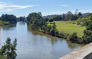
Grafton is a city in the Northern Rivers region of the Australian state of New South Wales. It is located on the Clarence River, on a floodplain, approximately 608 kilometres (378 mi) by road north-northeast of the state capital Sydney.

<span class="mw-page-title-main">Northern Rivers</span> Region in New South Wales, Australia

Northern Rivers is the most north-easterly region of the Australian state of New South Wales, located between 590 and 820 kilometres north of the state capital, Sydney, and encompasses the catchments and fertile valleys of the Clarence, Richmond, and Tweed rivers. It extends from Tweed Heads in the north to the southern extent of the Clarence river catchment which lies between Grafton and Coffs Harbour, and includes the main towns of Tweed Heads, Byron Bay, Ballina, Kyogle, Lismore, Casino and Grafton. At its most northern point, the region is 102 kilometres (63 mi) south-southeast of the Queensland capital, Brisbane.

<span class="mw-page-title-main">Ballina, New South Wales</span> Town in New South Wales, Australia

Ballina is a town in the Northern Rivers region of New South Wales, Australia, and the seat of the Ballina Shire local government area. It lies 740 km (460 mi) north of Sydney and 185 km (115 mi) south of Brisbane. Ballina's urban population at the end of 2021 was 46,190. The town lies on the Richmond River and serves as a gateway to Byron Bay.

<span class="mw-page-title-main">Richmond River</span> River in New South Wales, Australia

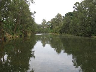
The Richmond River is a river situated in the Northern Rivers region of New South Wales, Australia.

<span class="mw-page-title-main">Coraki, New South Wales</span> Town in New South Wales, Australia

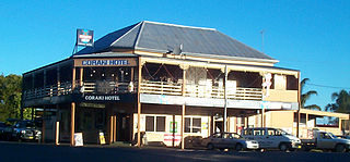
Coraki is a small town that sits on the confluence of the Richmond and Wilsons Rivers in northern New South Wales, Australia in Richmond Valley Shire. At the 2016 census, Coraki had a population of 1,277 people.

<span class="mw-page-title-main">Yamba, New South Wales</span> Town in New South Wales, Australia

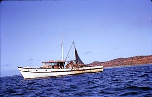
Yamba is a town in the Northern Rivers region of New South Wales, Australia located at the mouth of the Clarence River.

<span class="mw-page-title-main">Iluka, New South Wales</span> Town in New South Wales, Australia

Iluka is a small village at the mouth of the Clarence River in north-eastern New South Wales, Australia. It is situated directly across the river from the resort town of Yamba. At the 2016 census, Iluka had a population of 1,718 people. The town's name is derived from an Aboriginal word meaning "near the sea".

<span class="mw-page-title-main">Lennox Head, New South Wales</span> Town in New South Wales, Australia

Lennox Head is a seaside village in the Northern Rivers region of New South Wales, Australia, situated on the stretch of coast between Byron Bay and Ballina in Ballina Shire local government area. It had a population of 7,741 in the 2016 Australian census.

<span class="mw-page-title-main">Woodburn, New South Wales</span> Town in New South Wales, Australia

Woodburn is a small highway town on the banks of the Richmond River in New South Wales, Australia. Until the town was bypassed in September 2020, the busy Pacific Highway passed through the centre of town. Woodburn is 712 km north of the state capital, Sydney, and 34 km south of the regional city of Lismore.

<span class="mw-page-title-main">Yugambeh–Bundjalung languages</span> Language branch spoken in Australia

Yugambeh–Bundjalung, also known as Bandjalangic, is a branch of the Pama–Nyungan language family, that is spoken in north-eastern New South Wales and South-East Queensland.

<span class="mw-page-title-main">Brunswick Heads</span> Town in New South Wales, Australia

Brunswick Heads is a small town on the north coast of New South Wales, Australia in Byron Shire. At the 2016 census, the town had a population of 1,737 people.

The Gidabal, also known as Kitabal and Githabul, are an indigenous Australian tribe of southern Queensland, who inhabited an area in south-east Queensland and north-east New South Wales, now within the Southern Downs, Tenterfield and Kyogle Local Government regions.

The Richmond River massacres were a series of murders of groups of Indigenous Australians and European Australians in the region around the Richmond River in north-eastern New South Wales in the mid-nineteenth century.

<span class="mw-page-title-main">Angels Beach</span>

Angels Beach is a surfing beach on the Pacific Ocean on the north coast of New South Wales, Australia.

<span class="mw-page-title-main">Bundjalung people</span> Aboriginal Australian people of New South

The Bundjalung people, also spelled Bunjalung, Badjalang and Bandjalang, are Aboriginal Australians who are the original custodians of a region from around Grafton in northern coastal New South Wales to Beaudesert in south-east Queensland. The region is located approximately 550 kilometres (340 mi) northeast of Sydney and 100 kilometres (62 mi) south of Brisbane that now includes the Bundjalung National Park.

<span class="mw-page-title-main">Wilsons River (New South Wales)</span> River in New South Wales, Australia

Wilsons River, a perennial river and part of the Richmond River catchment, is situated in the Northern Rivers district of New South Wales, Australia.

The Bundjalung people are a large Aboriginal nation, a federation of a number of groups of clans which occupy the land from Grafton on the Clarence river of northern New South Wales north to the town of Ipswich and the Beaudesert, in southern Queensland, and down around the other side of the Great Dividing Range and back to Grafton. In the north, Bundjalung Nation shares a border with Yuggera Nation and Barrunggam Nation; to the east the Tasman Sea ; to the south Gumbaynggirr Nation; and to the west it borders Ngarabal Nation.

The Western Bundjalung or Bundjalung people are an aggregation of tribes of Australian Aboriginal people who inhabit north-east NSW along the Clarence River, now within the Clarence Valley, Glen Innes Severn Shire, Kyogle, Richmond Valley, and Tenterfield Shire Council areas.

Albert Digby Moran (1948–2020) was an Australian Aboriginal artist. His work derived inspiration from his Bundjalung ancestors in the north of New South Wales, Australia, where he remains one of the Northern Rivers' most recognised artists.

Woodburn Shire was a local government area in the Northern Rivers region of New South Wales, Australia.

References

  1. 1 2 3 Australian Bureau of Statistics (27 June 2017). "Evans Head (Urban Centre/Locality)". 2016 Census QuickStats. Retrieved 24 January 2019. OOjs UI icon edit-ltr-progressive.svg CC-BY icon.svg Material was copied from this source, which is available under a Creative Commons Attribution 4.0 International License.
  2. Tindale, Norman Barnett (1974). "Badjalang (QLD)". Aboriginal Tribes of Australia: Their Terrain, Environmental Controls, Distribution, Limits, and Proper Names. Australian National University Press. p. 191.
  3. "Evans Head". Geographical Names Register (GNR) of NSW. Geographical Names Board of New South Wales . Retrieved 20 September 2009. OOjs UI icon edit-ltr-progressive.svg
  4. "Evans Head Air Weapons Range". Defence Aircraft Noise. Department of Defence. Retrieved 25 December 2020.
  5. "Evans Head Memorial Aerodrome". New South Wales State Heritage Register . Department of Planning & Environment. H01649. Retrieved 18 May 2018. CC BY icon.svg Text is licensed by State of New South Wales (Department of Planning and Environment) under CC-BY 4.0 licence .
  6. Ross, Hannah (30 April 2021). "NSW Bandjalang people victorious after 25-year native title fight". ABC News (Australian Broadcasting Corporation). Retrieved 7 May 2021.
  7. "Statistics by Catalogue Number". Australian Bureau of Statistics. Retrieved 18 January 2024.
  8. "Search Census data". Australian Bureau of Statistics. Retrieved 18 January 2024.
  9. "Shipwrecks exposed". Mid Coast Observer. Rural Press. 5 August 2009. p. 6.
  10. 1 2 3 4 5 6 7 8 Messenger, Ken; Friendship R, Publisher Ken Messenger, Box 282 Hornsby NSW, 2020
  11. Search for Lost Boat Extended, The Canberra Times, 2 Jan 1964
  12. "Lost at Sea in an Esky". maritimemuseumsaustralia.com. The Maritime Museum. Retrieved 29 December 2020.

Commons-logo.svg Media related to Evans Head, New South Wales at Wikimedia Commons