Bucksport, South Carolina

Last updated

Bucksport, South Carolina
Bucksport 0319.JPG
Along the Intracoastal Waterway at Bucksport
SCMap-doton-Bucksport.PNG
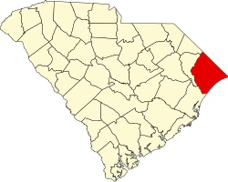
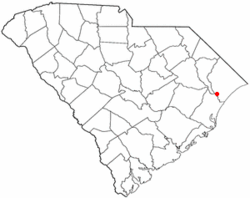
Location in South Carolina
Coordinates: 33°40′2″N79°6′18″W / 33.66722°N 79.10500°W / 33.66722; -79.10500
Country United States
State South Carolina
County Horry
Area
[1]
  Total4.22 sq mi (10.94 km2)
  Land4.20 sq mi (10.89 km2)
  Water0.02 sq mi (0.05 km2)
Elevation
20 ft (6 m)
Population
 (2020) [2]
  Total745
  Density177.21/sq mi (68.42/km2)
Time zone UTC-5 (EST)
  Summer (DST) UTC-4 (EDT)
ZIP code
29527
Area code(s) 843, 854
FIPS code 45-10000 [3]
GNIS feature ID1231099 [4]

Bucksport is an unincorporated community and census-designated place (CDP) in Horry County, South Carolina, United States. The population was 876 at the 2010 census. [5] It is a rural port on the Atlantic Intracoastal Waterway at the merger point with the Waccamaw River. The port has some services available for boaters and is also home to the Bucksport Restaurant.

Contents

History

Henry Buck of Bucksport, Maine, moved to South Carolina in the 1820s to start lumber mills; Horry County had a significant timber industry with its cypress, pine and hardwood forests. One of Buck's mills was in what became Bucksport. Sawmills in Bucksport and Bucksville produced three million board feet of lumber annually by 1850. Buck used his ships to transport lumber to Georgetown and Charleston in South Carolina and as far away as New York City and Boston, and even to other countries. Lumber from Buck's operation even went into the construction of the Brooklyn Bridge. The Independent Republic Quarterly said, "By 1860, due largely to Bucksville and Bucksport, Horry District had become one of the five greatest timber-producing districts in the state." [6]

Geography

Bucksport is in southwestern Horry County at 33°40′37″N79°6′54″W / 33.67694°N 79.11500°W / 33.67694; -79.11500 (33.676876, -79.114896). [7] The CDP extends from the Waccamaw River in the southeast to U.S. Route 701 in the north, with Bucksport Road forming the main road through the community. US 701 leads northeast 11 miles (18 km) to Conway, the Horry county seat, and southwest 25 miles (40 km) to Georgetown. Myrtle Beach, 12 miles (19 km) to the east as the crow flies, is 25 miles (40 km) away by highway across the Waccamaw River and Intracoastal Waterway.

According to the United States Census Bureau, the Bucksport CDP has a total area of 4.2 square miles (10.9 km2), of which 0.02 square miles (0.05 km2), or 0.48%, are water. [5]

Demographics

Historical population
CensusPop.Note
2020 745
U.S. Decennial Census [8]

2020 census

Bucksport racial composition [9]
RaceNum.Perc.
White (non-Hispanic)516.85%
Black or African American (non-Hispanic)66088.59%
Other/Mixed 273.62%
Hispanic or Latino 70.94%

As of the 2020 United States census, there were 745 people, 280 households, and 163 families residing in the CDP.

2000 census

As of the census [3] of 2000, there were 1,117 people, 359 households, and 285 families residing in the CDP. The population density was 290.8 inhabitants per square mile (112.3/km2). There were 388 housing units at an average density of 101.0 per square mile (39.0/km2). The racial makeup of the CDP was 2.24% White, 96.60% African American, 0.45% Native American, 0.18% from other races, and 0.54% from two or more races. Hispanic or Latino of any race were 0.09% of the population.

There were 359 households, out of which 36.8% had children under the age of 18 living with them, 38.4% were married couples living together, 34.8% had a female householder with no husband present, and 20.6% were non-families. 18.7% of all households were made up of individuals, and 7.8% had someone living alone who was 65 years of age or older. The average household size was 3.11 and the average family size was 3.53.

In the CDP, the population was spread out, with 32.9% under the age of 18, 9.5% from 18 to 24, 28.9% from 25 to 44, 18.3% from 45 to 64, and 10.5% who were 65 years of age or older. The median age was 32 years. For every 100 females, there were 86.2 males. For every 100 females age 18 and over, there were 77.3 males.

The median income for a household in the CDP was $24,038, and the median income for a family was $23,750. Males had a median income of $31,618 versus $19,186 for females. The per capita income for the CDP was $10,832. About 14.9% of families and 20.9% of the population were below the poverty line, including 28.6% of those under age 18 and 35.6% of those age 65 or over.

Education

Bucksport has a public library, a branch of the Horry County Memorial Library. [10]

Related Research Articles

<span class="mw-page-title-main">Marion County, South Carolina</span> County in South Carolina, United States

Marion County is a county located in the coastal plain of the U.S. state of South Carolina. As of the 2020 census, its population was 29,183. Its county seat is Marion. It is a majority-minority county.

<span class="mw-page-title-main">Horry County, South Carolina</span> County in South Carolina, United States

Horry County is the easternmost county in the U.S. state of South Carolina. As of the 2020 census, its population was 351,029. It is the fourth-most populous county in South Carolina. The county seat is Conway.

<span class="mw-page-title-main">Georgetown County, South Carolina</span> County in South Carolina, United States

Georgetown County is a county located in the U.S. state of South Carolina. As of the 2020 census, the population was 63,404. Its county seat is Georgetown. The county was founded in 1769. It is named for George III of the United Kingdom.

<span class="mw-page-title-main">Citrus, California</span> Census-designated place in California, United States

Citrus is a census-designated place (CDP) in Los Angeles County, California, United States. It is located in the San Gabriel Valley between Azusa to the north and west, Glendora to the east, and Covina to the south. The population was 10,866 at the 2010 census, up from 10,581 at the 2000 census. Citrus is named after Citrus Avenue, which passes through the community.

<span class="mw-page-title-main">Fiskdale, Massachusetts</span> CDP in Sturbridge, Massachusetts, United States

Fiskdale is a census-designated place (CDP) in the town of Sturbridge in Worcester County, Massachusetts, United States. The population was 2,583 at the 2010 census.

<span class="mw-page-title-main">Cold Springs, Washoe County, Nevada</span> Census-designated place in Nevada, United States

Cold Springs is a census-designated place (CDP) in Washoe County, Nevada, United States. It is known as Eitse'ihpaa or Eitse'ippaa in Shoshoni. It is located just off U.S. Route 395 in the northwestern part of the Reno–Sparks Metropolitan Statistical Area, adjacent to the California state line. The population was 8,544 at the 2010 census.

<span class="mw-page-title-main">Five Points, North Carolina</span> Census-designated place in North Carolina, United States

Five Points is a census-designated place (CDP) in Hoke County, North Carolina, United States. The population was 689 at the 2010 census.

<span class="mw-page-title-main">Murrells Inlet, South Carolina</span> Census-designated place in South Carolina, United States

Murrells Inlet is an unincorporated area and census-designated place in Georgetown County, South Carolina, United States. The population was 7,547 at the 2010 census. It is about 13 miles south of Myrtle Beach, South Carolina and 21 miles north of Georgetown, the county seat.

<span class="mw-page-title-main">Pawleys Island, South Carolina</span> Town in South Carolina, United States

Pawleys Island is a town in Georgetown County, South Carolina, United States, and the Atlantic coast barrier island on which the town is located.

<span class="mw-page-title-main">Aynor, South Carolina</span> Town in South Carolina, United States

Aynor is a small town in Horry County, South Carolina, United States, south of Galivants Ferry. The population was 560 at the 2010 census and estimated in 2018 to be 934. Aynor High School consistently ranks as one of the best schools in Horry County and South Carolina.

<span class="mw-page-title-main">Conway, South Carolina</span> City in South Carolina, United States

Conway is a city in Horry County, South Carolina. The population was 24,849 at the 2020 census, up from 17,103 in 2010 census. It is the county seat of Horry County and is part of the Myrtle Beach metropolitan area. It is the home of Coastal Carolina University.

<span class="mw-page-title-main">Forestbrook, South Carolina</span> Census-designated place in South Carolina, United States

Forestbrook is a census-designated place (CDP) in Horry County, South Carolina, United States. The population was 4,612 at the 2010 census, up from 3,391 at the 2000 census.

<span class="mw-page-title-main">Garden City, South Carolina</span> Census-designated place in South Carolina, United States

Garden City, sometimes known as Garden City Beach, is a census-designated place (CDP) in Horry County, South Carolina, United States. The population was 9,209 at the 2010 census. Garden City Beach is located directly south of Surfside Beach. The developed part of the beach extends south beyond the limits of the Garden City CDP, into Georgetown County, and ends on a peninsula at the mouth of Murrells Inlet.

<span class="mw-page-title-main">Little River, South Carolina</span> CDP in South Carolina, United States

Little River is a census-designated place (CDP) in Horry County, South Carolina, United States. The population was 11,711 at the 2020 census.

<span class="mw-page-title-main">Red Hill, South Carolina</span> Census-designated place in South Carolina, United States

Red Hill is a census-designated place (CDP) in Horry County, South Carolina, United States. The population was 13,223 at the 2010 census, up from 10,509 at the 2000 census.

<span class="mw-page-title-main">Socastee, South Carolina</span> CDP in South Carolina, United States

Socastee is a census-designated place (CDP) in Horry County, South Carolina, United States. The population was 19,952 at the 2010 census.

<span class="mw-page-title-main">Carolina Forest, South Carolina</span> Census-designated place in South Carolina, United States

Carolina Forest is a census-designated place (CDP) in Horry County, South Carolina, United States. It was first listed as a CDP in the 2020 census with a population of 23,342.

Bucksville is a small unincorporated community in Horry County, South Carolina, United States. It lies near Bucksport on the Pee Dee River and Waccamaw River. Two properties are listed on the National Register of Historic Places: the Buck's Upper Mill Farm and Hebron Church.

Bucksport is a census-designated place (CDP) in the town of Bucksport in Hancock County, Maine, United States. The population was 2,885 at the 2010 census, down from 2,970 at the 2000 census.

<span class="mw-page-title-main">Bucksport, Maine</span> Town in the state of Maine, United States

Bucksport is a historical town in Hancock County, Maine, United States. The population was 4,944 at the 2020 census. Bucksport is across the Penobscot River estuary from Fort Knox and the Penobscot Narrows Bridge, which replaced the Waldo–Hancock Bridge.

References

  1. "ArcGIS REST Services Directory". United States Census Bureau. Retrieved October 15, 2022.
  2. "Census Population API". United States Census Bureau. Retrieved October 15, 2022.
  3. 1 2 "U.S. Census website". United States Census Bureau . Retrieved January 31, 2008.
  4. "US Board on Geographic Names". United States Geological Survey. October 25, 2007. Retrieved January 31, 2008.
  5. 1 2 "Geographic Identifiers: 2010 Census Summary File 1 (G001): Bucksport CDP, South Carolina". American Factfinder. U.S. Census Bureau. Archived from the original on February 13, 2020. Retrieved January 26, 2018.
  6. Dickerson, Brad (April 11, 2011). "Horry County was lukewarm to secession calls in Civil War days". The Sun News . Archived from the original on April 12, 2011. Retrieved April 11, 2011.
  7. "US Gazetteer files: 2010, 2000, and 1990". United States Census Bureau. February 12, 2011. Retrieved April 23, 2011.
  8. "Census of Population and Housing". Census.gov. Retrieved June 4, 2016.
  9. "Explore Census Data". data.census.gov. Retrieved December 15, 2021.
  10. "Locations & Hours". Greenville County Library System. Retrieved June 8, 2019.