Butchers Creek, Queensland

Last updated

Butchers Creek
Queensland
Australia Queensland location map.svg
Red pog.svg
Butchers Creek
Coordinates 17°20′23″S145°41′55″E / 17.3397°S 145.6986°E / -17.3397; 145.6986 (Butchers Creek (centre of locality)) Coordinates: 17°20′23″S145°41′55″E / 17.3397°S 145.6986°E / -17.3397; 145.6986 (Butchers Creek (centre of locality))
Population113 (2016 census) [1]
 • Density4.065/km2 (10.53/sq mi)
Postcode(s) 4885
Area27.8 km2 (10.7 sq mi)
Time zone AEST (UTC+10:00)
LGA(s) Tablelands Region
State electorate(s) Hill
Federal division(s) Kennedy
Suburbs around Butchers Creek:
Lake Eacham Gadgarra Gadgarra
North Johnstone Butchers Creek Gadgarra
Glen Allyn Topaz Wooroonooran

Butchers Creek is a rural locality in the Tablelands Region, Queensland, Australia. [2] In the 2016 census, Butchers Creek had a population of 113 people. [1]

Contents

Geography

Butchers Creek is on the eastern edge of the Atherton Tableland. It is one of the few parts of the tableland that drains eastward, its creeks being tributaries of the Mulgrave River. [3] The area receives high rainfall and the traditional land use has been for dairying and beef fattening. [4]

History

Butchers Creek is said to take its name from a massacre of the Ngajanji people at a bora ring in the area in the 1880s. [5]

In the early 20th century, a group of Russian immigrants established dairy farms in the area, giving it the nickname "Little Siberia". [6]

Butchers Creek Provisional School opened on 8 October 1913 with 11 students studying under teacher John Tait. It became Butchers Creek State School in 1918. [7] The school celebrated its centenary in 2013. [8]

In the 2016 census, Butchers Creek had a population of 113 people. [1]

Education

Butchers Creek State School is a government primary (Prep-6) school for boys and girls at Cnr Topaz & Gadaloff Roads ( 17°21′40″S145°41′32″E / 17.3612°S 145.6922°E / -17.3612; 145.6922 (Butchers Creek State School) ). [9] [10]

In 2016 the school had an enrolment of 27 students with 2 teachers and 4 non-teaching staff (2 full-time equivalent). [11]

In 2018 the school had an enrolment of 11 students with 2 teachers (1 full-time equivalent) and 4 non-teaching staff (2 full-time equivalent). [12] It includes a special education program. [9]

Notable residents

Alexander Prokhorov, winner of the Nobel Prize for Physics in 1964, was born in Butchers Creek (then part of Peeramon) and attended Butchers Creek State School. [8]

Related Research Articles

<span class="mw-page-title-main">Yungaburra</span> Town in Queensland, Australia

Yungaburra is a rural town and locality in the Tablelands Region, Queensland, Australia. In the 2016 census, the locality of Yungaburra had a population of 1,239 people.

<span class="mw-page-title-main">Dimbulah, Queensland</span> Town in Queensland, Australia

Dimbulah is a town and locality in Far North Queensland, Australia, 114 kilometres (71 mi) from Cairns by road, on the Atherton Tableland. It is within the local government area of Shire of Mareeba. In the 2016 census, the locality of Dimbulah had a population of 1,050 people.

<span class="mw-page-title-main">Gordonvale, Queensland</span> Town in Queensland, Australia

Gordonvale is a rural sugar-growing town and locality situated on the southern side of Cairns in the Cairns Region, Queensland, Australia. In the 2021 census, the locality of Gordonvale had a population of 6,944 people.

<span class="mw-page-title-main">Atherton, Queensland</span> Town in Queensland, Australia

Atherton is a rural town and locality in the Tablelands Region, Queensland, Australia. In the 2016 census, Atherton had a population of 7,331 people.

<span class="mw-page-title-main">Edmonton, Queensland</span> Suburb of Cairns, Queensland, Australia

Edmonton is a town and suburb in the Cairns Region, Queensland, Australia. In the 2016 census, Edmonton had a population of 10,753 people.

<span class="mw-page-title-main">Kuranda, Queensland</span> Town in Queensland, Australia

Kuranda is a rural town and locality on the Atherton Tableland in the Shire of Mareeba, Queensland, Australia. In the 2016 census, Kuranda had a population of 3,008 people. It is 25 kilometres (16 mi) from Cairns, via the Kuranda Range road. It is surrounded by tropical rainforest and adjacent to the Wet Tropics of Queensland World Heritage listed Barron Gorge National Park.

<span class="mw-page-title-main">Herberton, Queensland</span> Town in Queensland, Australia

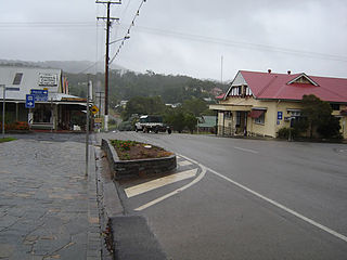
Herberton is a rural town and locality in the Tablelands Region, Queensland, Australia. In the 2016 census, the locality of Herberton had a population of 855 people.

<span class="mw-page-title-main">Tolga, Queensland</span> Town in Queensland, Australia

Tolga is a rural town and locality in the Tablelands Region, Queensland, Australia. In the 2016 census, Tolga had a population of 2,718 people.

<span class="mw-page-title-main">Mount Garnet, Queensland</span> Town in Queensland, Australia

Mount Garnet is a rural town and locality in the Tablelands Region, Queensland, Australia. In the 2016 census, Mount Garnet had a population of 430 people.

<span class="mw-page-title-main">Malanda, Queensland</span> Town in Queensland, Australia

Malanda is a rural town and locality in the Tablelands Region, Queensland, Australia. In the 2016 census, the locality of Malanda had a population of 1,985 people. The economy is based upon agriculture and tourism.

<span class="mw-page-title-main">Kairi, Queensland</span> Town in Queensland, Australia

Kairi is a rural town and locality in the Tablelands Region, Queensland, Australia. In the 2016 census, Kairi had a population of 442 people.

<span class="mw-page-title-main">Millaa Millaa, Queensland</span> Town in Queensland, Australia

Millaa Millaa is a rural town and locality in the Tablelands Region, Queensland, Australia. In the 2016 census, the locality of Millaa Millaa had a population of 514 people.

<span class="mw-page-title-main">Ravenshoe, Queensland</span> Town in Queensland, Australia

Ravenshoe is a rural town and locality in the Tablelands Region, Queensland, Australia. In the 2021 census, the locality of Ravenshoe had a population of 1,332 people.

<span class="mw-page-title-main">Mutchilba, Queensland</span> Town in Queensland, Australia

Mutchilba is a rural town and locality in the Shire of Mareeba, in Far North Queensland, Australia. It is known for its production of mangoes.

<span class="mw-page-title-main">Walkerston, Queensland</span> Town in Queensland, Australia

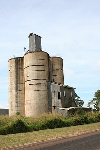
Walkerston is a town and locality in Mackay Region, Queensland, Australia. The town is situated on the Peak Downs Highway 14 kilometres (8.7 mi) south-west of Mackay. In the 2016 census, Walkerston had a population of 3,403 people.

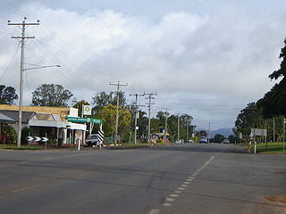
Bakers Creek is a rural town and coastal locality in the Mackay Region, Queensland, Australia. In the 2016 census, the locality of Bakers Creek had a population of 1,161 people.

<span class="mw-page-title-main">White Rock, Queensland (Cairns Region)</span> Suburb of Cairns, Queensland, Australia

White Rock is a suburb of Cairns in the Cairns Region, Queensland, Australia. In the 2016 census, White Rock had a population of 4,730 people.

Teelba is a rural locality in the Maranoa Region, Queensland, Australia. In the 2016 census Teelba had a population of 44 people.

<span class="mw-page-title-main">Julatten, Queensland</span> Town in Queensland, Australia

Julatten is a rural town and locality in the Shire of Mareeba, Queensland, Australia. In the 2016 census the locality of Julatten had a population of 1,091 people.

Moomin is a rural locality in the Tablelands Region, Queensland, Australia. In the 2016 census Moomin had a population of 133 people.

References

  1. 1 2 3 Australian Bureau of Statistics (27 June 2017). "Butchers Creek (SSC)". 2016 Census QuickStats. Retrieved 20 October 2018. OOjs UI icon edit-ltr-progressive.svg
  2. "Butchers Creek – locality in Tablelands Region (entry 48552)". Queensland Place Names. Queensland Government . Retrieved 19 September 2020.
  3. "Queensland Globe". State of Queensland . Retrieved 2 October 2017.
  4. "Annual Report 2016" (PDF). Butchers Creek State School. Archived (PDF) from the original on 2 October 2017. Retrieved 2 October 2017.
  5. Pannell, Sandra N. (Sandra Norma); Johnson, Emma; Cooperative Research Centre for Tropical Rainforest Ecology and Management (2006), Yamani country : a spatial history of the Atherton Tableland, North Queensland, Rainforest CRC, pp. 11–12, ISBN   978-0-86443-754-9
  6. "Local Heritage Places" (PDF). Mareeba Shire Council. p. 7. Archived from the original (PDF) on 21 March 2015. Retrieved 2 October 2017.
  7. Queensland Family History Society (2010), Queensland schools past and present (Version 1.01 ed.), Queensland Family History Society, ISBN   978-1-921171-26-0
  8. 1 2 Daley, Brigitte (10 November 2013). "Butchers Creek celebrates century". North Queensland Register . Archived from the original on 2 October 2017. Retrieved 2 October 2017.
  9. 1 2 "State and non-state school details". Queensland Government. 9 July 2018. Archived from the original on 21 November 2018. Retrieved 21 November 2018.
  10. "Butchers Creek State School" . Retrieved 21 November 2018.
  11. "Annual Report 2016" (PDF). Butchers Creek State School. Archived (PDF) from the original on 2 October 2017. Retrieved 2 October 2017.
  12. "ACARA School Profile 2018". Australian Curriculum, Assessment and Reporting Authority . Retrieved 28 January 2020.