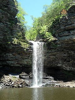
Petit Jean State Park is a 3,471-acre (1,405 ha) park in Conway County, Arkansas managed by the Arkansas Department of Parks and Tourism. It is located atop Petit Jean Mountain adjacent to the Arkansas River in the area between the Ouachita Mountains and Ozark Plateaus.

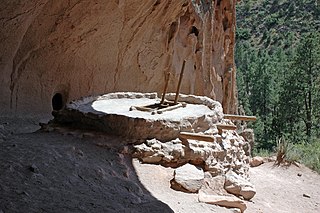
Bandelier National Monument is a 33,677-acre (13,629 ha) United States National Monument near Los Alamos in Sandoval and Los Alamos counties, New Mexico. The monument preserves the homes and territory of the Ancestral Puebloans of a later era in the Southwest. Most of the pueblo structures date to two eras, dating between 1150 and 1600 AD.

National Park Service rustic – sometimes colloquially called Parkitecture – is a style of architecture that developed in the early and middle 20th century in the United States National Park Service (NPS) through its efforts to create buildings that harmonized with the natural environment. Since its founding in 1916, the NPS sought to design and build visitor facilities without visually interrupting the natural or historic surroundings. The early results were characterized by intensive use of hand labor and a rejection of the regularity and symmetry of the industrial world, reflecting connections with the Arts and Crafts movement and American Picturesque architecture. Architects, landscape architects and engineers combined native wood and stone with convincingly native styles to create visually appealing structures that seemed to fit naturally within the majestic landscapes. Examples of the style can be found in numerous types of National Park structures, including entrance gateways, hotels and lodges, park roads and bridges, visitor centers, trail shelters, informational kiosks, and even mundane maintenance and support facilities. Many of these buildings are listed on the National Register of Historic Places.

Backbone State Park is Iowa's oldest state park, dedicated in 1919. Located in the valley of the Maquoketa River, it is approximately three miles (5 km) south of Strawberry Point in Delaware County. It is named for a narrow and steep ridge of bedrock carved by a loop of the Maquoketa River originally known as the Devil's Backbone. The initial 1,200 acres (490 ha) were donated by E.M. Carr of Lamont, Iowa. Backbone Lake Dam, a relatively low dam built by the Civilian Conservation Corps (CCC) in the 1930s, created Backbone Lake. The CCC constructed a majority of trails and buildings which make up the park.

The Black Moshannon State Park Historic Districts are three separate historic districts on the National Register of Historic Places (NRHP) at Black Moshannon State Park in Rush Township, Centre County, Pennsylvania in the United States. The structures in the historic districts were constructed in the 1930s during the Great Depression by the Civilian Conservation Corps (CCC). The three districts are: the Beach and Day Use District, with 18 contributing structures, including 11 different picnic pavilions, concession building, bathhouse, museum, and four open pit latrines; the Family Cabin District with 16 contributing properties, including 13 cabins, one lodge and two latrines; and the Maintenance District with four contributing properties, including a storage building, three-bay garage, gas pump house, and ranger's residence.

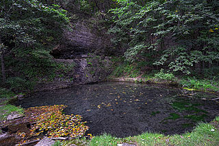
Devil's Den State Park is a 2,500-acre (1,000 ha) Arkansas state park in Washington County, near West Fork, Arkansas in the United States. The park was built by the Civilian Conservation Corps, beginning in 1933. Devil's Den State Park is in the Lee Creek Valley in the Boston Mountains, which are the southwestern part of The Ozarks. The park, with an 8 acres (3.2 ha) CCC-built lake, is open for year-round recreation, with trails for hiking, mountain biking and horseback riding. Devil's Den State Park also has several picnic areas, a swimming pool and cabins, with camping sites ranging from modern to primitive. Fossils of coral and crinoids can be found along the banks and within Lee Creek at Devil's Den State Park.

The Civilian Conservation Corps Powder Magazine in Capitol Reef National Park, Utah, was used in the 1930s to store explosives for use by Civilian Conservation Corps laborers in the construction of improvements to the park. Much of the CCC's work in the park involved the quarrying of sandstone blocks and slabs, which required explosives. The magazine was built about 1938 in association with CCC Camp NM-2, later called NP-6, located to the west of Fruita at Chimney Rock. The Fruita ranger station and the powder magazine are the only structures remaining from the CCC tenure in the park.

The Gasquet Ranger Station Historic District comprises a compound of buildings associated with the Gasquet Ranger District of Six Rivers National Forest. The U.S. Forest Service complex is located along the Smith River on U.S. Route 199 in Del Norte County, California, within Smith River National Recreation Area. Most of the buildings were built by the Civilian Conservation Corps between 1933 and 1939. Seven buildings and a rock wall remain of the CCC-built structures. The district office, the assistant district ranger's residence, a warehouse, two garages and a fuel house were built in the Forest Service rustic style that prevailed at the time. The style is reflected in distinctive detailing, including a recurring pine tree cut-out logo that appears on gables and shutters.

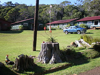
Civilian Conservation Corps Camp in Kokeʻe State Park is located at Hawaii Route 550, in Waimea, on the island of Kauai, in the U.S. state of Hawaii. It was built in 1935 with lumber that was put into the saltwater and floated to the shore at Port Allen, the seawater adding a natural termite protection to the lumber. The camp was in continual use for forest management, until Hurricane Iwa devastated it in 1982. In the 1990s it was restored through the efforts of the non-profit Hui O Laka environmental group, and is currently open to the public. It was added to the Hawaiʻi Register of Historic Places and the National Register of Historic Places on December 20, 1996.

Crossett Experimental Forest is an experimental forest operated by the Southern Research Station (SRS) of the United States Forest Service in Ashley County, Arkansas. It is managed out of the SRS office in Monticello, Arkansas, with onsite facilities about 6.8 miles (10.9 km) south of Crossett, Arkansas off Arkansas Highway 133.

The Bear Brook State Park Civilian Conservation Corps (CCC) Camp Historic District is the only surviving Civilian Conservation Corps work camp in New Hampshire. Located in Bear Brook State Park, in Allenstown, the camp's facilities have been adaptively reused to provide space for park administration and a small museum. It is located in the northwestern portion of the park, south of Deerfield Road. It is also believed to be one of the few relatively intact CCC camps in the nation. The district was listed on the National Register of Historic Places in 1992.

The Jualpa Mining Camp, also known as the Last Chance Basin Camp, is a former gold mining camp, just outside the city of Juneau, Alaska. Its main building is now operated as the Last Chance Mining Museum by the Gastineau Historical Society. The camp was located on the southern banks of Gold Creek, about 1 mile (1.6 km) north of Juneau, near what is now the end of Basin Road. The camp was the site of one of the largest gold finds in the Juneau mining district. It was established between 1910 and 1913 by the Alaska-Juneau Gold Mining Company and operated until 1944, producing more than $80 million worth of gold. The largest surviving structure of the camp is its air compressor building, which was 84 feet (26 m) long, and still houses the compressor used by the company. Also surviving are a variety of railroad-related resources, which the company used to bring or to its mill on the Gastineau channel, an electrical transformer house, powder magazine, and cable hoist.

Shady Lake Recreation Area is a campground and public recreation area in southwestern Ouachita National Forest, southwest of Mena, Arkansas and west of Glenwood, Arkansas. The area is oriented around Shady Lake, a body of water on the South Fork Saline River impounded by a dam built c. 1940 by the Civilian Conservation Corps (CCC). The area is administered by the United States Forest Service (USFS).
The Powder Magazine is a surviving structure of the Civilian Conservation Corps (CCC) camp of the 1707th Company. Located in Ouachita National Forest in the northeast corner of Scott County, Arkansas, it is a small stone and concrete structure about 4 by 3 feet and between 3 and 4-1/2 feet in height. It is located about 50 yards (46 m) south of the T-shaped junction of two forest roads in 1993) on top of a ridge above Dutch Creek. The structure was built to house the camp's explosives, which were typically used by the camp crew for road and bridge building projects.
The CCC Company 3767 Powder Magazine Historic District encompasses a pair of storage structures built by the Civilian Conservation Corps (CCC) in Ouachita National Forest. It is located northwest of Jessieville, down a short abandoned roadway leading north from the junction of Gladstone Forest Road and Hampo Road. The larger building, which housed explosives used in CCC construction projects, is a roughly 9-by-7-foot stone building, with a separate wall wrapping around its east side. The smaller building, in which blasting caps were stored, is about 4 feet (1.2 m) square stone structure, with a concrete top and floor.

Townshend State Park is a state park in Townshend, Vermont. Embedded within Townshend State Forest, the park provides a camping facility and hiking trails for accessing Bald Mountain. The park's facilities were developed by the Civilian Conservation Corps in the 1930s, and are listed on the National Register of Historic Places for their well-preserved state.
The CCC Company 947 Powder Magazine is a historic powder magazine in the eastern part of Ouachita National Forest. It is located in southern Yell County, about 200 yards (180 m) down a slope north of a ridge running parallel to Forest Road 71. The structure is made of stone and concrete, and is 6 feet (1.8 m) square and 5 feet (1.5 m) high, with a flat concrete roof and floor. The entrance is on the southeast side. The building was erected about 1933 by a crew of the Civilian Conservation Corps, and was used to store explosive materials used in the construction of roads and bridges in the area.

Lacey-Keosauqua State Park is located southwest of Keosauqua, Iowa, United States. The park is located along the Des Moines River in Van Buren County. First dedicated in 1921, it is the largest state park in size in Iowa. In 1990, three areas were named nationally recognized historic districts and listed on the National Register of Historic Places.
The Stowe CCC Side Camp, now known as the Vermont State Ski Dorm, is a historic residence hall at 6992 Mountain Road in Stowe, Vermont. Built in 1935 by crews of the Civilian Conservation Corps, it is one of the largest surviving CCC-built housing units to survive in the state. It was converted for use as a ski lodge after World War II. It was listed on the National Register of Historic Places in 2002.
Civilian Conservation Corp Camp F-10, also called the Rockerville Civilian Conservation Corp Camp, is a historic district on Silver Mountain Road, 15 miles (24 km) southwest of Rapid City, South Dakota. Between 1933 and 1935, it functioned as a base camp for Civilian Conservation Corps (CCC) workers who were employed on multiple construction and forestry projects in the area during the Great Depression. The camp was added to the National Register of Historic Places in 2004; three buildings and the remains of a fireplace are included in the listing.


