
Nevada County is a county located in the southwestern part of the U.S. state of Arkansas. As of the 2010 census, the population was 8,997, less than half of its peak in 1920. The county seat is Prescott. Nevada County is Arkansas's 63rd county, formed during the Reconstruction era on March 20, 1871, from portions of Hempstead, Ouachita and Columbia counties. It was named after the state of Nevada because of the perceived similarity between their physical shapes; the Arkansas county's shape, inverted, roughly follows the same outline as the state's boundary. It is an alcohol prohibition or dry county.

Historic Washington State Park is a 101-acre (41 ha) Arkansas state park in Hemsptead County, Arkansas in the United States. The museum village contains a collection of pioneer artifacts from the town of Washington, Arkansas, which is a former pioneer settlement along the Southwest Trail. Walking interpretive tours are available throughout the 54 buildings. Washington served as a major trading point along the Southwest Trail, evolving into the Hempstead county seat and later the capital of Arkansas from 1863 to 1865 when Little Rock was threatened during the Civil War. The original plat of Washington was added to the National Register of Historic Places in 1972 as the Washington Historic District.

Highway 22 is an east–west state highway in the Arkansas River Valley. It is maintained by the Arkansas State Highway and Transportation Department (AHTD). The highway runs 75.60 miles (121.67 km) from US 64/US 71B east to Highway 7 in Dardanelle. Following the historic stagecoach line of the cross-country Butterfield Trail, the highway is one of the original 1926 state highways. It is designated by the AHTD as the True Grit Trail.

Elkin's Ferry Battlefield was the site of the Battle of Elkin's Ferry, an engagement of the Camden Expedition during the American Civil War. The battlefield is located about 10 miles (16 km) north of Prescott, Arkansas, spanning the Little Missouri River in Clark and Nevada counties. The 575-acre (233 ha) battlefield area was designated a part of the Camden Expedition Sites National Historic Landmark, made up of several of the Union expedition's key sites, on April 19, 1994.

The Camden Expedition Sites is a national historic landmark consisting of nine nationally significant historic places in southwest Arkansas where events of the Union army's disastrous Camden Expedition of 1864 occurred during the American Civil War. The Union was attempting to take over Shreveport, Louisiana. Each of the sites are individually listed on the National Register of Historic Places. It was designated a national historic landmark on April 19, 1994.

The Prairie D'Ane Battlefield, also known as Prairie D'Ann Battlefield or Prairie De Ann Battlefield in anglicized forms, was the site of the Civil War Battle of Prairie D'Ane, one of the engagements in southwestern Arkansas of the Union's Camden Expedition of 1864. It was listed on the National Register of Historic Places in 1974, and, with other sites, is part of the Camden Expedition Sites National Historic Landmark. It was declared part of the National Historic Landmark in 1994.

The Washington–Rochambeau Revolutionary Route is a 680-mile (1,090 km) series of roads used in 1781 by the Continental Army under the command of George Washington and the Expédition Particulière under the command of Jean-Baptiste de Rochambeau during their 14-week march from Newport, Rhode Island, to Yorktown, Virginia. 4,000 French and 3,000 American soldiers began the march.

U.S. Route 64 is a U.S. highway running from Teec Nos Pos, Arizona east to Nags Head, North Carolina. In the U.S. state of Arkansas, the route runs 246.35 miles (396.46 km) from the Oklahoma border in Fort Smith east to the Tennessee border in Memphis. The route passes through several cities and towns, including Fort Smith, Clarksville, Russellville, Conway, Searcy, and West Memphis. US 64 runs parallel to Interstate 40 until Conway, when I-40 takes a more southerly route.

The Carolina Methodist Church is a historic church in rural Nevada County, Arkansas, United States, about 5 miles (8.0 km) east of Rosston, that is listed on the National Register of Historic Places.

U.S. Highway 71 is a U.S. highway that runs from Krotz Springs, LA to the Fort Frances–International Falls International Bridge at the Canadian border. In Arkansas, the highway runs from the Louisiana state line near Doddridge to the Missouri state line near Bella Vista. In Texarkana, the highway runs along State Line Avenue with US 59 and partially runs in Texas. Other areas served by the highway include Fort Smith and Northwest Arkansas.
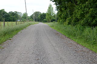
The Wortham Gymnasium was a historic athletic facility on Arkansas Highway 200 in Oak Grove, a rural community in Nevada County east of Rosston. Built in 1935 by a Works Progress Administration crew, this large gymnasium was the only surviving remnant of a major push in the 1920s and 1930s to improve the education of African Americans in Oak Grove. It was a single-story wood-frame structure with a gable roof, with a shed-roofed vestibule area on the main (southern) facade. At the time of its construction, it was the largest gymnasium in the state.
The Fort Smith to Jackson Road-Talbert's Ferry Segments are a section of an historic 19th century road in central western Baxter County, Arkansas. They are surviving elements of a road built in the 1830s which connected Fort Smith with Jackson County. It was one of the first roads to be built through north central Arkansas, and these segments, located near a crossing of the White River, are documented to have been used by parties removing Native Americans during the Trail of Tears in the 1830s.

The Springfield to Fayetteville Road-Cross Hollow Segment is a 2-mile (3.2 km) section of a historic 19th-century road in Benton County, Arkansas. The road is now designated Old Wire Road, and the historic segment runs northward from its junction with County Road 620, northeast of Lowell. This road bed is a part of one of the first roads built in the area, running from Fayetteville, Arkansas to Springfield, Missouri. Built in 1835, the road bed has its original width and original embankments. The road is notable as part of the northern route of the Trail of Tears, when Native Americans living east of the Mississippi River were forcibly relocated to what is now Oklahoma, and for its use in military operations during the American Civil War. It is the longest known intact segment of the Trail of Tears in Arkansas.

The Springfield to Fayetteville Road-Elkhorn Tavern Segment is a section of historic 19th-century roadway in Pea Ridge National Military Park in northwestern Arkansas. It is a dirt road, about 1 mile (1.6 km) long and 18 to 20 feet wide, that was built in 1835. The first major road through northwestern Arkansas, it connected Fayetteville, Arkansas with Springfield, Missouri. The road was part of the major northern route of the Trail of Tears, the forcible remove in the late 1830s of Native Americans from east of the Mississippi River to what is now Oklahoma. The road was also actively used by both Union and Confederate forces during the American Civil War, and was the major route of advance by Confederate forces leading to the Battle of Pea Ridge, whose battlefield is preserved by the park.
The Military Road-Cadron Segment is a portion of 19th-century roadway in Faulkner County, Arkansas, near the city of Conway. It consists of an original section of a military road built in the mid-1830s between Little Rock and the military outpost at Fort Smith, through what was then frontier territory. It is one of the only known surviving sections of the early military roads that crossed the Arkansas Territory, which is located west of Little Rock. The road is further notable as one of the routes by which Native Americans were relocated to Indian Territory from points east of the Mississippi River.
The Little Rock to Cantonment Gibson Rd-Fourth Street Segment is a history stretch of 19th-century roadbed in rural Pope County, Arkansas. It consists of about one mile of gravel roadway, now designated Fourth Street, east of Atkins, extending from Union Grove Loop in the west to Oakland Drive in the east. It is about 18 feet (5.5 m) wide, and is built on an embankment for much of its length. Completed by early 1828 as a military road connecting Little Rock to what is now Fort Gibson in Oklahoma, the road is historically significant for its use as part of the Trail of Tears removal of eastern Native Americans to the Indian Territory that is now Oklahoma.

The Little Rock to Cantonment Gibson Road-Short Mountain Segment is a historic 19th-century road section in Logan County, Arkansas. It is located northwest of Paris, consisting of 3.7 miles (6.0 km) of Short Mountain Road, extending westward from its crossing with Short Mountain Creek. The roadbed is about 12 feet (3.7 m) wide, and is heavily banked for much of its length. Built in 1828, it was originally part of the military road connecting Little Rock, Arkansas to what is now Gibson, Oklahoma. The road has been documented to be part of the Trail of Tears migration route.

Highway 51 is a designation for two north–south state highways in Southwest Arkansas. One route of 53.37 miles (85.89 km) begins Highway 53 near Whelen Springs and runs north to US Highway 67 in Donaldson. A second route of 7.92 miles (12.75 km) runs parallel to US 270 northwest of Malvern. Both routes are maintained by the Arkansas Department of Transportation (ArDOT).
The Memphis to Little Rock Road was a settlement road constructed between 1819 and Reconstruction in Arkansas. The project was one of many internal improvements to assist settlement of the Old Southwest as well as military defense of the Arkansas Territory.

Arkansas Highway 76 is the designation for a state Highway in the U.S. state of Arkansas. AR 76 is located in southwest Arkansas, and is split into two sections. The first section begins at U.S. Route 371 (US 371), and ends at US 278. The second section begins at AR 57 and AR 387 south of Chidester, and ends at AR 24 near Bragg City, or about 6.5 miles (10.5 km) northwest of Camden. Both sections are very rural.


