Related Research Articles

Melrose is a city located in the Greater Boston metropolitan area in Middlesex County, Massachusetts, United States. Its population as per the 2010 United States Census is 26,983. It is a suburb located approximately seven miles north of Boston and is situated in the center of the triangle created by Interstates 93, 95 and U.S. Route 1.

Lakeville is a town in Plymouth County, Massachusetts, United States. The population was 10,602 at the 2010 census.
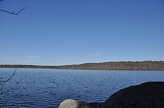
Anuxanon Island is a small forested crescent-shaped island in the Great Quittacas Pond within the town of Lakeville, Massachusetts, United States. The island is southeast of Cedar Pond and the intersection of Route 105 & Long Point Road.
Blue Hills Reservation is a 6,000-acre (2,400 ha) state park in Norfolk County, Massachusetts. Managed by the Massachusetts Department of Conservation and Recreation, it covers parts of Milton, Quincy, Braintree, Canton, Randolph, and Dedham. Located approximately ten miles south of downtown Boston, the reservation is one of the largest parcels of undeveloped conservation land within the Greater Boston metropolitan area. The park's varied terrain and scenic views make it a popular destination for hikers from the Boston area.

The Powwow River is a 22.8-mile-long (36.7 km) river located in New Hampshire and Massachusetts in the United States. It is a tributary of the Merrimack River, part of the Gulf of Maine watershed.
Cape Poge Wildlife Refuge is a wildlife refuge on Chappaquiddick Island owned and managed by The Trustees of Reservations. The refuge consists of 516 acres (2.09 km2) and includes the 1893 Cape Poge Lighthouse.

The Sudbury River is a 32.7-mile-long (52.6 km) tributary of the Concord River in Middlesex County, Massachusetts, in the United States.

The Ten Mile River is a river within the U.S. states of Massachusetts and Rhode Island. It flows approximately 22 miles (35 km) and drains a watershed of 54 square miles (140 km2).

Cedar Creek is a collection of developments and residences mainly surrounding Swiggetts Pond and Cubbage Pond along the Cedar Creek in Sussex County, Delaware, United States. It is part of the Salisbury, Maryland-Delaware Metropolitan Statistical Area. The area generally referred to as Cedar Creek follows Fleatown Road from Clendaniel Pond Road to Delaware Route 1, then heads south to Slaughter Neck Road, following Slaughter Neck Road until it connects with Cubbage Pond Road, ending back at the intersection of Cubbage Pond Road and Fleatown Road. The developments include Cedar Creek Estates, Cedar Village, The Meadows on Cubbage Pond, South Shores, The Village at Anderson Crossroads, and Pine Haven Park. Cedar Creek Nature Preserve is also located here off of Brick Granary Road where the Cedar Creek flows into Swiggetts Pond.

There are several neighborhoods in Plymouth, Massachusetts. With a total area of 134.0 mi², Plymouth is the largest municipality in Massachusetts by area. In addition, with a population of 51,701 at the 2000 census and an estimated population of 57,901 in 2007, Plymouth is the second-largest town in the state by population (after Framingham. As such, Plymouth is home to many distinct neighborhoods and geographical locations.
South Plymouth is the portion of Plymouth, Massachusetts, United States that covers much of the southern section of the town beginning at the Pine Hills, a large, mostly undeveloped forested area south of Plymouth Beach, Chiltonville and South Pond. The remainder of the section is south and east of the northeastern entrance to Myles Standish State Forest, stretching to the Bourne and Wareham town lines.
Fresh Pond is a 62-acre (250,000 m2) pond in the Manomet section of Plymouth, Massachusetts. The average depth is 12 feet (3.7 m) and the maximum depth is 30 feet (9.1 m). The southern shore of the pond is located in the Churchill Landing neighborhood, south of Manomet's business district and Manomet Bluffs, west of Fisherman's Landing, north of Cedar Bushes and Shallow Pond, and east of Beaver Dam Pond. Route 3A runs along the southeastern shore of the pond to its most southeastern point where it shoots away at a sharp curve known as the Brown Bear Curve, named after a defunct motel along the shore at that curve. A public beach, boat ramp, and a Native American burial site are located on the western shore of the pond on Bartlett Road, which has two intersections with Route 3A. The closer intersection is south of the Brown Bear Curve, while the other intersection is one mile (1.6 km) north, north of Manomet's business district. The pond is hydrologically associated with a cranberry bog operation located to the west of the pond. An unnamed brook heads west through the cranberry bog and ultimately leading to Beaver Dam Brook is the outflow of the pond.
Shallow Pond is an 18-acre (73,000 m2) pond in the Manomet section of Plymouth, Massachusetts. The pond is located south of Fresh Pond, north of Briggs Reservoir, southwest of Cedar Bushes and west of Manomet Beach. The water quality is impaired due to non-native aquatic plants and nuisance exotic species.
Snipatuit Pond is a shallow 710-acre (2.9 km2) warm water pond in Rochester, Massachusetts. The average depth is five feet and the maximum depth is six feet, except for one very small nine foot hole near the pump station on the west shore. The pond is the headwaters of the Mattapoisett River. The inflow comes from two sources: Cedar Swamp, which is located to the northeast, and Great Quittacas Pond, which is connected to Snipatuit Pond and located to the northwest. The water quality is impaired due to wetlands vegetation. The boat access to the pond is a dirt ramp with limited parking located off Neck Road. Shoreline access is limited to the area east of the pond bordering Neck Road.
Cedar Pond is an 80-acre (32 ha) lake in Coos County, northern New Hampshire, United States, in the town of Milan. The lake is located just south of Route 110A and west of Route 110B.
Cedar Pond is the name of some bodies of water in the United States:

The Bay Circuit Trail and Greenway or Bay Circuit is a Massachusetts recreational trail and greenway connecting the outlying suburbs of Boston from Plum Island in Newburyport to Kingston Bay in Duxbury, a distance of 200 miles (320 km).

Rocky Woods is a 491-acre (199 ha) open space preserve located in Medfield, Massachusetts. The preserve, managed by the land conservation non-profit organization The Trustees of Reservations, is notable for its rugged terrain. Rocky Woods offers 6.5 miles (10.5 km) of trails and former woods roads available for hiking, horseback riding, mountain biking, dog walking, catch and release fishing, snowshoeing and cross country skiing. The preserve is part of a larger area of protected open space including the abutting Fork Factory Brook preserve, also managed by The Trustees of Reservations.

Cedar Lake is located northwest of Sled Harbor, New York. Fish species present in the lake are brook trout, black bullhead, and white sucker. There is trail access on the north and west shores from Sled Harbor. There is also trail access to Whitney Lake. No motors are allowed on this lake.
References
| This Plymouth County, Massachusetts geography–related article is a stub. You can help Wikipedia by expanding it. |