Cedar Vale, Queensland

Last updated

Cedar Vale
Logan City,  Queensland
Fields along Cedar Vale Road at Cedar Vale, Queensland.jpg
Fields along Cedar Vale Road, 2016
Australia Queensland location map.svg
Red pog.svg
Cedar Vale
Coordinates 27°52′47″S153°00′54″E / 27.8797°S 153.015°E / -27.8797; 153.015 (Cedar Vale (centre of locality))
Population2,856 (2021 census) [1]
 • Density181.9/km2 (471.1/sq mi)
Postcode(s) 4285
Area15.7 km2 (6.1 sq mi)
Time zone AEST (UTC+10:00)
Location
LGA(s) Logan City
State electorate(s) Scenic Rim
Federal division(s) Wright
Suburbs around Cedar Vale:
Cedar Grove Jimboomba Jimboomba
Woodhill Cedar Vale Mundoolun
Veresdale Scrub Veresdale Scrub Mundoolun

Cedar Vale is a rural locality in the City of Logan, Queensland, Australia. [2] In the 2021 census, Cedar Vale had a population of 2,856 people. [1]

Contents

Geography

The Mount Lindesay Highway runs along the north-western boundary. [3] Scrubby Creek forms the northern and eastern boundary of the locality. [4]

History

Formerly in the Shire of Beaudesert, Cedar Vale became part of Logan City following the local government amalgamations in March 2008.

Demographics

In the 2011 census, Cedar Vale had a population of 2,971. [5]

In the 2016 census, Cedar Vale had a population of 2,792 people. [6]

In the 2021 census, Cedar Vale had a population of 2,856 people. [1]

Education

There are no schools in Cedar Vale. The nearest government primary schools are Jimboomba State School in neighbouring Jimboomba to the north, Veresdale Scrub State School in neighbouring Veresdale Scrub to the south, and Woodhill State School in neighbouring Woodhill to the south-west. The nearest government secondary schools are Flagstone State Community College in Flagstone to the north-west and Beaudesert State High School in Beaudesert to the south. [7]

Amenities

There are a number of parks in the area:

Related Research Articles

<span class="mw-page-title-main">Beaudesert, Queensland</span> Town in Queensland, Australia

Beaudesert is a rural town and locality in the Scenic Rim Region of Queensland, Australia. In the 2021 census, the locality of Beaudesert had a population of 6,752 people.
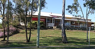
<span class="mw-page-title-main">Jimboomba</span> Town in Queensland, Australia

Jimboomba is a town and locality in the City of Logan, Queensland, Australia. In the 2021 census, the locality of Jimboomba had a population of 7,423 people.

<span class="mw-page-title-main">Electoral district of Albert</span> Electoral district of Queensland, Australia

Albert was a Legislative Assembly electorate in the state of Queensland which existed from 1887 to 1949 and 1959 to 2017.

<span class="mw-page-title-main">Logan Village, Queensland</span> Town in Queensland, Australia

Logan Village is a semi-rural town and locality in the City of Logan, Queensland, Australia. Logan Village was once known as the head of the navigable Logan River. Its importance as a town grew again when the railway arrived.

<span class="mw-page-title-main">Beaudesert railway line</span> Former branch railway in South East Queensland, Australia

The Beaudesert railway line is a disused branch railway in South East Queensland, Australia. The first section opened in 1885, the line was completed in 1888 and operated as a Queensland Government Railways (QGR) line until 1996. A heritage operation was undertaken for a short period in 2003. The Canungra railway line connected at Logan Village between 1915 and 1955, and the Beaudesert Shire Tramway connected with the terminal between 1903 and 1944. A study was undertaken in 2010 by the Queensland government concerning a potential Salisbury-to-Beaudesert rail corridor as a long-term potential proposal.

<span class="mw-page-title-main">Cedar Creek, Queensland (Logan & Gold Coast)</span> Suburb of City of Gold Coast, Queensland, Australia

Cedar Creek is a locality split between City of Gold Coast and Logan City in Queensland, Australia. In the 2021 census, Cedar Creek had a population of 861 people.
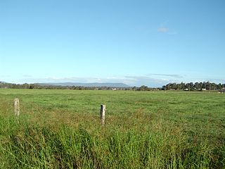
<span class="mw-page-title-main">Chambers Flat, Queensland</span> Suburb of Logan City, Queensland, Australia

Chambers Flat is a rural locality in the City of Logan, Queensland, Australia. In the 2021 census, Chambers Flat had a population of 2,718 people.
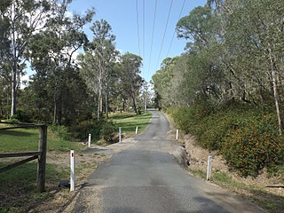
<span class="mw-page-title-main">Wolffdene, Queensland</span> Suburb of Logan City, Queensland, Australia

Wolffdene is a rural locality in the City of Logan, Queensland, Australia. In the 2021 census, Wolffdene had a population of 266 people.

<span class="mw-page-title-main">North Maclean, Queensland</span> Suburb of City of Logan, Queensland, Australia

North Maclean is a locality in the City of Logan, Queensland, Australia. In the 2021 census, North Maclean had a population of 1,581 people.

<span class="mw-page-title-main">Cedar Grove, Queensland</span> Suburb of Logan City, Queensland, Australia

Cedar Grove is a mixed-use locality in the City of Logan, Queensland, Australia. In the 2021 census, Cedar Grove had a population of 1,992 people.

<span class="mw-page-title-main">Tamborine, Queensland</span> Town in Queensland, Australia

Tamborine is a rural town in the Scenic Rim Region and a locality split between the Scenic Rim Region and the City of Logan in Queensland, Australia. In the 2021 census, the locality of Tamborine had a population of 4,388 people.

<span class="mw-page-title-main">Veresdale, Queensland</span> Suburb of Logan City, Queensland, Australia

Veresdale is a locality split between the City of Logan and the Scenic Rim Region, Queensland, Australia. In the 2021 census, Veresdale had a population of 414 people.

Veresdale Scrub is a locality split between the Scenic Rim Region and the City of Logan, both in Queensland, Australia. In the 2021 census, Veresdale Scrub had a population of 548 people.

<span class="mw-page-title-main">Woodhill, Queensland</span> Suburb of Logan City, Queensland, Australia

'Woodhill is a rural locality in the City of Logan, Queensland, Australia. In the 2021 census, Woodhill had a population of 1,231 people.

<span class="mw-page-title-main">Allenview, Queensland</span> Suburb of Scenic Rim Region, Queensland, Australia

Allenview is a rural locality in the Scenic Rim Region, Queensland, Australia. In the 2021 census, Allenview had a population of 209 people.

<span class="mw-page-title-main">Birnam, Queensland (Scenic Rim Region)</span> Suburb of Logan City, Queensland, Australia

Birnam is a rural locality in the Scenic Rim Region, Queensland, Australia. In the 2021 census, Birnam had a population of 109 people.

<span class="mw-page-title-main">Gleneagle, Queensland</span> Suburb of Scenic Rim Region, Queensland, Australia

Gleneagle is a rural locality in the Scenic Rim Region, Queensland, Australia. In the 2021 census, Gleneagle had a population of 2,106 people.
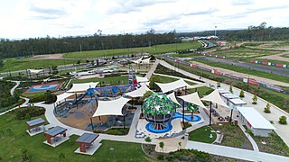
<span class="mw-page-title-main">Flagstone, Queensland</span> Suburb of Logan City, Queensland, Australia

Flagstone is a suburban locality in the Greater Flagstone district of the City of Logan, Queensland, Australia. In the 2021 census, Flagstone had a population of 7,087 people.

<span class="mw-page-title-main">Riverbend, Queensland</span> Suburb of Logan City, Queensland, Australia

Riverbend is a rural locality in the City of Logan, Queensland, Australia. Designated as a separate locality in 2017, it will be progressively developed for residential use as the population of the city grows. In the 2021 census, Riverbend had a population of 661 people.
<span class="mw-page-title-main">Glenlogan, Queensland</span> Suburb of Logan City, Queensland, Australia

Glenlogan is a rural locality in the City of Logan, Queensland, Australia. It is part of the suburban development corridor south of Brisbane in the Greater Flagstone development area. In the 2021 census, Glenlogan had a population of 1,122 people.

References

  1. 1 2 3 Australian Bureau of Statistics (28 June 2022). "Cedar Vale (SAL)". 2021 Census QuickStats. Retrieved 28 February 2023. OOjs UI icon edit-ltr-progressive.svg
  2. "Cedar Vale – locality in City of Logan (entry 45258)". Queensland Place Names. Queensland Government . Retrieved 27 December 2020.
  3. Google (15 September 2021). "Cedar Vale, Queensland" (Map). Google Maps . Google. Retrieved 15 September 2021.
  4. "Queensland Globe". State of Queensland . Retrieved 2 June 2022.
  5. Australian Bureau of Statistics (31 October 2012). "Cedar Vale(SSC)". 2011 Census QuickStats. Retrieved 6 May 2014. OOjs UI icon edit-ltr-progressive.svg
  6. Australian Bureau of Statistics (27 June 2017). "Cedar Vale (SSC)". 2016 Census QuickStats. Retrieved 20 October 2018. OOjs UI icon edit-ltr-progressive.svg
  7. "Layers: Locality; Schools and school catchments". Queensland Globe. Queensland Government . Retrieved 30 April 2024.
  8. 1 2 3 4 5 6 "Land for public recreation - Queensland". Queensland Open Data. Queensland Government. 20 November 2020. Archived from the original on 22 November 2020. Retrieved 22 November 2020.