Bethania Logan City, Queensland | |||||||||||||||
---|---|---|---|---|---|---|---|---|---|---|---|---|---|---|---|
Coordinates | 27°41′13″S153°09′27″E / 27.6869°S 153.1575°E | ||||||||||||||
Population | 6,333 (2021 census) [1] | ||||||||||||||
• Density | 1,092/km2 (2,828/sq mi) | ||||||||||||||
Postcode(s) | 4205 | ||||||||||||||
Elevation | 15 m (49 ft) | ||||||||||||||
Area | 5.8 km2 (2.2 sq mi) | ||||||||||||||
Time zone | AEST (UTC+10:00) | ||||||||||||||
Location |
| ||||||||||||||
LGA(s) | Logan City | ||||||||||||||
State electorate(s) | Waterford | ||||||||||||||
Federal division(s) | Forde | ||||||||||||||
|
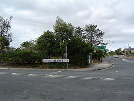
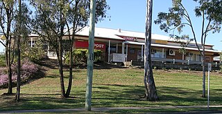
Bethania ( /bɛθɑːniə/ ) is a suburb in the City of Logan, Queensland, Australia. [2] In the 2021 census, Bethania had a population of 6,333 people. [1]
Bethania lies south of the Logan River. The lower lying areas near the river occasionally suffer floods. [3]
Bethania is situated on the main Beenleigh railway line and the suburb is served by Bethania railway station ( 27°41′20″S153°09′33″E / 27.6889°S 153.1592°E ). [4]
Beaudesert railway line branches from the South Coast railway line just south of the Bethania railway station at ( 27°41′24″S153°09′36″E / 27.6901°S 153.1600°E ) and runs to Beaudesert. It has been out of commission since August 2004.
Bethania was founded by Germans during the 1860s and is home to many different nationalities. By 1866 a small township had developed. It is believed the name is derived from Bethany, the biblical village in Israel. [2] [5]
A Lutheran church was built in 1864 made from slabs on what is now the railway line. A cemetery was established beside the church with graves from 1866. In 1872 the present church was built close to the first church ( 27°41′29″S153°09′41″E / 27.691361°S 153.161392°E ). The road to the church became known as Church Road. [6]
The first railway bridge was destroyed by flood in 1887. A new concrete, steel and timber bridge lasted until 1972 when it was replaced by a pre-stressed concrete bridge. [5]
The suburb was affected badly by the 1974 Brisbane flood. Duck Island became part of the suburb when part of the river was silted up. [5] Sand and gravel has been mined from the alluvial deposits in recent years.
Bethania Lutheran Primary School opened on 27 January 1976. [7]
In the 2011 census, Bethania had a population of 4,590 people, 53.3% female and 46.7% male. [8] The median age of the Bethania population was 41 years, 4 years above the national median of 37. [8] 68.7% of the people living in Bethania were born in Australia. The other top responses for country of birth were England 6.6%, New Zealand 6%, Scotland 1.4%, Philippines 0.9% and Germany 0.9%. [8] 86.9% of the people spoke only English at home; the next most common languages were 0.8% Spanish, 0.5% German, 0.5% Hindi, 0.4% Tagalog, 0.3% Samoan. [8]
In the 2016 census, Bethania had a population of 5,385 people, 53.5% female and 46.5% male. The median age of the Bethania population was 47 years, 9 years above the national median of 38. 66.7% of the people living in Bethania were born in Australia. The other top responses for country of birth were England 6.8%, New Zealand 6.3%, Scotland 1.4%, Philippines 1.3%, and China (excludes SARs and Taiwan) 1.2%. 86.9% of the people spoke only English at home; the next most common languages were 1.0% Mandarin, 0.9% Cantonese, 0.8% Spanish, 0.4% German, and 0.4% Samoan. [9]
In the 2021 census, Bethania had a population of 6,333 people, 55.3% female and 44.7% male. The median age of the Bethania population was 48 years, 10 years above the national median of 38. 65.5% of the people living in Bethania were born in Australia. The other top responses for country of birth were New Zealand 7.6%, England 6.0%, Philippines 1.0%, China (excludes SARs and Taiwan) 1.0%, and Scotland 0.9%. 82.1% of the people spoke only English at home; the next most common languages were 1.1% Mandarin, 0.6% Samoan, 0.6% Spanish, 0.5% Cantonese, and 0.5% Hindi. [1]
Bethania has a number of heritage-listed sites, including:
Bethania Lutheran Primary School is a private primary (Prep-6) school for boys and girls at 66 Glastonbury Drive ( 27°41′39″S153°09′28″E / 27.6943°S 153.1578°E ). [10] [11] In 2023, the school had an enrolment of 328 students with 21 teachers (18 full-time equivalent) and 25 non-teaching staff (17 full-time equivalent). [12]
Palm Lake Christian Fellowship conduct their services at the Palm Lake Resort at 43 Goodooga Drive; it is part of the Wesleyan Methodist Church. [13]
Bethania railway station provides access to regular Queensland Rail City network services to Brisbane and Beenleigh.
Jimboomba is a town and locality in the City of Logan, Queensland, Australia. In the 2021 census, the locality of Jimboomba had a population of 7,423 people.
Beenleigh is a town and suburb in the City of Logan, Queensland, Australia. In the 2021 census, the suburb of Beenleigh had a population of 8,425 people.
Moorooka is a southern suburb in the City of Brisbane, Queensland, Australia. In the 2021 census, Moorooka had a population of 10,783 people.
Kuraby is an outer southern suburb in the City of Brisbane, Queensland, Australia. In the 2021 census, Kuraby had a population of 8,737 people.
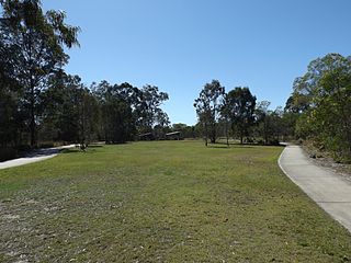
Marsden is a suburb in the City of Logan, Queensland, Australia. In the 2021 census, Marsden had a population of 14,795 people.
Waterford West is a suburb in the City of Logan, Queensland, Australia. In the 2021 census, Waterford West had a population of 6,942 people.
Logan Village is a semi-rural town and locality in the City of Logan, Queensland, Australia. Logan Village was once known as the head of the navigable Logan River. Its importance as a town grew again when the railway arrived.
Munruben is a rural locality in the City of Logan, Queensland, Australia. Once a rural community, it has been developed into a low density residential community. In the 2021 census, Munruben had a population of 2,753 people.
The Beaudesert railway line is a disused branch railway in South East Queensland, Australia. The first section opened in 1885, the line was completed in 1888 and operated as a Queensland Government Railways (QGR) line until 1996. A heritage operation was undertaken for a short period in 2003. The Canungra railway line connected at Logan Village between 1915 and 1955, and the Beaudesert Shire Tramway connected with the terminal between 1903 and 1944. A study was undertaken in 2010 by the Queensland government concerning a potential Salisbury-to-Beaudesert rail corridor as a long-term potential proposal.
Edens Landing is a suburb in the City of Logan, Queensland, Australia. In the 2021 census, Edens Landing had a population of 5,094 people.
Bahrs Scrub is an urban locality in the City of Logan, Queensland, Australia. In the 2021 census, Bahrs Scrub had a population of 4,508 people.
Windaroo is a residential suburb in the outer southern areas of the City of Logan, Queensland, Australia. In the 2021 census, Windaroo had a population of 2,771 people.
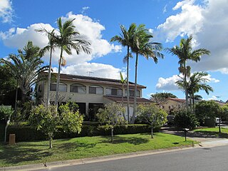
Mount Warren Park is a residential suburb in the outer eastern area of the City of Logan, Queensland, Australia. The mountain of Mount Warren is within the suburb.
Buccan is a rural locality in the City of Logan, Queensland, Australia. In the 2021 census, Buccan had a population of 2,134 people.
Waterford is a town and suburb in the City of Logan, Queensland, Australia. In the 2021 census, the suburb of Waterford had a population of 5,796 people.
Boyland is a rural locality in the Scenic Rim Region, Queensland, Australia. In the 2021 census, Boyland had a population of 855 people.
Kerry is a rural locality in the Scenic Rim Region, Queensland, Australia. In the 2021 census, the locality of Kerry had a population of 306 people.
Cedar Grove is a mixed-use locality in the City of Logan, Queensland, Australia. In the 2021 census, Cedar Grove had a population of 1,992 people.
Veresdale is a locality split between the City of Logan and the Scenic Rim Region, Queensland, Australia. In the 2021 census, Veresdale had a population of 414 people.
Gleneagle is a rural locality in the Scenic Rim Region, Queensland, Australia. In the 2021 census, Gleneagle had a population of 2,106 people.