Waterford Logan City, Queensland | |||||||||||||||
---|---|---|---|---|---|---|---|---|---|---|---|---|---|---|---|
Coordinates | 27°42′54″S153°08′34″E / 27.715°S 153.1427°E | ||||||||||||||
Population | 5,796 (2021 census) [1] | ||||||||||||||
• Density | 852/km2 (2,208/sq mi) | ||||||||||||||
Postcode(s) | 4133 | ||||||||||||||
Elevation | 17 m (56 ft) | ||||||||||||||
Area | 6.8 km2 (2.6 sq mi) | ||||||||||||||
Time zone | AEST (UTC+10:00) | ||||||||||||||
Location |
| ||||||||||||||
LGA(s) | Logan City | ||||||||||||||
State electorate(s) | Macalister | ||||||||||||||
Federal division(s) | Forde | ||||||||||||||
|
Waterford is a town and suburb in the City of Logan, Queensland, Australia. [2] [3] In the 2021 census, the suburb of Waterford had a population of 5,796 people. [1]
The suburb is on the east side of the Logan River and is 7 km south-east of Logan Central. [4] The western side of the suburb follows the Logan River, while the southern edge draws a straight line along Dairy Creek Road. Here it connects to Gardiner Road which then joins Logan River Road. Waterford-Tamborine Road (State Route 95) starts in the north of Waterford and exits to the south. [5]
The town is believed to be named by Irish settlers after Waterford in Ireland because of a ford in the Logan River. The name was recorded by surveyor William Fryar on 11 June 1866. [2] The first town lots were offered for sale in the Town of Waterford in July 1866. [6]
Logan Provisional School opened on 28 June 1869 in Charles Wilson's barn on the east of the Logan River with an initial enrolment of 22 students. On 3 January 1871, the school moved to a new site with a purpose-built 30-by-16-foot (9.1 by 4.9 m) school building, then known as Waterford Primary School, with 25 students. It was later renamed Waterford State School. [7] [8] [9]
The Beaudesert railway line from Bethania to Beaudesert opened on 21 September 1885. [10] Waterford railway station ( 27°42′17″S153°08′53″E / 27.7047°S 153.1481°E ) served the town. [11] Due to the rising use of cars, passenger services terminated in 1961 but freight services continued until 20 May 1996. [12]
In 1949, the Apostolic Church at Waterford was demolished and re-erected in East Ipswich. [13]
The College of the Good Shepherd was established on 2 February 1987 by local Anglican Church families wanting a faith-based school in their community. It opened in temporary buildings with 73 students in Years 6 to 8. The school's first permanent buildings were completed in late 1987. It was later renamed Canterbury College. [7] [14]
Year | Pop. | ±% |
---|---|---|
2006 | 845 | — |
2011 | 3,931 | +365.2% |
2016 | 5,484 | +39.5% |
2021 | 5,796 | +5.7% |
Source: [15] [16] [17] [1] |
In the 2011 census, the suburb of Waterford had a population of 3,931 people, 52.9% female and 47.1% male. The median age of the Waterford population was 33 years, 4 years below the national median of 37. 65.6% of people living in Waterford were born in Australia. The other top responses for country of birth were New Zealand 7.2%, England 4.9%, Scotland 0.9%, Philippines 0.9%, Malaysia 0.8%. 80.2% of people spoke only English at home; the next most common languages were 1.2% Cantonese, 0.7% Romanian, 0.6% Tagalog, 0.5% Hindi, 0.5% Mandarin. [16]
In the 2016 census, the suburb of Waterford had a population of 5,484 people, 52.8% female and 47.2% male. The median age of the Waterford population was 30 years, 8 years below the national median of 38. 65.7% of people living in Waterford were born in Australia. The other top responses for country of birth were New Zealand 9.5%, England 4.3%, India 1.7%, South Africa 0.8% and Afghanistan 0.8%. 79.2% of people spoke only English at home; the next most common languages were 1.1% Samoan, 1.1% Hindi, 0.9% Mandarin, 0.7% Cantonese and 0.6% Hazaraghi. [17]
In the 2021 census, the suburb of Waterford had a population of 5,796 people, 53.1% female and 46.9% male. The median age of the Waterford population was 32 years, 6 years below the national median of 38. 65.8% of people living in Waterford were born in Australia. The other top responses for country of birth were New Zealand 8.7%, England 3.3%, India 2.7%, Afghanistan 1.7% and the Philippines 1.0%. 77.2% of people spoke only English at home; the next most common languages were 1.6% Punjabi, 1.4% Hazaraghi, 1.2% Samoan, 1.2% Hindi, 1.1% Mandarin. [1]
Waterford has a number of heritage-listed sites, including:
Waterford State School is a government primary (Early Childhood-6) school for boys and girls at 40 Nerang Street ( 27°41′45″S153°08′43″E / 27.6959°S 153.1454°E ). [18] [19] In 2023, the school had an enrolment of 519 students with 40 teachers (35 full-time equivalent) and 36 non-teaching staff (22 full-time equivalent). [20] It includes a special education program. [18]
Canterbury College is an Anglican primary and secondary (Prep-12) school for boys and girls at Old Logan Village Road ( 27°42′36″S153°08′57″E / 27.7099°S 153.1493°E ). [18] [21] In 2023, the school had an enrolment of 1,417 students with 120 teachers (118 full-time equivalent) and 83 non-teaching staff (71 full-time equivalent). [20]
There is no government secondary school in Waterford. The nearest government secondary schools are Loganlea State High School in neighbouring Loganlea to the north and Windaroo Valley State High School in neighbouring Bahrs Scrub to the south-east. [22]
There is a boat ramp at Albert Street on the south bank of the Logan River ( 27°41′30″S153°08′22″E / 27.6918°S 153.1394°E ). It is managed by the Logan City Council. [23]
There are a number of parks in the area:
Public transport includes some local buses in parts of Waterford. The closest train station is in its neighbouring suburb to the north Bethania (a 40-60min walk or 5-10min drive).
Bethania is a suburb in the City of Logan, Queensland, Australia. In the 2021 census, Bethania had a population of 6,333 people.
Ashmore is a suburb of the City of Gold Coast, Queensland, Australia. In the 2021 census, Ashmore had a population of 12,415 people.
Crestmead is a suburb in the City of Logan, Queensland, Australia. In the 2021 census, Crestmead had a population of 12,271 people.
Logan Reserve is a rural residential suburb in the City of Logan, Queensland, Australia. In the 2021 census, Logan Reserve had a population of 7,016 people.
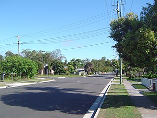
Loganlea is a suburb in the City of Logan, Queensland, Australia. In the 2021 census, Loganlea had a population of 8,716 people.
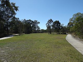
Marsden is a suburb in the City of Logan, Queensland, Australia. In the 2021 census, Marsden had a population of 14,795 people.
Waterford West is a suburb in the City of Logan, Queensland, Australia. In the 2021 census, Waterford West had a population of 6,942 people.
Logan Village is a semi-rural town and locality in the City of Logan, Queensland, Australia. Logan Village was once known as the head of the navigable Logan River. Its importance as a town grew again when the railway arrived.
Munruben is a rural locality in the City of Logan, Queensland, Australia. Once a rural community, it has been developed into a low density residential community. In the 2021 census, Munruben had a population of 2,753 people.
Bahrs Scrub is an urban locality in the City of Logan, Queensland, Australia. In the 2021 census, Bahrs Scrub had a population of 4,508 people.
Windaroo is a residential suburb in the outer southern areas of the City of Logan, Queensland, Australia. In the 2021 census, Windaroo had a population of 2,771 people.
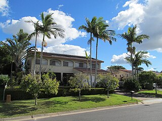
Mount Warren Park is a residential suburb in the outer eastern area of the City of Logan, Queensland, Australia. The mountain of Mount Warren is within the suburb.
Buccan is a rural locality in the City of Logan, Queensland, Australia. In the 2021 census, Buccan had a population of 2,134 people.
Wonglepong is a rural locality in the Scenic Rim Region, Queensland, Australia. In the 2021 census, Wonglepong had a population of 364 people.
Bannockburn is a suburb in the City of Logan, Queensland, Australia. In the 2021 census, Bannockburn had a population of 960 people.
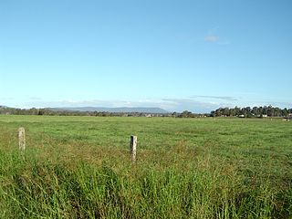
Chambers Flat is a rural locality in the City of Logan, Queensland, Australia. In the 2021 census, Chambers Flat had a population of 2,718 people.
Kerry is a rural locality in the Scenic Rim Region, Queensland, Australia. In the 2021 census, the locality of Kerry had a population of 306 people.
Mount Nathan is a rural locality in the City of Gold Coast, Queensland, Australia. In the 2021 census, Mount Nathan had a population of 1,375 people.
Tamborine is a rural town in the Scenic Rim Region and a locality split between the Scenic Rim Region and the City of Logan in Queensland, Australia. In the 2021 census, the locality of Tamborine had a population of 4,388 people.
Gleneagle is a rural locality in the Scenic Rim Region, Queensland, Australia. In the 2021 census, Gleneagle had a population of 2,106 people.