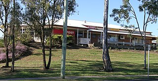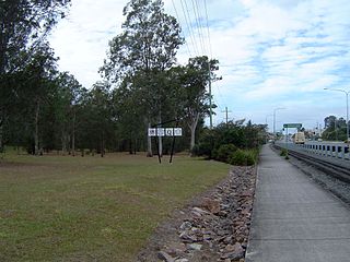
Jimboomba is a town and locality in the City of Logan, Queensland, Australia. In the 2016 census, the locality of Jimboomba had a population of 13,201 people.

Drewvale is an outer suburb of the City of Brisbane, Queensland, Australia. In the 2016 census, Drewvale had a population of 4,476 people.

Delaneys Creek is a rural locality in the Moreton Bay Region, Queensland, Australia. In the 2016 census, Delaneys Creek had a population of 1,061 people.

Park Ridge South is a residential locality in the City of Logan, Queensland, Australia. In the 2016 census, Park Ridge South had a population of 1,762 people.
Kurwongbah is a rural locality in the Moreton Bay Region, Queensland, Australia. In the 2016 census, Kurwongbah had a population of 1,430 people.

Holmview is a residential suburb in the City of Logan, Queensland, Australia. In the 2016 census, Holmview had a population of 2,358 people.

New Beith is a rural residential locality in the City of Logan, Queensland, Australia. In the 2016 census, New Beith had a population of 4,081 people.

Boyland is a rural locality in the Scenic Rim Region, Queensland, Australia. In the 2016 census Boyland had a population of 823 people.

North Maclean is a locality in the City of Logan, Queensland, Australia. In the 2016 census, North Maclean had a population of 1,536 people.

Cedar Grove is a mixed-use locality in the City of Logan, Queensland, Australia. In the 2016 census, Cedar Grove had a population of 2,041 people.
Undullah is a rural locality split between the City of Logan and the Scenic Rim Region, Queensland, Australia. In the 2016 census, Undullah had a population of 45 people.

Allenview is a rural locality in the Scenic Rim Region, Queensland, Australia. In the 2016 census, Allenview had a population of 184 people.

Birnam is a rural locality in the Scenic Rim Region, Queensland, Australia. In the 2016 census, Birnam had a population of 106 people.
Upper Flagstone is a rural locality in the Lockyer Valley Region, Queensland, Australia. In the 2016 census Upper Flagstone had a population of 171 people.
Kairabah is a rural locality in the City of Logan, Queensland, Australia. In the 2016 census Kairabah had a population of 0 people.
Rockmount is a rural locality in the Lockyer Valley Region, Queensland, Australia. In the 2016 census, Rockmount had a population of 87 people.
Egypt is a rural locality in the Lockyer Valley Region, Queensland, Australia. In the 2016 census, Egypt had a population of 15 people.

Flagstone is a suburban locality in the Greater Flagstone district of the City of Logan, Queensland, Australia. In 2018, the estimated population of Flagstone was 5,651 people.
Riverbend is a rural locality in the City of Logan, Queensland, Australia. Designated as a separate locality in 2017, it will be progressively developed for residential use as the population of the city grows.
Glenlogan is a rural locality in the City of Logan, Queensland, Australia. It is part of the suburban development corridor south of Brisbane in the Greater Flagstone development area.


