Logan Reserve, Queensland

Last updated

Map all coordinates using: OpenStreetMap  
Download coordinates as: KML
Logan Reserve
Logan City,  Queensland
Henderson Park Logans Reserve.JPG
Henderson Park, 2014
Australia Queensland location map.svg
Red pog.svg
Logan Reserve
Coordinates 27°43′01″S153°06′24″E / 27.7169°S 153.1066°E / -27.7169; 153.1066 (Logan Reserve (centre of suburb)) Coordinates: 27°43′01″S153°06′24″E / 27.7169°S 153.1066°E / -27.7169; 153.1066 (Logan Reserve (centre of suburb))
Population3,521 (2016 census) [1]
 • Density241.2/km2 (624.6/sq mi)
Established1862
Postcode(s) 4133
Area14.6 km2 (5.6 sq mi)
Time zone AEST (UTC+10:00)
Location
LGA(s) Logan City
State electorate(s)
Federal division(s) Forde
Suburbs around Logan Reserve:
Crestmead Waterford West Waterford
Park Ridge Logan Reserve Buccan
Chambers Flat Chambers Flat Buccan

Logan Reserve is a rural residential suburb in the City of Logan, Queensland, Australia. [2] In the 2016 census, Logan Reserve had a population of 3,521 people. [1]

Contents

Geography

Logan Reserve offers acreage bushland homes and a few suburban-style streets to its north. Most properties here range from two to ten acres, with dwelling types varying between cottage style, Tudor, large western red cedar and large country estates.[ citation needed ]

History

The birth of Logan Reserve came in 1862, when 500,000 acres of the Logan Agricultural Reserve were released for use by settlers. Cotton was the first crop grown, and in 1864 to 1865 a small bark church/school became the first public building to be erected. Early settlers hailed from Yorkshire and timber-getting and farming were the primary industries during the 1890s and remained important through to the early 20th century, when tobacco growing was taken on.[ citation needed ]

Logan Roman Catholic Non-Vested School opened circa 1864. It was taken over by the Queensland Government on 1 February 1875 and in 1876 it became Logan Reserve Provisional School in 1876. On 1 August 1914 it became Logan Reserve State School. [3]

In the 2011 census, Logan Reserve recorded a population of 2,154 people, 49.9% female and 50.1% male. [4] The median age of the Logan Reserve population was 30 years, 7 years below the national median of 37. 71.6% of people living in Logan Reserve were born in Australia. The other top responses for country of birth were New Zealand 6.6%, England 4.6%, Cambodia 1.8%, Samoa 1.3%, Fiji 1.1%. 81.3% of people spoke only English at home; the next most common languages were 3% Khmer, 2.5% Samoan, 1.9% Hmong, 1.3% Vietnamese, 0.6% Hindi. [4]

In the 2016 census, Logan Reserve had a population of 3,521 people. [1]

Developments

Logan Reserve is currently undergoing numerous residential developments. These are some of the notable developments:[ citation needed ]

Education

Logan Reserve State School is a government primary (Prep-6) school for boys and girls at 369-379 School Road ( 27°42′50″S153°06′52″E / 27.7140°S 153.1144°E / -27.7140; 153.1144 (Logan Reserve State School) ). [5] [6] In 2017, the school had an enrolment of 512 students with 36 teachers (32 full-time equivalent) and 22 non-teaching staff (15 full-time equivalent). [7] It includes a special education program. [5] [8]

There are no secondary schools in Logan Reserve. The nearest secondary school is Marsden State High School in neighbouring Waterford West. [9]

Related Research Articles

Bethania, Queensland Suburb of Logan City, Queensland, Australia

Bethania is a suburb in the City of Logan, Queensland, Australia. In the 2016 census Bethania had a population of 5,385 people.

Stretton, Queensland Suburb of Brisbane, Queensland, Australia

Stretton is a southern suburb in the City of Brisbane, Queensland, Australia. In the 2016 census, Stretton had a population of 4,334.

Cornubia, Queensland Suburb of Logan City, Queensland, Australia

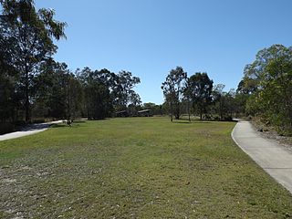
Cornubia is a suburb in the City of Logan, Queensland, Australia. In the 2016 census, Cornubia had a population of 7,317 people.

Woodridge, Queensland Suburb of Logan City, Queensland, Australia

Woodridge is a town and suburb in the City of Logan, Queensland, Australia. In the 2016 census, the suburb of Woodridge had a population of 12,579 people. Woodridge was home to a major timber reserve.

Browns Plains, Queensland Suburb of Logan City, Queensland, Australia

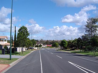
Browns Plains is a suburb in the City of Logan, Queensland, Australia. In the 2016 census Browns Plains had a population of 6,309 people.

Berrinba, Queensland Suburb of Logan City, Queensland, Australia

Berrinba is a suburb in Logan City, Queensland, Australia. In the 2016 census, Berrinba had a population of 1,345 people.

Boronia Heights, Queensland Suburb of Logan City, Queensland, Australia

Boronia Heights is a suburb in the City of Logan, Queensland, Australia. In the 2016 census Boronia Heights had a population of 7,862 people.

Crestmead, Queensland Suburb of Logan City, Queensland, Australia

Crestmead is a suburb in the City of Logan, Queensland, Australia. In the 2016 census Crestmead had a population of 12,153 people.

Heritage Park, Queensland Suburb of Logan City, Queensland, Australia

Heritage Park is a suburb in the City of Logan, Queensland, Australia. In the 2016 census Heritage Park had a population of 4,976 people.

Logan Central Suburb of Logan City, Queensland, Australia

Logan Central is a mixed-use suburb and the central business district and administrative centre of the City of Logan, Queensland, Australia. In the 2016 census, Logan Central had a population of 5,945 people.

Loganholme, Queensland Suburb of Logan City, Queensland, Australia

Loganholme is a suburb in the City of Logan, Queensland, Australia. In the 2016 census, Loganholme had a population of 6,303 people.

Loganlea, Queensland Suburb of Logan City, Queensland, Australia

Loganlea is a suburb in the City of Logan, Queensland, Australia. In the 2016 census, Loganlea had a population of 7,321 people.

Marsden, Queensland Suburb of Logan City, Queensland, Australia

Marsden is a suburb in the City of Logan, Queensland, Australia. In the 2016 census, Marsden had a population of 14,071 people.

Park Ridge, Queensland Suburb of Logan City, Queensland, Australia

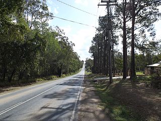
Park Ridge is a suburb in the City of Logan, Queensland, Australia. In the 2016 census, Park Ridge had a population of 2,503 people.

Regents Park, Queensland Suburb of Logan City, Queensland, Australia

Regents Park is a suburb in the City of Logan, Queensland, Australia. In the 2016 census Regents Park had a population of 10,962 people.

Shailer Park, Queensland Suburb of City of Logan, Queensland, Australia

Shailer Park is a suburb in the City of Logan, Queensland, Australia. In the 2016 census, Shailer Park had a population of 11,759 people.

Waterford West, Queensland Suburb of Logan City, Queensland, Australia

Waterford West is a suburb in the City of Logan, Queensland, Australia. In the 2016 census, Waterford West had a population of 6,431 people.

Slacks Creek, Queensland Suburb of Logan City, Queensland, Australia

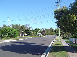
Slacks Creek is a suburb in the City of Logan, Queensland, Australia. In the 2016 census, Slacks Creek had a population of 10,432 people.

Bahrs Scrub, Queensland Suburb of Logan City, Queensland, Australia

Bahrs Scrub is an urban locality in the City of Logan, Queensland, Australia. In the 2016 census, Bahrs Scrub had a population of 1,919 people.

Waterford, Queensland Town in Queensland, Australia

Waterford is a town and suburb in the City of Logan, Queensland, Australia. In the 2016 census, the suburb of Waterford had a population of 5,484 people.

References

  1. 1 2 3 Australian Bureau of Statistics (27 June 2017). "Logan Reserve (SSC)". 2016 Census QuickStats. Retrieved 20 October 2018. OOjs UI icon edit-ltr-progressive.svg
  2. "Logan Reserve – suburb in City of Logan (entry 45275)". Queensland Place Names. Queensland Government . Retrieved 26 January 2020.
  3. Queensland Family History Society (2010), Queensland schools past and present (Version 1.01 ed.), Queensland Family History Society, ISBN   978-1-921171-26-0
  4. 1 2 Australian Bureau of Statistics (31 October 2012). "Logan Reserve (State Suburb)". 2011 Census QuickStats. Retrieved 6 February 2018. OOjs UI icon edit-ltr-progressive.svg
  5. 1 2 "State and non-state school details". Queensland Government. 9 July 2018. Archived from the original on 21 November 2018. Retrieved 21 November 2018.
  6. "Logan Reserve State School". Archived from the original on 17 March 2020. Retrieved 21 November 2018.
  7. "ACARA School Profile 2017". Archived from the original on 22 November 2018. Retrieved 22 November 2018.
  8. "Logan Reserve SS - Special Education Program". Archived from the original on 17 March 2020. Retrieved 21 November 2018.
  9. "Queensland Globe". State of Queensland . Retrieved 30 March 2020.