Forestdale, Queensland

Last updated

Forestdale
Logan City,  Queensland
Forestdale Drive Forestdale.jpg
Forestdale Drive, 2014
Australia Queensland location map.svg
Red pog.svg
Forestdale
Coordinates 27°39′50″S153°00′06″E / 27.6638°S 153.0016°E / -27.6638; 153.0016
Population2,531 (2016 census) [1]
 • Density415/km2 (1,075/sq mi)
Postcode(s) 4118
Area6.1 km2 (2.4 sq mi)
Time zone AEST (UTC+10:00)
Location
LGA(s) Logan City
State electorate(s) Algester
Federal division(s) Wright
Suburbs around Forestdale:
Heathwood Larapinta Parkinson
Greenbank Forestdale Hillcrest
Greenbank Greenbank Boronia Heights

Forestdale is a suburb of Logan City, Queensland, Australia. [2] In the 2016 census, Forestdale had a population of 2,531 people. [1]

Contents

Geography

Forestdale is bounded to the west by the Brisbane-to-Sydney railway line and by Johnson Road to the north. [3]

Oxley Creek flows through the suburb from the south-west (Greenbank) to the north (Heathwood/Larapinta). [3]

Forestdale is named as such due to the lack of tree clearance compared to surrounding suburbs, although the risk of bushfire is greater than its neighbouring suburbs.[ citation needed ] "Forest" is from the modern day English word meaning a dense growth of trees and "dale" is originated from Middle English meaning a man who lived in the valley. [4] The suffix is a reference to Robin Hood, an archer according to medieval folk tales. Many of the streets in the suburb are named after characters from Robin Hood stories. [5]

Apart from substantial areas of reserve land, some market gardening, retail and minor pockets of farmland destined for development, Forestdale is residential in nature. Most houses are large and sit on extensive blocks of land.

History

Forestdale is a subdivision of and previously part of Browns Plains.

Demographics

In the 2011 census, the population of Forestdale was 2,520, 48.6% female and 51.4% male. [6] The median age of the Forestdale population was 39 years, 2 years above the national median of 37. 71.4% of people living in Forestdale were born in Australia. The other top responses for country of birth were England 6.3%, New Zealand 3.5%, Taiwan 1.9%, Vietnam 1.4%, South Africa 1.2%. 81.7% of people spoke only English at home; the next most common languages were 2.7% Mandarin, 2.3% Vietnamese, 1.4% Spanish, 1% Cantonese, 1% Greek. [6]

In the 2016 census, Forestdale had a population of 2,531 people. [1]

Education

There are no schools in Forestdale. The nearest primary schools are in neighbouring Boronia Heights and nearby Regents Park and Browns Plains. The nearest secondary schools are Forest Lake State High School (in Forest Lake), Stretton State College (in Stretton), Browns Plains State High School (in Browns Plains) and Park Ridge State High School (in Park Ridge). [3]

Greenwood Lakes

The Greenwood Lakes wetland with high conservation values is found in Forestdale. Visitors to the park may undertake bushwalking, walk the dog, bird watching and use the picnic tables, boardwalk and viewing platform provided. [7] A large lake and terraced banks along Oxley Creek were created by commercial sand extraction operations in the area. [7]

Related Research Articles

<span class="mw-page-title-main">Logan City</span> City in Queensland, Australia

The City of Logan is a local government area situated within the south of the Brisbane metropolitan area in South East Queensland, Australia. Situated between the City of Brisbane to the north and the City of Gold Coast to the south, the City also borders the Scenic Rim Region, the City of Ipswich, and Redland City LGAs. Logan City is divided into 70 suburbs and 12 divisions; a councillor is elected to each of the latter. The council had a population of 326,615 in June 2018.

<span class="mw-page-title-main">Inala, Queensland</span> Suburb of Brisbane, Queensland, Australia

Inala is a south-western suburb in the City of Brisbane, Queensland, Australia. In the 2021 census, Inala had a population of 15,273 people.

<span class="mw-page-title-main">Stretton, Queensland</span> Suburb of Brisbane, Queensland, Australia

Stretton is a southern suburb in the City of Brisbane, Queensland, Australia. In the 2016 census, Stretton had a population of 4,334. The suburb is known for its Hollywood-sized mansions on nearby streets off Gowan and Compton Roads.

<span class="mw-page-title-main">Eight Mile Plains, Queensland</span> Suburb of Brisbane, Queensland, Australia

Eight Mile Plains is an outer southern suburb in the City of Brisbane, Queensland, Australia. In the 2016 census, Eight Mile Plains had a population of 15,322 people.

<span class="mw-page-title-main">Forest Lake, Queensland</span> Suburb of Brisbane, Queensland, Australia

Forest Lake is an outer south-western suburb of the City of Brisbane, Queensland, Australia. In the 2016 census, Forest Lake had a population of 22,904 people.

<span class="mw-page-title-main">Browns Plains, Queensland</span> Suburb of Logan City, Queensland, Australia

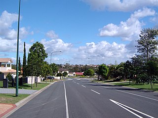
Browns Plains is a suburb in the City of Logan, Queensland, Australia. In the 2021 census, Browns Plains had a population of 6,632 people.

<span class="mw-page-title-main">Larapinta, Queensland</span> Suburb of Brisbane, Queensland, Australia

Larapinta is an outer southern industrial suburb in the City of Brisbane, Queensland, Australia. In the 2016 census, Larapinta had a population of 0 people.

<span class="mw-page-title-main">Greenbank, Queensland</span> Suburb of Logan City, Queensland, Australia

Greenbank is a rural residential suburb in the City of Logan, Queensland, Australia. In the 2016 census, Greenbank had a population of 7,694 people.

<span class="mw-page-title-main">Heritage Park, Queensland</span> Suburb of Logan City, Queensland, Australia

Heritage Park is a suburb in the City of Logan, Queensland, Australia. In the 2021 census, Heritage Park had a population of 4,930 people.

<span class="mw-page-title-main">Meadowbrook, Queensland</span> Suburb of Logan City, Queensland, Australia

Meadowbrook is a mixed-use suburb in the City of Logan, Queensland, Australia. In the 2016 census, Meadowbrook had a population of 3,113 people. The Logan Hospital and a TAFE college are located in the suburb.

<span class="mw-page-title-main">Underwood, Queensland</span> Suburb of Logan City, Queensland, Australia

Underwood is a suburb in the City of Logan, Queensland, Australia. In the 2016 census, Underwood had a population of 6,341 people.

<span class="mw-page-title-main">Heathwood, Queensland</span> Suburb of Brisbane, Queensland, Australia

Heathwood is an outer south-western suburb in the City of Brisbane, Queensland, Australia. In the 2016 census, Heathwood had a population of 2,794 people.

<span class="mw-page-title-main">Ellen Grove, Queensland</span> Suburb of Brisbane, Queensland, Australia

Ellen Grove is an outer south-western suburb in the City of Brisbane, Queensland, Australia. In the 2016 census, Ellen Grove had a population of 2,906 people.

<span class="mw-page-title-main">Carole Park, Queensland</span> Suburb of Ipswich, Queensland, Australia

Carole Park is an industrial suburb in the City of Ipswich, Queensland, Australia. In the 2016 census Carole Park had a population of 4 people.

<span class="mw-page-title-main">Drewvale, Queensland</span> Suburb of Brisbane, Queensland, Australia

Drewvale is an outer suburb of the City of Brisbane, Queensland, Australia. In the 2016 census, Drewvale had a population of 4,779 people.

<span class="mw-page-title-main">Doolandella, Queensland</span> Suburb of Brisbane, Queensland, Australia

Doolandella is an outer western suburb in the City of Brisbane, Queensland, Australia. In the 2021 census, Doolandella had a population of 7,123 people.

<span class="mw-page-title-main">Parkinson, Queensland</span> Suburb of Brisbane, Queensland, Australia

Parkinson is an outer southern suburb in the City of Brisbane, Queensland, Australia. In the 2016 census, Parkinson had a population of 10,878 people.

<span class="mw-page-title-main">Richlands, Queensland</span> Suburb of Brisbane, Queensland, Australia

Richlands is an outer south-western suburb in the City of Brisbane, Queensland, Australia. In the 2016 census, Richlands had a population of 3,598 people.

<span class="mw-page-title-main">Windaroo, Queensland</span> Suburb of Logan City, Queensland, Australia

Windaroo is a residential suburb in the outer southern areas of the City of Logan, Queensland, Australia. In the 2016 census, Windaroo had a population of 2,827 people.

<span class="mw-page-title-main">New Beith, Queensland</span> Suburb of Logan City, Queensland, Australia

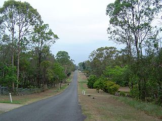
New Beith is a rural residential locality in the City of Logan, Queensland, Australia. In the 2021 census, New Beith had a population of 5,642 people.

References

  1. 1 2 3 Australian Bureau of Statistics (27 June 2017). "Forestdale (SSC)". 2016 Census QuickStats. Retrieved 20 October 2018. OOjs UI icon edit-ltr-progressive.svg
  2. "Forestdale – suburb in City of Logan (entry 45265)". Queensland Place Names. Queensland Government . Retrieved 26 January 2020.
  3. 1 2 3 "Queensland Globe". State of Queensland . Retrieved 14 March 2020.
  4. Surname Meanings and Origins Archived 20 March 2008 at the Wayback Machine . Retrieved 7 September 2014.
  5. "Forestdale History". Archived from the original on 16 February 2008. Retrieved 7 September 2014.
  6. 1 2 Australian Bureau of Statistics (31 October 2012). "Forestdale (State Suburb)". 2011 Census QuickStats. Retrieved 11 March 2014. OOjs UI icon edit-ltr-progressive.svg
  7. 1 2 "Greenwood Lakes". Logan City Council. Archived from the original on 14 September 2014. Retrieved 14 September 2014.