Wolffdene, Queensland

Last updated

Wolffdene
Queensland
Wickham Road at Wolffdene, Queensland.jpg
Wickham Road, 2016
Australia Queensland location map.svg
Red pog.svg
Wolffdene
Coordinates 27°46′50″S153°10′27″E / 27.7805°S 153.1741°E / -27.7805; 153.1741 (Wolffdene (centre of locality)) Coordinates: 27°46′50″S153°10′27″E / 27.7805°S 153.1741°E / -27.7805; 153.1741 (Wolffdene (centre of locality))
Population288 (2016 census) [1]
 • Density25.95/km2 (67.2/sq mi)
Postcode(s) 4207
Area11.1 km2 (4.3 sq mi)
Time zone AEST (UTC+10:00)
Location
LGA(s) Logan City
State electorate(s) Logan
Federal division(s) Forde
Suburbs around Wolffdene:
Buccan Belivah
Bannockburn
Yatala
Logan Village Wolffdene Luscombe
Cedar Creek Cedar Creek Luscombe

Wolffdene is a rural locality in the City of Logan, Queensland, Australia. [2] In the 2016 census Wolffdene had a population of 288 people. [1]

Contents

Geography

The locality is bounded to the east by the Albert River. [3]

History

Belivah Provisional School opened circa 1874 and classes were held in a church. In September 1891 the residents were agitating to relocate the school to a location closer to where more children lived, but Queensland Government did not wish to pay for a new provisional school. [4] In March 1892 the residents commenced the construction of a new school themselves and the Queensland Government agreed to contribute £37 to complete the building. [5] It was renamed Wolffdene Provisional School. On 1 January 1909 it became Wolffdene State School. It closed in 1935 but re-opened 15 February 1939. It closed permanently on 31 August 1942. [6] [7] It was located at 810 Beaudesert Beenleigh Road ( 27°47′02″S153°11′10″E / 27.7838°S 153.1862°E / -27.7838; 153.1862 (Wolffedene State School (site)) ). [8] [9]

In 1989, the Goss Government rejected a proposal to build Wolffdene Dam on the Albert River. Later, a dam near Glendower Homestead was once planned in a Queensland Government water strategy report from 1990. The option was discarded after it was revealed the site was too costly to build a dam for the amount of water it would have provided. [10]

In the 2011 census, Wolffdene had a population of 292 people. [11]

In the 2016 census Wolffdene had a population of 288 people. [1]

Education

There are no schools in Wolffdene. The nearest government schools are Windaroo State School in Mount Warren Park to the north and Cedar Creek State School in Cedar Creek to the south. The nearest government secondary school is Windaroo Valley State High School in Bahrs Scrub to the north. [3]

Related Research Articles

Beaudesert, Queensland Town in Queensland, Australia

Beaudesert is a rural town and locality in the Scenic Rim Region, Queensland, Australia. In the 2016 census, Beaudesert had a population of 6,395 people.

Jimboomba Town in Queensland, Australia

Jimboomba is a town and locality in the City of Logan, Queensland, Australia. In the 2016 census, the locality of Jimboomba had a population of 13,201 people.

Beenleigh, Queensland Suburb of City of Logan, Queensland, Australia

Beenleigh is a town and suburb in the City of Logan, Queensland, Australia. In the 2016 census, Beenleigh had a population of 8,252 people.

Greenslopes, Queensland Suburb of Brisbane, Queensland, Australia

Greenslopes is a suburb in the City of Brisbane, Queensland, Australia. In the 2016 census Greenslopes had a population of 8,936 people.

Woodridge, Queensland Suburb of Logan City, Queensland, Australia

Woodridge is a town and suburb in the City of Logan, Queensland, Australia. In the 2016 census, the suburb of Woodridge had a population of 12,579 people. Woodridge was home to a major timber reserve.

Yatala, Queensland Suburb of Gold Coast City, Queensland, Australia

Yatala is a suburb in the City of Gold Coast, Queensland, Australia. In the 2016 census Yatala had a population of 1,312 people.

Logan Village, Queensland Suburb of Logan City, Queensland, Australia

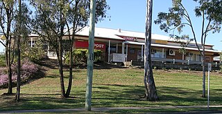
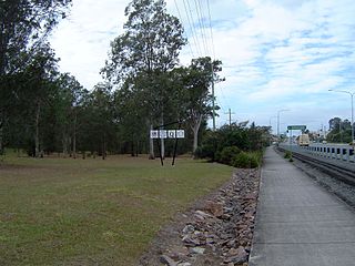
Logan Village is a semi-rural town and locality in the City of Logan, Queensland, Australia. In the 2016 census, the locality of Logan Village had a population of 4,417 people. Logan Village was once known as the head of the navigable Logan River. Its importance as a town grew again when the railway arrived.

Munruben, Queensland Suburb of Logan City, Queensland, Australia

Munruben is a locality in Logan City, Queensland, Australia. Once a rural community, it has been developed into a low density residential community. At the 2016 Australian Census the suburb recorded a population of 2,871.

Bulwer, Queensland Suburb of City of Brisbane, Queensland, Australia

Bulwer is a coastal town and locality at the north-western end of Moreton Island in the City of Brisbane, Queensland, Australia. In the 2016 census the locality of Bulwer had a population of 49 people.

Bahrs Scrub, Queensland Suburb of Logan City, Queensland, Australia

Bahrs Scrub is an urban locality in the City of Logan, Queensland, Australia. In the 2016 census, Bahrs Scrub had a population of 1,919 people.

Mount Warren Park, Queensland Suburb of Logan City, Queensland, Australia

Mount Warren Park is a residential suburb in the outer eastern area of City of Logan, Queensland, Australia. The mountain Mount Warren is within the suburb. In the 2016 census, Mount Warren Park had a population of 5,791 people.

Advancetown, Queensland Suburb of Gold Coast, Queensland, Australia

Advancetown is a rural outer locality in the City of Gold Coast, Queensland, Australia. In the 2016 census, Advancetown had a population of 482 people.

Gilston, Queensland Suburb of City of Gold Coast, Queensland, Australia

Gilston is a rural residential locality in the City of Gold Coast, Queensland, Australia. In the 2016 census, Gilston had a population of 2,459 people.

Alberton, Queensland Suburb of Gold Coast, Queensland, Australia

Alberton is a rural locality in the City of Gold Coast, Queensland, Australia. In the 2016 census, Alberton had a population of 590 people.

Cedar Creek, Queensland (Logan & Gold Coast) Suburb of City of Gold Coast, Queensland, Australia

Cedar Creek is a locality split between City of Gold Coast and Logan City in Queensland, Australia. In the 2016 census Cedar Creek had a population of 838 people.

Belivah, Queensland Suburb of Logan City, Queensland, Australia

Belivah is a suburb in the City of Logan, Queensland, Australia. In the 2016 census, Belivah had a population of 317.

Tamborine, Queensland Suburb of Logan City, Queensland, Australia

Tamborine is a town in the Scenic Rim Region and a locality split between the Scenic Rim Region and the City of Logan in Queensland, Australia. In the 2016 census the locality of Tamborine had a population of 3,950 people.

Gleneagle, Queensland Suburb of Scenic Rim Region, Queensland, Australia

Gleneagle is a rural locality in the Scenic Rim Region, Queensland, Australia. In the 2016 census, Gleneagle had a population of 1877 people.

Monduran, Queensland Suburb of Bundaberg Region, Queensland, Australia

Monduran is a rural locality in the Bundaberg Region, Queensland, Australia. In the 2016 census, Monduran had a population of 91 people.

Riverbend, Queensland Suburb of Logan City, Queensland, Australia

Riverbend is a rural locality in the City of Logan, Queensland, Australia. It is expected to be developed for residential use as the population of the city grows.

References

  1. 1 2 3 Australian Bureau of Statistics (27 June 2017). "Wolffdene (SSC)". 2016 Census QuickStats. Retrieved 20 October 2018. OOjs UI icon edit-ltr-progressive.svg
  2. "Wolffdene – locality in City of Logan (entry 45297)". Queensland Place Names. Queensland Government . Retrieved 27 December 2020.
  3. 1 2 "Queensland Globe". State of Queensland . Retrieved 24 March 2021.
  4. "To-day's Deputation". Brisbane (5, 908). Queensland, Australia. 24 September 1891. p. 4. Archived from the original on 29 January 2021. Retrieved 18 September 2020 via National Library of Australia.
  5. "To-Day, Marh 3". The Brisbane Courier . XLVIII (10, 650). Queensland, Australia. 3 March 1892. p. 4. Archived from the original on 29 January 2021. Retrieved 18 September 2020 via National Library of Australia.
  6. Queensland Family History Society (2010), Queensland schools past and present (Version 1.01 ed.), Queensland Family History Society, ISBN   978-1-921171-26-0
  7. "Agency ID 8403, Wolffdene State School". Queensland State Archives . Retrieved 3 April 2014.
  8. "Tamborine" (Map). Queensland Government. 1926. marked with an "S". Archived from the original on 5 April 2020. Retrieved 18 September 2020.
  9. Clair, Kieran (6 November 2017). "Queensland history on the auctioneer's block south of the city". The Courier-Mail . Archived from the original on 18 September 2020. Retrieved 18 September 2020.
  10. Darrell Giles. "Albert River dam site revealed". The Sunday Mail (Brisbane) . Queensland Newspapers. Archived from the original on 3 June 2012. Retrieved 19 July 2010.
  11. Australian Bureau of Statistics (31 October 2012). "Wolffdene". 2011 Census QuickStats. Retrieved 2 April 2014. OOjs UI icon edit-ltr-progressive.svg