Riverbend, Queensland

Last updated

Riverbend
Logan City,  Queensland
Australia Queensland location map.svg
Red pog.svg
Riverbend
Coordinates 27°49′40″S152°58′20″E / 27.8277°S 152.9722°E / -27.8277; 152.9722 (Riverbend (centre of locality)) Coordinates: 27°49′40″S152°58′20″E / 27.8277°S 152.9722°E / -27.8277; 152.9722 (Riverbend (centre of locality))
Established2017
Postcode(s) 4280
Area16.0 km2 (6.2 sq mi)
Time zone AEST (UTC+10:00)
LGA(s) Logan City
State electorate(s) Logan
Federal division(s) Wright
Suburbs around Riverbend:
Flagstone South Maclean South Maclean
Flagstone Riverbend Jimboomba
Monarch Glen
Kagaru
Cedar Grove Glenlogan

Riverbend is a rural locality in the City of Logan, Queensland, Australia. [1] Designated as a separate locality in 2017, it will be progressively developed for residential use as the population of the city grows. [2]

Contents

Geography

Riverbend is situated along the development corridor south of Brisbane in the Greater Flagstone development area. The locality takes its name from the bend in the Logan River on the southern boundary of the suburb. [1] [3]

On the river on the southern boundary is the Cedar Grove Weir. [3]

History

Riverbend is situated in the Bundjalung traditional Aboriginal country. [4] [5]

Jimboomba Timber Reserve Provisional School opened circa 1899. In 1906, it was renamed Martindale Provisional School. On 1 January 1909, it became Martindale State School. It was in the area of Gittins Road (approx 27°50′02″S152°57′15″E / 27.8340°S 152.9541°E / -27.8340; 152.9541 (Martindale State School) ). [6] It closed in 1922. [7] The school building was then relocated to Cedar Grove, where it opened as Cedar Grove State School in 1923 and closed in 1965. [8]

Riverbend was approved and designated as a locality within Logan City by the Department of Natural Resources and Mines in September 2017. [2] It was excised from land formerly in Jimboomba. [1]

Education

There are no schools in Riverbend. The nearest government primary schools are Flagstone State School in neighbouring Flagstone to the north-west and Jimboomba State School in neighbouring Jimboomba to the east. The nearest government secondary school is Flagstone State Community College in Flagstone. [3]

Related Research Articles

Jimboomba Town in Queensland, Australia

Jimboomba is a town and locality in the City of Logan, Queensland, Australia. In the 2016 census, the locality of Jimboomba had a population of 13,201 people.

Greenbank, Queensland Suburb of Logan City, Queensland, Australia

Greenbank is a rural residential suburb in the City of Logan, Queensland, Australia. In the 2016 census, Greenbank had a population of 7,694 people.

Underwood, Queensland Suburb of Logan City, Queensland, Australia

Underwood is a suburb in the City of Logan, Queensland, Australia. In the 2016 census, Underwood had a population of 6,341 people.

Karrabin, Queensland Suburb of Ipswich, Queensland, Australia

Karrabin is a rural locality in the City of Ipswich, Queensland, Australia. In the 2016 census, Karrabin had a population of 423 people.

Closeburn, Queensland Suburb of Moreton Bay Region, Queensland, Australia

Closeburn is a rural locality in the Moreton Bay Region, Queensland, Australia. In the 2016 census, Closeburn had a population of 594 people.

Stockleigh is a rural locality in the City of Logan, Queensland, Australia. In the 2016 census, Stockleigh had a population of 765 people.

Greater Flagstone

Greater Flagstone is a district and development area located within the Logan City local government area in south-east Queensland, Australia. Greater Flagstone is situated along the Sydney–Brisbane rail corridor between two future employment precincts at North Maclean and Bromelton. Greater Flagstone is expected to provide approximately 50,000 dwellings to house a population of up to 120,000 people with a development plan expected to take 30-40 years. The suburb of Flagstone was gazetted in 1997 and district suburbs were gazetted from 2016.

North Maclean, Queensland Suburb of City of Logan, Queensland, Australia

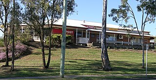
North Maclean is a locality in the City of Logan, Queensland, Australia. In the 2016 census, North Maclean had a population of 1,536 people.

South Maclean, Queensland Suburb of Logan City, Queensland, Australia

South Maclean is a rural locality in the City of Logan, Queensland, Australia. In the 2016 census South Maclean had a population of 1,362 people.

Cedar Grove, Queensland Suburb of Logan City, Queensland, Australia

Cedar Grove is a mixed-use locality in the City of Logan, Queensland, Australia. In the 2016 census, Cedar Grove had a population of 2,041 people.

Tamborine, Queensland Suburb of Logan City, Queensland, Australia

Tamborine is a rural town in the Scenic Rim Region and a locality split between the Scenic Rim Region and the City of Logan in Queensland, Australia. In the 2016 census, the locality of Tamborine had a population of 3,950 people.

Allenview, Queensland Suburb of Scenic Rim Region, Queensland, Australia

Allenview is a rural locality in the Scenic Rim Region, Queensland, Australia. In the 2016 census, Allenview had a population of 184 people.

Upper Flagstone is a rural locality in the Lockyer Valley Region, Queensland, Australia. In the 2016 census Upper Flagstone had a population of 171 people.

Lamington, Queensland Suburb of Scenic Rim Region, Queensland, Australia

Lamington is a rural locality in the Scenic Rim Region, Queensland, Australia. In the 2016 census, Lamington had a population of 86 people.

Rockmount is a rural locality in the Lockyer Valley Region, Queensland, Australia. In the 2016 census, Rockmount had a population of 87 people.

Flagstone, Queensland Suburb of Logan City, Queensland, Australia

Flagstone is a suburban locality in the Greater Flagstone district of the City of Logan, Queensland, Australia. In 2018, the estimated population of Flagstone was 5,651 people.

Flinders Lakes is a rural locality in the City of Logan, Queensland, Australia.

Monarch Glen is a rural locality in the City of Logan, Queensland, Australia. It is situated along the development corridor south of Brisbane in the Greater Flagstone development area

Glenlogan is a rural locality in the City of Logan, Queensland, Australia. It is part of the suburban development corridor south of Brisbane in the Greater Flagstone development area.

Silverbark Ridge is a rural locality in the City of Logan, Queensland, Australia. It is situated along the development corridor south of Brisbane in the Greater Flagstone development area and expected to become a residential area as the city's population increases.

References

  1. 1 2 3 "Riverbend – locality in City of Logan (entry 50117)". Queensland Place Names. Queensland Government . Retrieved 16 November 2019.
  2. 1 2 "Riverbend". Logan City Council . 25 January 2018. Archived from the original on 3 August 2019.
  3. 1 2 3 "Queensland Globe". State of Queensland . Retrieved 2 June 2022.
  4. "Bundjalung – Muurrbay Aboriginal Language and Culture Co-operative". muurrbay.org.au. Archived from the original on 21 September 2020. Retrieved 19 December 2020.
  5. "AIATSIS code E66: Yugarabul". Federal government. Australian Institute of Aboriginal and Torres Strait Islander Studies. Archived from the original on 13 August 2020. Retrieved 31 July 2020.
  6. "Jimboomba". Logan City Council . Archived from the original on 8 March 2020. Retrieved 29 April 2020.
  7. Queensland Family History Society (2010), Queensland schools past and present (Version 1.01 ed.), Queensland Family History Society, ISBN   978-1-921171-26-0
  8. "Agency ID 6292, Cedar Grove State School". Queensland State Archives . Retrieved 11 May 2014.