Regents Park, Queensland

Last updated

Regents Park
Logan City,  Queensland
Lamberth Road Regents Park.JPG
Lamberth Road, 2014
Australia Queensland location map.svg
Red pog.svg
Regents Park
Coordinates 27°40′36″S153°02′31″E / 27.6766°S 153.0419°E / -27.6766; 153.0419 (Regents Park (centre of suburb))
Population11,103 (SAL 2021) [1]
Postcode(s) 4118
Area4.8 km2 (1.9 sq mi)
Time zone AEST (UTC+10:00)
Location
LGA(s) Logan City
State electorate(s)
Federal division(s) Rankin
Suburbs around Regents Park:
Hillcrest Browns Plains Browns Plains
Hillcrest Regents Park Heritage Park
Boronia Heights Park Ridge Park Ridge

Regents Park is a suburb in the City of Logan, Queensland, Australia. [2] In the 2021 census, Regents Park had a population of 11,103 people. [3]

Contents

Geography

The suburb is 4.76 square kilometres (1.84 sq mi) in area and the land use is almost entirely residential. [4]

History

Regents Park was originally part of Browns Plains. It was subdivided for residential housing in the early 1974.The first name for this area was Emerald Hills, hence Emerald Drive The name Regents Park was proposed by the land developer. [2] [5]

St Bernardine's Catholic School opened on 27 January 1982. [6]

Yugumbir State School opened on 28 January 1986. [7] The name 'Yugumbir' is an Aboriginal word for the district. [8]

Regents Park State School opened on 1 January 1994. [7]

Demographics

Historical population
YearPop.±% p.a.
19915,399    
19968,206+8.73%
20019,184+2.28%
20069,538+0.76%
YearPop.±% p.a.
201110,657 [9] +2.24%
201610,962 [10] +0.57%
202111,103 [3] +0.26%

In the 2011 census, Regents Park had a population of 10,657 people; the population was 50.5% female and 49.5% male. The median age of the Regents Park population was 30 years, 7 years below the Australian average. Children aged under 15 years made up 25.3% of the population and people aged 65 years and over made up 6.0% of the population. 67.1% of people living in Regents Park were born in Australia, similar to the national average of 69.8%. The other top responses for country of birth were New Zealand 9.2%, England 3.6%, Philippines 1.5%, Bosnia and Herzegovina 0.9%, South Africa 0.6%. 80.2% of people spoke only English at home; the next most popular languages were 1.3% Samoan, 1.2% Serbian, 1.2% Spanish, 0.8% Mandarin, 0.7% Croatian. The most common response for religious affiliation was No Religion 24.9%, followed by Catholic 23.1%, Anglican 15.8%, Uniting Church 5.0% and Presbyterian and Reformed 3.1%. The great majority of households (84.9%) were family households, 12.3% were single person households and 2.8% were group households. The average household size was 3.1 people. [9]

In the 2021 census, Regents Park had a population of 11,103 people; the population was 50.9% female and 49.1% male. The median age of the Regents Park population was 34 years, 4 years below the Australian average. Children aged under 15 years made up 23.5% of the population and people aged 65 years and over made up 9.6% of the population. 65.3% of people living in Regents Park were born in Australia, similar to the national average of 66.9%. The other top responses for country of birth were New Zealand 7.6%, India 3.2%, England 2.5%, the Philippines 1.8% and China (without SARs) 1.2%. 71.1% of people spoke only English at home; the next most popular languages were 3.2% Punjabi, 2.3% Mandarin, 1.3% Serbian, 1.2.% Hindi and 1.0% Arabic. The most common response for religious affiliation was No Religion at 41.5%, followed by Catholic 17.0%, Anglican 8.0% and 3.9% were other Christians. The great majority of households (83.9%) were family households, 13.5% were single (or lone) person households and 2.6% were group households. The average household size was 3.0 people. [3]

Education

Regents Park State School Regents Park State School, 2024.jpg
Regents Park State School

Regents Park State School is a government primary (Prep-6) school for boys and girls at Emerald Drive ( 27°40′55″S153°02′06″E / 27.6820°S 153.0350°E / -27.6820; 153.0350 (Regents Park State School) ). [11] [12] In 2018, the school had an enrolment of 760 students with 58 teachers (51 full-time equivalent) and 46 non-teaching staff (34 full-time equivalent). [13] It includes a special education program. [11] [14]

Yugumbir State School, 2022 Yugumbir State School, 2022.jpg
Yugumbir State School, 2022

Yugumbir State School is a government primary (Prep-6) school for boys and girls at Vansittart Road ( 27°40′33″S153°02′58″E / 27.6759°S 153.0494°E / -27.6759; 153.0494 (Yugumbir State School) ). [11] [15] In 2018, the school had an enrolment of 1,086 students with 77 teachers (73 full-time equivalent) and 42 non-teaching staff (29 full-time equivalent). [13] It includes a special education program. [11]

St Bernardine's School is a Catholic primary (Prep-6) school for boys and girls at 25 Vergulde Road ( 27°40′11″S153°02′05″E / 27.6697°S 153.0348°E / -27.6697; 153.0348 (St Bernardine's School) ). [11] [16] In 2018, the school had an enrolment of 738 students with 46 teachers (41 full-time equivalent) and 28 non-teaching staff (20 full-time equivalent). [13]

There are no secondary schools in Regents Park. The nearest government secondary schools are Browns Plains State High School in neighbouring Browns Plains to the north-west and Park Ridge State High School in neighbouring Park Ridge to the south. [17]

Amenities

There are a number of parks in the suburb, including:

Related Research Articles

<span class="mw-page-title-main">Mansfield, Queensland</span> Suburb of Brisbane, Queensland, Australia

Mansfield is a suburb in the City of Brisbane, Queensland, Australia. In the 2016 census, Mansfield had a population of 8,695 people.

<span class="mw-page-title-main">Algester, Queensland</span> Suburb of Brisbane, Queensland, Australia

Algester is a southern suburb in the City of Brisbane, Queensland, Australia. In the 2016 census, Algester had a population of 8,433 people.

<span class="mw-page-title-main">Sunnybank Hills, Queensland</span> Suburb of Brisbane, Queensland, Australia

Sunnybank Hills is an outer southern suburb in the City of Brisbane, Queensland, Australia. In the 2021 census, Sunnybank Hills had a population of 18,085 people.

<span class="mw-page-title-main">Seven Hills, Queensland</span> Suburb of Brisbane, Queensland, Australia

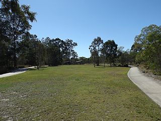
Seven Hills is a suburb in the City of Brisbane, Queensland, Australia. In the 2021 census, Seven Hills had a population of 2,732 people.

<span class="mw-page-title-main">Ashmore, Queensland</span> Suburb of Gold Coast, Queensland, Australia

Ashmore is a suburb of the City of Gold Coast, Queensland, Australia. In the 2016 census, Ashmore had a population of 11,910 people.

<span class="mw-page-title-main">Browns Plains, Queensland</span> Suburb of Logan City, Queensland, Australia

Browns Plains is a suburb in the City of Logan, Queensland, Australia. In the 2021 census, Browns Plains had a population of 6,632 people.

<span class="mw-page-title-main">Heritage Park, Queensland</span> Suburb of Logan City, Queensland, Australia

Heritage Park is a suburb in the City of Logan, Queensland, Australia. In the 2021 census, Heritage Park had a population of 4,930 people.

<span class="mw-page-title-main">Marsden, Queensland</span> Suburb of Logan City, Queensland, Australia

Marsden is a suburb in the City of Logan, Queensland, Australia. In the 2016 census, Marsden had a population of 14,071 people.

<span class="mw-page-title-main">Rochedale South, Queensland</span> Suburb of Logan City, Queensland, Australia

Rochedale South is a northern residential suburb in the City of Logan, Queensland, Australia. In the 2016 census, Rochedale South had a population of 15,317 people.

<span class="mw-page-title-main">Shailer Park, Queensland</span> Suburb of City of Logan, Queensland, Australia

Shailer Park is a suburb in the City of Logan, Queensland, Australia. In the 2021 census, Shailer Park had a population of 12,182 people.

<span class="mw-page-title-main">Holland Park West, Queensland</span> Suburb of Brisbane, Queensland, Australia

Holland Park West is a suburb in the City of Brisbane, Queensland, Australia. In the 2016 census, Holland Park West had a population of 6,376 people.

<span class="mw-page-title-main">Mount Gravatt East, Queensland</span> Suburb of Brisbane, Queensland, Australia

Mount Gravatt East is a southern suburb in the City of Brisbane, Queensland, Australia. In the 2016 census, Mount Gravatt East had a population of 11,838 people.

<span class="mw-page-title-main">Stafford Heights, Queensland</span> Suburb of Brisbane, Queensland, Australia

Stafford Heights is a northern suburb in the City of Brisbane, Queensland, Australia. In the 2016 census, Stafford Heights had a population of 6,833 people.

<span class="mw-page-title-main">Pallara, Queensland</span> Suburb of Brisbane, Queensland, Australia

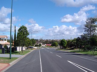
Pallara is an outer southern suburb in the City of Brisbane, Queensland, Australia. In the 2021 census, Pallara had a population of 3,861 people.

Rothwell is a coastal suburb in the City of Moreton Bay, Queensland, Australia. In the 2021 census, Rothwell had a population of 7,538 people.

<span class="mw-page-title-main">Slacks Creek, Queensland</span> Suburb of Logan City, Queensland, Australia

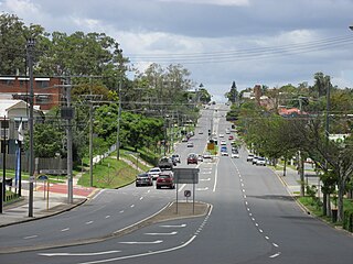
Slacks Creek is a suburb in the City of Logan, Queensland, Australia. In the 2016 census, Slacks Creek had a population of 10,432 people.

<span class="mw-page-title-main">Mount Warren Park, Queensland</span> Suburb of Logan City, Queensland, Australia

Mount Warren Park is a residential suburb in the outer eastern area of the City of Logan, Queensland, Australia. The mountain of Mount Warren is within the suburb. In the 2016 census, Mount Warren Park had a population of 5,791 people.

<span class="mw-page-title-main">Waterford, Queensland</span> Town in Queensland, Australia

Waterford is a town and suburb in the City of Logan, Queensland, Australia. In the 2021 census, the suburb of Waterford had a population of 5,796 people.

<span class="mw-page-title-main">Biddaddaba, Queensland</span> Suburb of Scenic Rim Region, Queensland, Australia

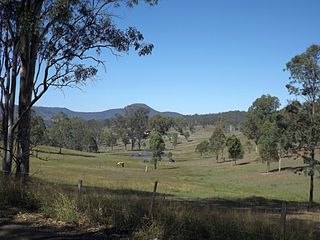
Biddaddaba is a rural locality in the Scenic Rim Region, Queensland, Australia. In the 2021 census, Biddaddaba had a population of 171 people.

Benobble is a rural locality in the Scenic Rim Region, Queensland, Australia. In the 2016 census, Benobble had a population of 43 people.

References

  1. Australian Bureau of Statistics (28 June 2022). "Regents Park (Qld) (suburb and locality)". Australian Census 2021 QuickStats. Retrieved 28 June 2022.  OOjs UI icon edit-ltr-progressive.svg
  2. 1 2 "Regents Park – suburb in City of Logan (entry 47119)". Queensland Place Names. Queensland Government . Retrieved 27 December 2020.
  3. 1 2 3 Australian Bureau of Statistics (28 June 2022). "Regents Park (SAL)". 2021 Census QuickStats. Retrieved 28 February 2023. OOjs UI icon edit-ltr-progressive.svg
  4. "Layers: Locality; Protected areas and forests; Land use". Queensland Globe. Queensland Government. Archived from the original on 19 December 2017. Retrieved 13 April 2024.
  5. "Regents Park". Suburbs. Logan City Council. Archived from the original on 8 May 2014. Retrieved 7 May 2014.
  6. Queensland Family History Society (2010), Queensland schools past and present (Version 1.01 ed.), Queensland Family History Society, ISBN   978-1-921171-26-0
  7. 1 2 "Opening and closing dates of Queensland Schools". Queensland Government . Retrieved 18 April 2019.
  8. "Prospectus 2014" (PDF). Yugumbir State School. Archived from the original (PDF) on 8 May 2014. Retrieved 7 May 2014.
  9. 1 2 Australian Bureau of Statistics (31 October 2012). "Regents Park (SSC)". 2011 Census QuickStats. Retrieved 7 May 2014. OOjs UI icon edit-ltr-progressive.svg
  10. Australian Bureau of Statistics (27 June 2017). "Regents Park (SSC)". 2016 Census QuickStats. Retrieved 20 October 2018. OOjs UI icon edit-ltr-progressive.svg
  11. 1 2 3 4 5 "State and non-state school details". Queensland Government. 9 July 2018. Archived from the original on 21 November 2018. Retrieved 21 November 2018.
  12. "Regents Park State School". Regents Park State School. 29 November 2020. Retrieved 13 April 2024.
  13. 1 2 3 "ACARA School Profile 2018". Australian Curriculum, Assessment and Reporting Authority. Archived from the original on 27 August 2020. Retrieved 28 January 2020.
  14. "Regents Park SS - Special Education Program". Archived from the original on 12 March 2020. Retrieved 21 November 2018.
  15. "Yugumbir State School". Yugumbir State School. 29 November 2020. Retrieved 13 April 2024.
  16. "St Bernardine's School". Archived from the original on 25 November 2012. Retrieved 21 November 2018.
  17. "Queensland Globe". State of Queensland . Retrieved 8 March 2021.
  18. 1 2 3 4 5 6 7 8 "Land for public recreation - Queensland". Queensland Open Data. Queensland Government. 20 November 2020. Archived from the original on 22 November 2020. Retrieved 22 November 2020.
  19. "Regents Park parks". Logan City Council . Archived from the original on 7 March 2022. Retrieved 7 March 2022.