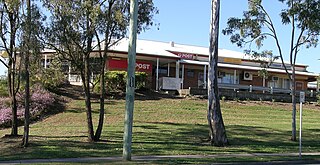
Jimboomba is a town and locality in the City of Logan, Queensland, Australia. In the 2021 census, the locality of Jimboomba had a population of 7,423 people.
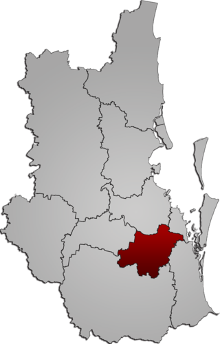
The City of Logan is a local government area (LGA) located in the south of Greater Brisbane in South East Queensland (SEQ), Australia. Situated between the City of Brisbane to the north and the City of Gold Coast to the south, the City of Logan also borders the Scenic Rim Region, the City of Ipswich, and Redland City LGAs. Logan is divided into 70 suburbs and 12 divisions; a councillor is elected to each of the latter. The council had a population of 326,615 as of June 2018.

Beenleigh is a town and suburb in the City of Logan, Queensland, Australia. In the 2021 census, the suburb of Beenleigh had a population of 8,425 people.
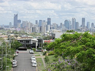
Greenslopes is a southern suburb in the City of Brisbane, Queensland, Australia. It is 6.0 kilometres (3.7 mi) by road south of the Brisbane CBD. In the 2021 census, Greenslopes had a population of 7,941 people.

Greenbank is a rural residential suburb in the City of Logan, Queensland, Australia. In the 2021 census, Greenbank had a population of 9,587 people.

Hillcrest is a western suburb in the City of Logan, Queensland, Australia. In the 2021 census, Hillcrest had a population of 6,268 people.
Loganlea is a suburb in the City of Logan, Queensland, Australia. In the 2021 census, Loganlea had a population of 8,716 people.

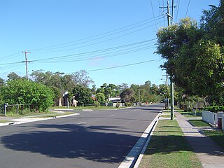
Underwood is a suburb in the City of Logan, Queensland, Australia. In the 2021 census, Underwood had a population of 6,809 people.

Munruben is a rural locality in the City of Logan, Queensland, Australia. Once a rural community, it has been developed into a low density residential community. In the 2021 census, Munruben had a population of 2,753 people.

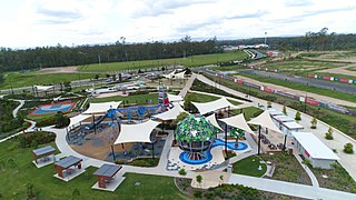
Greater Flagstone is a district and development area located within the Logan City local government area in south-east Queensland, Australia. Greater Flagstone is situated along the Sydney–Brisbane rail corridor between two future employment precincts at North Maclean and Bromelton. Greater Flagstone is expected to provide approximately 50,000 dwellings to house a population of up to 120,000 people with a development plan expected to take 30-40 years. The suburb of Flagstone was gazetted in 1997 and district suburbs were gazetted from 2016.

New Beith is a rural residential locality in the City of Logan, Queensland, Australia. In the 2021 census, New Beith had a population of 5,642 people.

Tweed Heads West is a suburb of Tweed Heads, located on the Tweed River in north-eastern New South Wales, Australia, in Tweed Shire along the Queensland and New South Wales border.

North Maclean is a locality in the City of Logan, Queensland, Australia. In the 2021 census, North Maclean had a population of 1,581 people.

Undullah is a rural locality split between the City of Logan and the Scenic Rim Region, Queensland, Australia. In the 2021 census, Undullah had a population of 24 people.
Cobaki Lakes is a suburb of Tweed Heads, located in the Northern Rivers Region of New South Wales, along the Queensland and New South Wales border.
Flagstone is a suburban locality in the Greater Flagstone district of the City of Logan, Queensland, Australia. In the 2021 census, Flagstone had a population of 7,087 people.

Flinders Lakes is a rural locality in the City of Logan, Queensland, Australia. It is situated along the development corridor south of Brisbane in the Greater Flagstone development area and is one of four new suburbs that have been created in Logan to house a predicted population boom between Brisbane and the Gold Coast.

Monarch Glen is a rural locality in the City of Logan, Queensland, Australia. It is situated along the development corridor south of Brisbane in the Greater Flagstone development area and is one of four new suburbs that have been created in Logan to house a predicted population boom between Brisbane and the Gold Coast. In the 2021 census, Monarch Glen had "no people or a very low population".

Riverbend is a rural locality in the City of Logan, Queensland, Australia. Designated as a separate locality in 2017, it will be progressively developed for residential use as the population of the city grows. In the 2021 census, Riverbend had a population of 661 people.
Glenlogan is a rural locality in the City of Logan, Queensland, Australia. It is part of the suburban development corridor south of Brisbane in the Greater Flagstone development area. In the 2021 census, Glenlogan had a population of 1,122 people.
