Clark, Pennsylvania | |
---|---|
Coordinates: 41°16′55″N80°24′35″W / 41.28194°N 80.40972°W | |
Country | United States |
State | Pennsylvania |
County | Mercer |
Established | 1829 |
Area | |
• Total | 3.62 sq mi (9.38 km2) |
• Land | 3.01 sq mi (7.80 km2) |
• Water | 0.61 sq mi (1.58 km2) |
Highest elevation [2] (southwest corner of township) | 1,200 ft (400 m) |
Lowest elevation [2] (Shenango River Reservoir) | 896 ft (273 m) |
Population | |
• Total | 576 |
• Density | 191.30/sq mi (73.87/km2) |
Time zone | UTC-4 (EST) |
• Summer (DST) | UTC-5 (EDT) |
Zip code | 16113 |
Area code | 724 |
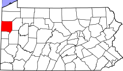
Clark is a borough in western Mercer County, Pennsylvania, United States, along the southern shore of the Shenango River Reservoir. The population was 576 at the 2020 census. [4] It is part of the Hermitage micropolitan area.
Clark bore the name of Clarksville into the late 1950s. The original community was moved to the present site following the construction of a Shenango River dam for flood control near Sharpsville.
Clark is located at 41°16′55″N80°24′35″W / 41.28194°N 80.40972°W (41.282049, -80.409591). [5]
According to the United States Census Bureau, the borough has a total area of 3.8 square miles (9.8 km2), of which 3.0 square miles (7.8 km2) is land and 0.7 square miles (1.8 km2) (19.31%) is water.
Census | Pop. | Note | %± |
---|---|---|---|
1880 | 264 | — | |
1900 | 220 | — | |
1910 | 216 | −1.8% | |
1920 | 224 | 3.7% | |
1930 | 279 | 24.6% | |
1940 | 321 | 15.1% | |
1950 | 345 | 7.5% | |
1960 | 312 | −9.6% | |
1970 | 467 | 49.7% | |
1980 | 667 | 42.8% | |
1990 | 610 | −8.5% | |
2000 | 633 | 3.8% | |
2010 | 640 | 1.1% | |
2020 | 576 | −10.0% | |
2021 (est.) | 571 | [4] | −0.9% |
Sources: [6] [7] [8] [9] [3] |
As of the census [7] of 2000, there were 633 people, 227 households, and 194 families residing in the borough. The population density was 207.9 inhabitants per square mile (80.3/km2). There were 233 housing units at an average density of 76.5 per square mile (29.5/km2). The racial makeup of the borough was 99.53% White, 0.16% African American, 0.16% from other races, and 0.16% from two or more races. Hispanic or Latino of any race were 0.47% of the population.
There were 227 households, out of which 32.2% had children under the age of 18 living with them, 76.7% were married couples living together, 7.0% had a female householder with no husband present, and 14.1% were non-families. 11.9% of all households were made up of individuals, and 5.3% had someone living alone who was 65 years of age or older. The average household size was 2.79 and the average family size was 3.02.
In the borough the population was spread out, with 23.4% under the age of 18, 6.3% from 18 to 24, 28.0% from 25 to 44, 29.2% from 45 to 64, and 13.1% who were 65 years of age or older. The median age was 41 years. For every 100 females there were 92.4 males. For every 100 females age 18 and over, there were 93.2 males.
The median income for a household in the borough was $53,438, and the median income for a family was $56,944. Males had a median income of $40,729 versus $26,625 for females. The per capita income for the borough was $24,892. About 1.0% of families and 1.7% of the population were below the poverty line, including none of those under age 18 and 4.3% of those age 65 or over.
Mercer County is a county in the Commonwealth of Pennsylvania. As of the 2020 census, the population was 110,652. Its county seat is Mercer, and its largest city is Hermitage. The county is part of the Northwest Pennsylvania region of the state.
North Shenango Township is a township in Crawford County, Pennsylvania, United States. The population was 1,274 at the 2020 census, down from 1,410 at the 2010 census.
Pymatuning South is a census-designated place (CDP) in Crawford County, Pennsylvania, United States. The population was 479 at the 2010 census.
South Shenango Township is a township in Crawford County, Pennsylvania, United States. The population was 1,831 at the 2020 census, down from 2,037 at the 2010 census.
West Fallowfield Township is a township in Crawford County, Pennsylvania, United States. The population was 576 at the 2020 census, down from 605 at the 2010 census.
West Shenango Township is a township in Crawford County, Pennsylvania, United States. The population was 433 at the 2020 census, down from 504 at the 2010 census.
South New Castle is a borough in central Lawrence County, Pennsylvania, United States. The population was 649 at the 2020 census. It is primarily a residential community which lies south of the city of New Castle, and is part of the Pittsburgh metropolitan area. The borough will officially be annexed into nearby Shenango Township on January 1, 2026.
Greenville is a borough with home rule status in northwestern Mercer County, Pennsylvania, United States. Located along the Shenango River, it lies roughly 80 miles from both Pittsburgh and Cleveland. It is 1.89 square miles in area, and had a population of 5,541 as of the 2020 census.
Hermitage is a city in western Mercer County, Pennsylvania, United States. The population was 16,230 at the 2020 census, making it the largest city in Mercer County. It is located about 15 miles (24 km) northeast of Youngstown and about 60 miles (97 km) northwest of Pittsburgh. It is the principal city of the Hermitage micropolitan area, which includes all of Mercer County.
Jackson Center is a borough in eastern Mercer County, Pennsylvania, United States. The population was 192 at the 2020 census. It is part of the Hermitage micropolitan area.
Jamestown is a borough in northwestern Mercer County, Pennsylvania, United States, along the Shenango River. The population was reported as 580 on the 2020 census. It is part of the Hermitage micropolitan area.
Mercer is a borough in and the county seat of Mercer County, Pennsylvania, United States. The population was 1,982 at the 2020 census. It is part of the Hermitage micropolitan area.
New Lebanon is a borough in northeastern Mercer County, Pennsylvania, United States. The population was 186 at the 2020 census. It is part of the Hermitage micropolitan area.
Sandy Lake is a borough in eastern Mercer County, Pennsylvania, United States. It was established in 1849. The population was 649 at the 2020 census. It is part of the Hermitage micropolitan area.
Sharpsville is a borough that is located in western Mercer County, Pennsylvania, United States, along the Shenango River. The population was 4,253 as of the 2020 census. It is part of the Hermitage micropolitan area.
Sheakleyville is a borough in northern Mercer County, Pennsylvania, United States. The population was 142 at the 2010 census, a figure which increased to 150 tabulated residents in 2020. It is part of the Hermitage micropolitan area.
Shenango Township is a township in Mercer County, Pennsylvania, United States. The population was 3,519 at the 2020 census, down from 3,929 in 2010.
Stoneboro is a borough in eastern Mercer County, Pennsylvania, United States. The population was 946 at the 2020 census. It is part of the Hermitage micropolitan area.
West Middlesex is a borough along the Shenango River in southwestern Mercer County, Pennsylvania, United States. The population was 815 at the 2020 Census. It is part of the Hermitage micropolitan area.
Wheatland is a former borough in Mercer County, Pennsylvania, United States, along the Shenango River. The population was 583 at the 2020 census. On January 1, 2024, Wheatland merged with the neighboring city of Hermitage after residents of both communities voted to approve the merger in November 2022.