Clinton, Massachusetts | |
---|---|
Coordinates: 42°25′15″N71°41′10″W / 42.42083°N 71.68611°W | |
Country | United States |
State | Massachusetts |
County | Worcester |
Area | |
• Total | 1.50 sq mi (3.87 km2) |
• Land | 1.49 sq mi (3.87 km2) |
• Water | 0.00 sq mi (0.01 km2) |
Elevation | 367 ft (112 m) |
Population (2020) | |
• Total | 8,166 |
• Density | 5,469.52/sq mi (2,112.39/km2) |
Time zone | UTC-5 (Eastern (EST)) |
• Summer (DST) | UTC-4 (EDT) |
ZIP code | 01510 |
Area code | 978 |
FIPS code | 25-14430 |
GNIS feature ID | 0610841 |
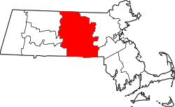
Clinton is a census-designated place (CDP) in the town of Clinton in Worcester County, Massachusetts, United States. The population was 7,389 at the 2010 census.
Clinton is located at 42°25′15″N71°41′10″W / 42.42083°N 71.68611°W (42.420935, -71.686149). [2]
According to the United States Census Bureau, the CDP has a total area of 3.9 km2 (1.5 sq mi), all land.
Census | Pop. | Note | %± |
---|---|---|---|
2020 | 8,166 | — | |
U.S. Decennial Census [3] |
As of the census [4] of 2000, there were 7,884 people, 3,360 households, and 1,942 families residing in the CDP. The population density was 2,029.4 people/km2 (5,256 people/sq mi). There were 3,529 housing units at an average density of 908.4 units/km2 (2,353 units/sq mi). The racial makeup of the CDP was 89.62% White, 2.32% Black or African American, 0.25% Native American, 0.76% Asian, 0.06% Pacific Islander, 4.90% from other races, and 2.08% from two or more races. Hispanic or Latino of any race were 11.07% of the population.
There were 3,360 households, out of which 26.4% had children under the age of 18 living with them, 40.3% were married couples living together, 12.8% had a female householder with no husband present, and 42.2% were non-families. 35.1% of all households were made up of individuals, and 14.3% had someone living alone who was 65 years of age or older. The average household size was 2.33 and the average family size was 3.05.
In the CDP, the population was spread out, with 22.1% under the age of 18, 8.1% from 18 to 24, 33.2% from 25 to 44, 21.0% from 45 to 64, and 15.6% who were 65 years of age or older. The median age was 37 years. For every 100 females, there were 94.5 males. For every 100 females age 18 and over, there were 90.8 males.
The median income for a household in the CDP was $43,570, and the median income for a family was $52,686. Males had a median income of $36,920 versus $27,039 for females. The per capita income for the CDP was $21,857. About 5.3% of families and 7.9% of the population were below the poverty line, including 5.6% of those under age 18 and 14.7% of those age 65 or over.
Oak Ridge is a census-designated place and unincorporated area in Orange County, Florida, United States. The population was 22,685 at the 2010 census. It is part of the Orlando–Kissimmee–Sanford, Florida Metropolitan Statistical Area.
Mansfield Center is a census-designated place (CDP) in the town of Mansfield in Bristol County, Massachusetts, United States. The population was 7,360 at the 2010 census.
Norton Center is a census-designated place (CDP) in the town of Norton in Bristol County, Massachusetts, United States. The population was 2,671 at the 2010 census.
Ocean Grove is a census-designated place (CDP) in the town of Swansea in Bristol County, Massachusetts, United States, on the north shore of Mount Hope Bay near the Cole River. The population was 2,811 at the 2010 census, and 2,904 as of the 2020 census.
Marshfield Hills is a census-designated place (CDP) in the town of Marshfield in Plymouth County, Massachusetts, United States. The population was 2,356 at the 2010 census. The historic center of the village has been designated a historic district and listed on the National Register of Historic Places.
East Douglas is a census-designated place (CDP) in the town of Douglas in Worcester County, Massachusetts, United States. The population was 2,557 at the 2010 census.
Valley Falls is a village and census-designated place (CDP) in the town of Cumberland, Providence County, Rhode Island, United States. The population was 12,094 at the 2020 census.
Ashaway is an unincorporated village and census-designated place (CDP) in the town of Hopkinton, Rhode Island, USA. It is a principal village of Hopkinton, along with Hope Valley, although it is the smaller of the two. The population was 1,485 at the 2010 census. The name Ashaway is derived from the American Indian name for the river that runs through the village, the Ashawague or Ashawaug, which means "land in the middle" or "land between" in the Niantic and Mohegan languages. The name "Ashawague River" appears as late as 1832 on the Findley map of Rhode Island published in Philadelphia.
Narragansett Pier is an unincorporated village and a census-designated place (CDP) in the town of Narragansett in Washington County, Rhode Island, United States. The population was 3,409 at the 2010 census.
West Brattleboro is a census-designated place (CDP) in the town of Brattleboro, Vermont, United States. The population was 3,222 at the 2000 census.
Medfield is a census-designated place (CDP) in the town of Medfield in Norfolk County, Massachusetts, United States. The population was 6,483 at the 2010 census.
Duxbury is a census-designated place (CDP) in the town of Duxbury in Plymouth County, Massachusetts, United States. The population was 1,802 at the 2010 census.
Hingham is a census-designated place (CDP) in the town of Hingham in Plymouth County, Massachusetts, United States. The population was 5,650 at the 2010 census.
Marshfield is a census-designated place (CDP) in the town of Marshfield in Plymouth County, Massachusetts, United States. The population was 4,335 at the 2010 census.
Athol is a census-designated place (CDP) in the town of Athol in Worcester County, Massachusetts, United States. The population was 8,265 at the 2010 census.
East Brookfield is a census-designated place (CDP) in the town of East Brookfield in Worcester County, Massachusetts, United States. The population was 1,323 at the 2010 census.
Lunenburg is a census-designated place (CDP) in the town of Lunenburg in Worcester County, Massachusetts, United States. The population was 1,760 at the 2010 census.
Milford is a census-designated place (CDP) in the town of Milford in Worcester County, Massachusetts, United States. The population was 25,055 at the 2010 census.
Brattleboro is a census-designated place (CDP) corresponding to the densely populated core of the town of Brattleboro in Windham County, Vermont, United States. The population was 8,289 at the 2000 census.
Rib Mountain is a census-designated place (CDP) in the town of Rib Mountain in Marathon County, Wisconsin, United States. The population was 6,061 at the 2020 census.