Denare Beach is a northern village on the east shore of Amisk Lake, Saskatchewan. Located on Highway 167, the community is 20 kilometres (12 mi) south-west of Flin Flon and 422 kilometres (262 mi) north-east of Prince Albert.
Patuanak is a community in northern Saskatchewan, Canada. It is the administrative headquarters of the Dene First Nations reserve near Churchill River and the north end of Lac Île-à-la-Crosse. In Dene, it sounds similar to Boni Cheri (Bëghą́nı̨ch’ërë).
Missinipe, meaning "big water" or "difficult river", is a northern settlement in northern Saskatchewan along the western shore of Otter Lake. The hamlet is situated 80 kilometres (50 mi) north of La Ronge along Highway 2 within the Northern Saskatchewan Administration District and the provincial Census Division No. 18.
Buffalo Narrows is a northern village in Saskatchewan, Canada. It is a community of 1,110 people. Located at the "Narrows" between Peter Pond Lake and Churchill Lake, tourism and resource extraction are its main economic activities.

Dore Lake is a northern hamlet located on the southern shore of South Bay of Doré Lake, which is one of the largest lakes in northern Saskatchewan. Its name is the French word for "walleye". The community is accessed by Highway 924 and by Dore Lake Airport.

The Rural Municipality of Meadow Lake No. 588 is a rural municipality (RM) in the Canadian province of Saskatchewan within Census Division No. 17 and SARM Division No. 6.
Big River is a town located on the southern end of Cowan Lake in north central Saskatchewan, Canada. It is just north of Saskatchewan's extensive grain belt on Highway 55 and about 16 kilometres (10 mi) west of Prince Albert National Park. Delaronde Lake is accessed east of the town. Big River is approximately 132 kilometres (82 mi) from Prince Albert.
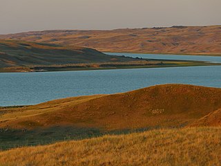
Tramping Lake is a village in the Canadian province of Saskatchewan within the Rural Municipality of Tramping Lake No. 380 and Census Division No. 13. The village gets its name from nearby Tramping Lake, which is a lake along the course of Eagle Creek.
Jans Bay is a northern hamlet in the Canadian province of Saskatchewan. It is on the eastern shore of Canoe Lake and access is from Highway 965.

Meota is a village in the Canadian province of Saskatchewan within the Rural Municipality of Meota No. 468 and Census Division No. 17. The village name is derived from the Cree phrase Meotate or Mo-Was-In-Ota, meaning "good place to camp" or "it is good here."

The Rural Municipality of Pittville No. 169 is a rural municipality (RM) in the Canadian province of Saskatchewan within Census Division No. 8 and SARM Division No. 3. Located in the southwest portion of the province, it is northwest of the town of Gull Lake.
Turnor Lake is a community on the southern shore of Turnor Lake. From Highway 155 it is accessible by Highway 909. The community includes the Northern Hamlet of Turnor Lake and Turnor Lake 193B of the Birch Narrows First Nation.
Pelican Pointe is a resort village in the Canadian province of Saskatchewan within Census Division No. 6. It is on the eastern shore of Last Mountain Lake in the Rural Municipality of McKillop No. 220. Access is from Highway 322.

Pinehouse is a northern village located in the boreal forest of Saskatchewan on the western shore of Pinehouse Lake within the Canadian Shield.
St. George's Hill is a northern hamlet in the Canadian prairie province of Saskatchewan. It is located where the Highway 925 spans the Dillon River about 10 kilometres south of Dillon. The mayor is Donna Janvier.
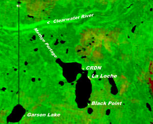
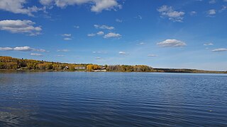
Garson Lake is a northern settlement in Saskatchewan on the eastern shore of Garson Lake. It is located near the Alberta border and can be accessed by Highway 956 off of Highway 155. A winter road connects it to Fort McMurray, Alberta in the winter months.
Sled Lake is a northern settlement in Northern Saskatchewan. The community is at the south-eastern shore of Sled Lake and access is from Highway 924.
Hatchet Lake Denesuline Nation is a Denesuline First Nation in northern Saskatchewan. The main settlement, Wollaston Lake, is an unincorporated community on Wollaston Lake in the boreal forest of north-eastern Saskatchewan, Canada.

The Rural Municipality of Snipe Lake No. 259 is a rural municipality (RM) in the Canadian province of Saskatchewan within Census Division No. 8 and SARM Division No. 3.
The Rural Municipality of Riverside No. 168 is a rural municipality (RM) in the Canadian province of Saskatchewan within Census Division No. 8 and SARM Division No. 3.

