
Edam is a village in the Canadian province of Saskatchewan within the Rural Municipality of Turtle River No. 469 and Census Division No. 17. Edam is located off Highway 26, south of Turtleford and north of Vawn.

Fox Valley is a village in the Canadian province of Saskatchewan within the Rural Municipality of Fox Valley No. 171 and Census Division No. 8. Fox Valley is located just off Highway 21, approximately 64 kilometres (40 mi) north of Maple Creek and 51 kilometres (32 mi) south of Leader in the southwest region of the province. The early settlers of the village and surrounding area included many Germans from Russia. The local economy is heavily dependent on agriculture and natural gas.
Eston is a town in the Rural Municipality of Snipe Lake No. 259, Saskatchewan, Canada. The population was 1,061 at the 2016 Census. The town is located at the junction of Highway 30 and Highway 44, approximately 70 kilometres (43 mi) south-east of Kindersley. Eston Riverside Regional Park is 21 kilometres (13 mi) south of town on the north bank of the South Saskatchewan River.
Brownlee is a village in the Canadian province of Saskatchewan within the Rural Municipality of Eyebrow No. 193 and Census Division No. 7. The village is located approximately 58 km northwest of the City of Moose Jaw on Highway 42.
Richmound is a village in the Canadian province of Saskatchewan within the Rural Municipality of Enterprise No. 142 and Census Division No. 8. It is approximately 80 kilometres (50 mi) northeast of Medicine Hat, Alberta. The economy is driven in large part by the oil and gas sector as well as agriculture. The area was originally settled by Germans, mostly Catholics from South Russia.

Denholm is a village in the Canadian province of Saskatchewan within the Rural Municipality of Mayfield No. 406 and Census Division No. 16.
Dorintosh is a village in the Canadian province of Saskatchewan within the Rural Municipality of Meadow Lake No. 588 and Census Division No. 17.
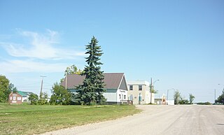
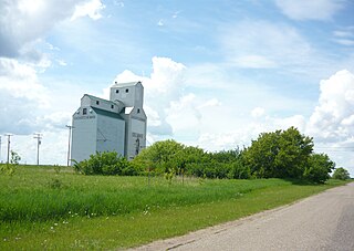
Tramping Lake is a village in the Canadian province of Saskatchewan within the Rural Municipality of Tramping Lake No. 380 and Census Division No. 13. The village gets its name from nearby Tramping Lake, which is a lake along the course of Eagle Creek.
Liberty is a village in the Canadian province of Saskatchewan within the Rural Municipality of Big Arm No. 251 and Census Division No. 11. The village is located along Highway 2, 120 km (75 mi) north of the City of Regina.
MacNutt is a village in the Canadian province of Saskatchewan within the Rural Municipality of Churchbridge No. 211 and Census Division No. 5. The former District of Landestreu was renamed in 1909 to honour Thomas MacNutt, the area Member of the Legislative Assembly at the time. The village was settled between the late 1880s and the 1910s by immigrants of predominantly German origin.
Makwa is a village in the Canadian province of Saskatchewan within the Rural Municipality of Loon Lake No. 561 and Census Division No. 17.
Marcelin is a village in the Canadian province of Saskatchewan within the Rural Municipality of Blaine Lake No. 434 and Census Division No. 16. It was named after the first postmaster Antoine Marcelin in 1904.

Meacham is a village in the Canadian province of Saskatchewan within the Rural Municipality of Colonsay No. 342 and Census Division No. 11. It is located 69 kilometres east of the City of Saskatoon on Highway 2.
Medstead is a village in the Canadian province of Saskatchewan within the Rural Municipality of Medstead No. 497 and Census Division No. 16.

Meota is a village in the Canadian province of Saskatchewan within the Rural Municipality of Meota No. 468 and Census Division No. 17. The village name is derived from the Cree phrase Meotate or Mo-Was-In-Ota, meaning "good place to camp" or "it is good here."

Fiske is a hamlet in Pleasant Valley Rural Municipality No. 288, Saskatchewan, Canada. Listed as a designated place by Statistics Canada, the hamlet had a population of 65 in the Canada 2016 Census. Fiske is located approximately 53.7 kilometres (33.4 mi) east of Kindersley and 30.6 kilometres (19.0 mi) west of Rosetown on Highway 7.
Delmas is a hamlet in the Rural Municipality of Battle River No. 438, Saskatchewan, Canada. Listed as a designated place by Statistics Canada, the hamlet had a population of 128 in the Canada 2016 Census. The hamlet is located approximately 32.6 kilometres (20.3 mi) west of North Battleford on Highway 16.

Griffin is a special service area within the Rural Municipality of Griffin No. 66 in the Canadian province of Saskatchewan. Listed as a designated place by Statistics Canada, the community had a population of 111 in the Canada 2016 Census. The community is also the seat of the Rural Municipality of Griffin No. 66.
Cole Bay is a northern hamlet in Saskatchewan's northern boreal forest. It is located on the southern shore of Canoe Lake. The population in the Canada Census of 2011 was 230, an increase of 47.4% over 156 in 2006.
Leslie is a special service area in the Rural Municipality of Elfros No. 307, Saskatchewan, Canada. Listed as a designated place by Statistics Canada, the community had a population of 15 in the Canada 2016 Census. The community is located just off of Highway 16 between Foam Lake and Elfros.

