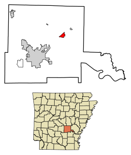
Arkansas County is a county located in the U.S. state of Arkansas. As of the 2010 census, the population was 19,019. Located in the Arkansas Delta, the county has two county seats, DeWitt and Stuttgart.

Warren is a city in and the county seat of Bradley County, Arkansas, United States. As of the 2010 census, the population was 6,003.

Rison is a city in and the county seat of Cleveland County, Arkansas, United States. Its population was 1,344 at the 2010 U.S. census. It is included in the Pine Bluff, Arkansas Metropolitan Statistical Area. Rison is a bedroom community for people who work in Pine Bluff. The largest employers are the city and county governments, the Cleveland County School District, the Cleveland County Nursing Home. There are two banks, eight churches, and about forty-five businesses within the city limits. Among the local properties listed on the National Register of Historic Places are the Rison Cities Service Station and the Rison Texaco Service Station.

Altheimer is a city in Plum Bayou Township, Jefferson County, Arkansas. It is situated on the Union Pacific Railway, 11 miles (18 km) northeast of Pine Bluff. As of the 2010 census it had a population of 984, down from 1,192 at the 2000 census. As of 2018 the estimated population was 829.

Ashdown is a city in Little River County, Arkansas, United States. The community was incorporated in 1892 and has been the county seat since 1906. Located within the Arkansas Timberlands between the Little River and the Red River, Ashdown's economy and development have historically been tied to the timber industry, a trend that continues to this day. Ashdown's population at the 2010 census was 4,723, a slight decrease from the 2000 census. The city's well-preserved history and proximity to outdoor recreation such as Millwood State Park draws tourists to the area. Although not within the Texarkana metropolitan area, the city's proximity to Texarkana impacts many areas of life in Ashdown.

Camden is a city in and the county seat of Ouachita County in the south-central part of the U.S. state of Arkansas. The city is located about 100 miles south of Little Rock. Situated on bluffs overlooking the Ouachita River, the city developed because of the river. The recorded history began in 1782 when a Spanish military post was established on the site of an old French trading post called Écore à Fabri. When Ouachita County was formed in 1842, American settlers changed the name to Camden. The city became an important port during the steamboat era when Camden became known as the “Queen City” of the Ouachita. In 1864, Camden became the unintended focus of the Red River Campaign, a major Civil War effort resulting in several significant battles.

The Arkansas Post was the first European settlement in the Mississippi Alluvial Plain and present-day Arkansas. Henri de Tonti established it in 1686 as a French trading post on the lower Arkansas River, where the French and Spanish traded with the Quapaw people for years.

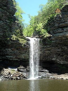
Petit Jean State Park is a 3,471-acre (1,405 ha) park in Conway County, Arkansas managed by the Arkansas Department of Parks and Tourism. It is located atop Petit Jean Mountain adjacent to the Arkansas River in the area between the Ouachita Mountains and Ozark Plateaus.

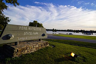
Pere Marquette State Park is an 8,050-acre (3,260 ha) protected area in southwestern Jersey County, Illinois, United States. It is located near the city of Grafton, Illinois, at the confluence of the Mississippi River and the Illinois River. The park is located on Illinois Route 100, which at this location is also part of both the Great River Road and the Meeting of the Great Rivers Scenic Byway. The park is operated and maintained by the Illinois Department of Natural Resources, and is Illinois' largest state park in area. The park is also part of the Confluence Greenway and is at the northwestern end of the 21.5-mile (34.6 km) Sam Vadalabene Bike Trail.

Black Moshannon State Park is a 3,480-acre (1,410 ha) Pennsylvania state park in Rush Township, Centre County, Pennsylvania, United States. It surrounds Black Moshannon Lake, formed by a dam on Black Moshannon Creek, which has given its name to the lake and park. The park is just west of the Allegheny Front, 9 miles (14 km) east of Philipsburg on Pennsylvania Route 504, and is largely surrounded by Moshannon State Forest. A bog in the park provides a habitat for diverse wildlife not common in other areas of the state, such as carnivorous plants, orchids, and species normally found farther north. As home to the "largest reconstituted bog in Pennsylvania", it was chosen by the Pennsylvania Department of Conservation and Natural Resources for its "25 Must-see Pennsylvania State Parks" list.

Trough Creek State Park is a 554 acres (224 ha) Pennsylvania state park in Cass, Penn and Todd Townships, Huntingdon County, Pennsylvania in the United States. The majority of the park is in Todd Township along Pennsylvania Route 994, east of the unincorporated village of Entriken. Huntingdon is the nearest borough. The park borders Rothrock State Forest and Raystown Lake National Recreation Area. There is a growing population of bald eagles at the lake. Fourteen eagles were spotted in January 2007. This is up from two that were spotted in 1990, the first year that an eagle survey was taken. These three sections of state and federal owned property combine together to provide hunting, hiking and fishing opportunities for the outdoorsman.

Located near Dardanelle, Arkansas and rising about 1,350 feet (410 m) above the mountain valleys of west-central Arkansas to an elevation of about 1,755 feet (535 m) above sea level, Mount Nebo has views of 34,000 acres (140 km2) Lake Dardanelle, the Arkansas River and the surrounding mountain ridges. Atop this biblically named plateau is Mount Nebo State Park. Developed as a resort area in the late 19th century, it became a state park in 1928, its early development spearheaded by the Civilian Conservation Corps. Park activities include hiking, camping, and other outdoor pursuits.

The McDonald's Sign, also known as McDonald's Store #433 Sign, in Pine Bluff, Arkansas, United States, is one of only a few surviving examples of a single-arch McDonald's sign. The sign was erected in 1962 and remained at its original location until 2007. That year, McDonald's Store #433 moved and the sign was renovated and moved to the new location. The McDonald's sign was added to the U.S. National Register of Historic Places in 2006.

Wanakena is a hamlet located on the shore of Cranberry Lake in the town of Fine in St. Lawrence County, New York, United States. Tourism is a major industry in the area; a small year-round population is supplemented by an influx seasonal residents each summer. It is the location of the SUNY-ESF Ranger School.
Crocketts Bluff is an unincorporated community in Arkansas County, Arkansas, United States. It is the location of Crocketts Bluff Hunting Lodge, which is located at the end of the dirt road north of the point at which AR 153 turns south, and is listed on the National Register of Historic Places. Crocketts Bluff sits at the highest point in Arkansas County.
Fullerton is an unincorporated community in Vernon Parish, Louisiana, United States. Fullerton was once an industrial community (1907-1927), having developed around a large lumber mill. In 1986, the community and mill were added to the National Register of Historic Places as Fullerton Mill and Town because of their role in industry and in the development of housing for the mill workers.

The Masonic Temple is a historic fraternal and commercial building at East Fourth Avenue and State Street in Pine Bluff, Arkansas. Fundraising for the building was led by Joseph Carter Corbin and J. N. Donohoo. It is a four-story brick building, built between 1902 and 1904 by the state's African-American Masonic lodge, the Sovereign Grand Lodge of Free and Accepted Masons. It was at the time Pine Bluff's tallest building; the ground floor held retail space, the second floor professional offices, and the upper floors were devoted to the Masonic organizations.
The First African Baptist Church at Raccoon Bluff is a historic church on Sapelo Island, Georgia. The church was built in c.1899-1900 and is the last surviving remnant of the Raccoon Bluff community, once the largest community on Sapelo Island. It was added to the National Register of Historic Places in 1996.
Lassen Lodge is a hamlet in Tehama County, California, United States, located 36 miles east of Red Bluff. Latitude: 40.3454362 Longitude: -121.7105392, Elevation: 4235 ft

The Warren and Ouachita Valley Railway Station is a historic railroad station at 325 West Cedar Street in Warren, Arkansas. It was built in 1909 by the Warren and Ouachita Valley Railroad, which in 1899 ran tracks from Warren to Banks, primarily to serve the lumber industry. The station is a two-story wood-frame structure with an attached single story warehouse. The main block has a hipped roof with shed dormers, and the warehouse roof is a gable roof that extends over loading areas. The building was extensively damaged by fire and rebuilt in 1911.


