
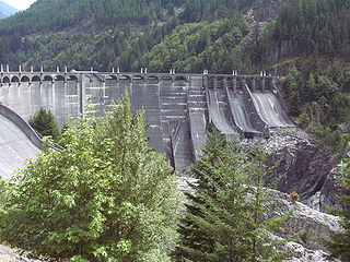
Bonneville Lock and Dam consists of several run-of-the-river dam structures that together complete a span of the Columbia River between the U.S. states of Oregon and Washington at River Mile 146.1. The dam is located 40 miles (64 km) east of Portland, Oregon, in the Columbia River Gorge. The primary functions of Bonneville Lock and Dam are electrical power generation and river navigation. The dam was built and is managed by the United States Army Corps of Engineers. At the time of its construction in the 1930s it was the largest water impoundment project of its type in the nation, able to withstand flooding on an unprecedented scale. Electrical power generated at Bonneville is distributed by the Bonneville Power Administration. Bonneville Dam is named for Army Capt. Benjamin Bonneville, an early explorer credited with charting much of the Oregon Trail. The Bonneville Dam Historic District was designated a National Historic Landmark District in 1987.
The Bonneville Power Administration (BPA) is an American federal agency operating in the Pacific Northwest. BPA was created by an act of Congress in 1937 to market electric power from the Bonneville Dam located on the Columbia River and to construct facilities necessary to transmit that power. Congress has since designated Bonneville to be the marketing agent for power from all of the federally owned hydroelectric projects in the Pacific Northwest. Bonneville is one of four regional Federal power marketing agencies within the U.S. Department of Energy (DOE).

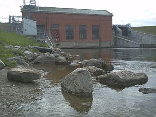
Cushman Dam No. 2 is a hydroelectric dam on the North Fork of the Skokomish River in Mason County, Washington, United States, forming Lake Kokanee. Built in 1930, its three 27,000 kilowatt generators provide 233 million kilowatt-hours annually to the Tacoma Power system. Along with Cushman Dam No. 1, it is part of Tacoma Power's Cushman Project.
Potlatch is an unincorporated community in Mason County, Washington, United States. It is located on the western shore of the Great Bend of Hood Canal, near the mouth of the Skokomish River.

Folsom Powerhouse State Historic Park is a historical site preserving an 1895 alternating current (AC) hydroelectric power station—one of the first in the United States.
Diablo Dam is one of three dams along the upper Skagit River in Whatcom County, Washington and part of the Skagit River Hydroelectric Project that supplies Seattle with some of its power needs. The dam was built in Diablo Canyon, a gorge of solid granite with vertical walls rising 160 feet (49 m) from the river bed, yet were less than 100 feet (30 m) apart. Construction began in 1927, and was completed in 1930. The dam began generating electricity in 1936.
Hungry Horse Dam is an arch dam in the Western United States, on the South Fork Flathead River in the Rocky Mountains of northwest Montana. It is located in Flathead National Forest in Flathead County, about fifteen miles (24 km) south of the west entrance to Glacier National Park, nine miles (14 km) southeast of Columbia Falls, and twenty miles (32 km) northeast of Kalispell. The Hungry Horse project, dam, and powerplant are operated by the U.S. Bureau of Reclamation. The entrance road leading to the dam is located in Hungry Horse.

Rainbow Dam is a hydroelectric dam on the Missouri River, 29 feet (8.8 m) high and 1,055 feet (322 m) long, located six miles northeast of Great Falls in the U.S. state of Montana.

Ryan Dam is a hydroelectric dam on the Missouri River, 10 miles (16 km) downstream from the city of Great Falls in the U.S. state of Montana. The dam is 1,336 feet (407 m) long and 61 feet (19 m) high; its reservoir is 7 miles (11 km) long and has a storage capacity of 5,000 acre-feet (6,200,000 m3). It is a run-of-river dam. The dam is built on the largest of the five Great Falls of the Missouri, the "Big Falls", also sometimes called "Great Falls". Since 1915, the six-unit powerhouse on the left side of the dam has occupied a significant portion of the 87-foot (27 m) high waterfall.
Tallulah Falls Lake is a 63-acre (250,000 m2) reservoir with 3.6 miles (5.8 km) of shoreline located in the Northeastern corner of Georgia in Rabun County. It is the fourth and smallest lake in a six-lake series created by hydroelectric dams operated by Georgia Power that follows the original course of the Tallulah River. The series starts upstream on the Tallulah River with Lake Burton followed by Lake Seed, Lake Rabun, Tallulah Falls Lake, Lake Tugalo and Lake Yonah. Georgia Power considers the lake full at a surface elevation of 1,500 feet (460 m).

Tieton Dam is an earth and concrete type dam on the Tieton River in Yakima County, in the U.S. state of Washington. The dam began operation in 1925. Its reservoir, Rimrock Lake, has a total capacity of 203,600 acre-feet (0.2511 km3) with a normal operating capacity of 198,000 acre-feet (0.244 km3) to provides water for agricultural irrigation. This dam is a component of the Yakima Project. Tieton Dam also produces electricity for Burbank Water and Power and Glendale Water and Power, near Los Angeles. The Southern California Public Power Agency installed two 7 megawatt generators in a project started in 2010. The power is transmitted over the DC Intertie that runs from Celilo, Oregon to Sylmar, California. Upstream from the dam, the river is impounded by Clear Creek Dam, another element of the Yakima Project. About 8 miles (13 km) downstream from the dam, the Tieton River is tapped for the Tieton Main Canal.

Hardy Dam is an earth-filled embankment dam and powerplant complex on the Muskegon River in Big Prairie Township, Newaygo County, Michigan. At the time of its completion, it was the largest earthen dam in North America east of the Mississippi. Its impoundment forms a lake with over 50 miles of shoreline. The dam impounds a reservoir with a surface area of 4,000 acres and its power plant has an installed capacity of 31.5 MW.

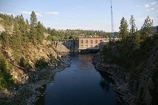
Long Lake Dam is a concrete gravity dam on the Spokane River, between Lincoln County and Stevens County about 30 miles (48 km) northwest of Spokane in eastern Washington. It forms Long Lake (Washington), a 23.5 mi (37.8 km) long reservoir, and has a hydroelectric generating capacity of 71 megawatts. The dam was built by Washington Water Power, which operates five other dams along the Spokane.
Cooke Dam is a hydro-electric dam on the Au Sable River in Michigan. It was listed on the National Register of Historic Places in 1996 as the Cooke Hydroelectric Plant.

The Big Creek Hydroelectric Project is an extensive hydroelectric power scheme on the upper San Joaquin River system, in the Sierra Nevada of central California. The project is owned and operated by Southern California Edison (SCE). The use and reuse of the waters of the San Joaquin River, its South Fork, and the namesake of the project, Big Creek – over a vertical drop of 6,200 ft (1,900 m) – have over the years inspired a nickname, "The Hardest Working Water in the World".
Nine Mile Falls Dam is a dam on the Spokane River, in the unincorporated community of Nine Mile Falls, Washington. It was built on the site of the falls in 1908, creating Nine Mile Reservoir. The dam was designed by the New York engineering firm of Sanderson & Porter, and originally constructed to satisfy the power needs of the Spokane and Inland Empire Railroad interurban trolley lines.

The Upper North Fork Feather River Project is a hydroelectric scheme in the Sierra Nevada of California, within Lassen and Plumas Counties. The project consists of three dams, five power plants, and multiple conduits and tunnels in the headwaters of the North Fork Feather River, a major tributary of the Feather—Sacramento River systems. The total installed capacity is 362.3 megawatts (MW), producing an annual average of 1,171.9 gigawatt hours (GWh). The project is also contracted for the delivery of irrigation water between March 31 and October 31 of each year. The project is owned and operated by Pacific Gas and Electric Company.

The Stairs Station Hydroelectric Power Plant was built in 1894-1895 in Big Cottonwood Canyon, about 8 miles (13 km) southeast of Salt Lake City, Utah. The plant comprises the powerhouse, switchyard, penstocks, and a pipeline. A dam next to the site is associated with the Granite Power Plant farther downstream, and is part of neither historic district. The powerhouse is the only remaining building associated with the plant. It is an example of an intact high-head generating plant from the late 19th century.

The Snoqualmie Falls Hydroelectric Plant is located just north of Snoqualmie in King County, Washington state, US. It is situated about 22 mi (35 km) east of Seattle. Located just below the Snoqualmie Falls, the power plant consists of two power houses, Plant 1 and Plant 2. Plant 1 was completed in 1899 and is located underground. It is the first completely underground hydroelectric power plant ever built in the world. Plant 2 was built in 1910 and is located along the right bank of the Snoqualmie River. Both plants receive water from a small reservoir created by a weir atop the falls. Plant 1 has an installed capacity of 13.7 MW and Plant 2 a capacity of 40.2 MW for a total installed capacity of 53.9 MW, enough to power 40,000 homes.

Seattle Municipal Light and Power Plant, also known as Cedar Falls Historic District, is a public hydroelectric plant near North Bend, Washington operated by Seattle City Light. The plant on the Cedar River was the first publicly-owned electrical generating plant for Seattle and one of the earliest in the country for a municipality of its size. It was listed on the National Register of Historic Places in 1997.


