Severe Tropical Cyclone Savannah at peak intensity on 17 March 2019 | |
| Meteorological history | |
|---|---|
| Formed | 8 March 2019 |
| Remnant low | 20 March 2019 |
| Dissipated | 24 March 2019 |
| Category 4 severe tropical cyclone | |
| 10-minute sustained (BOM) | |
| Highest winds | 175 km/h (110 mph) |
| Highest gusts | 250 km/h (155 mph) |
| Lowest pressure | 951 hPa (mbar);28.08 inHg |
| Category 3-equivalent tropical cyclone | |
| 1-minute sustained (SSHWS/JTWC) | |
| Highest winds | 195 km/h (120 mph) |
| Lowest pressure | 957 hPa (mbar);28.26 inHg |
| Overall effects | |
| Fatalities | 10 |
| Missing | 1 |
| Damage | >$7.5 million (2019 USD) |
| Areas affected | Bali,Java,Christmas Island,Cocos (Keeling) Islands |
| IBTrACS | |
Part of the 2018–19 Australian region and South-West Indian Ocean cyclone seasons | |
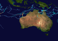
Severe Tropical Cyclone Savannah was a strong tropical cyclone that brought significant impacts to Java and Bali and minor impacts to Christmas Island and the Cocos (Keeling) Islands during March 2019. It was the sixteenth tropical low,sixth tropical cyclone and third severe tropical cyclone of the 2018–19 Australian region cyclone season. Savannah developed from a tropical low that formed well to the east of Christmas Island on 8 March. The system was slow to develop initially,but reached tropical cyclone intensity on 13 March after adopting a southwesterly track. Savannah underwent rapid intensification and reached peak intensity on 17 March as a Category 4 severe tropical cyclone on the Australian scale. Ten-minute sustained winds were estimated as 175 kilometres per hour (109 mph),with a central barometric pressure of 951 hPa (28.08 inHg). One-minute sustained winds reached 185 kilometres per hour (115 mph) at this time,equivalent to a Category 3 major hurricane on the Saffir–Simpson hurricane wind scale. Weakening commenced soon afterwards,and responsibility for the system passed from the Australian Bureau of Meteorology to Météo-France. As it moved into the new region,Savannah became the eighth of a record-breaking ten intense tropical cyclones in the 2018–19 South-West Indian Ocean cyclone season. Savannah was downgraded to a tropical depression on 20 March,and its remnants dissipated in the central Indian Ocean on 24 March.
Contents
- Meteorological history
- Impacts
- Indonesia
- Australia
- Aftermath
- See also
- Notes
- References
- External links
Savannah brought significant impacts to Java and Bali early in its lifetime. Prolonged heavy rainfall and river level rise led to widespread flooding and landslides throughout the region. Floodwaters impacted scores of villages,causing damage to thousands of homes,submerging thousands of hectares of agricultural land and cutting off access to key infrastructure and services. Thousands of families were affected during the event,with evacuations occurring both before and after the flooding. According to local media reports,the total damage and economic losses caused by the disaster exceeded Rp106 billion (US$7.5 million). [nb 1] Ten people were reported to have died during the event,making Savannah the deadliest tropical cyclone in the Australian region since Tropical Cyclone Cempaka in 2017. News reports also indicate that at least five people were injured and that one person went missing during the disaster. [nb 2]