
The Spearhead is a 2,457 m (8,061 ft) peak in the Garibaldi Ranges of British Columbia, Canada, and is one of the main summits of the Blackcomb Mountain portion of the Whistler Blackcomb ski resort, located at the apex of the Blackcomb and Spearhead Glaciers, which is named for it. It also is the namesake of the Spearhead Range, which is the short range flanking the north side of Fitzsimmons Creek and ending on its northwest end at Blackcomb Mountain. The mountain's name was officially adopted on August 27, 1965, by the Geographical Names Board of Canada.
The Cambria Icefield is an icefield in the Boundary Ranges of the Coast Mountains in northwestern British Columbia, Canada, located southeast of Stewart.

The Mamquam Icefield is an icefield in southwestern British Columbia, Canada, located at the headwaters of Skookum Creek. It lies at the southern end of Garibaldi Provincial Park and is one of the southernmost icefields in the Pacific Ranges of the Coast Mountains. The highest summit of the icefield is Mamquam Mountain, located at its southern end with an elevation of 2,588 m (8,491 ft).
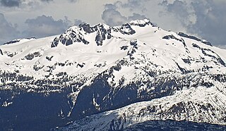
Mamquam Mountain is a mountain in the Pacific Ranges of the Coast Mountains in southwestern British Columbia, Canada, located 6 km (3.7 mi) southeast of Eanastick Meadows and 22 km (14 mi) east of Brackendale. It represents the highest summit of the Mamquam Icefield and lies at the southern end of Garibaldi Provincial Park. Mamquam Mountain was named on September 2, 1930, in association with the Mamquam River.
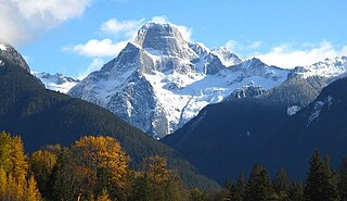
Mount Bute, also known as Bute Mountain, is a 2,810-metre (9,220-foot) mountain located in the Coast Mountains of British Columbia, Canada. Situated at the southern extreme of the Homathko Icefield, Mount Bute has an impressive 800-metre sheer granite west face, and Bute Glacier dominates the north aspect. This imposing mountain is visible from Waddington Harbour at the head of Bute Inlet, in a remote wilderness area that few visit. Its nearest higher peak is Mount Grenville, 13.0 km (8.1 mi) to the east-northeast. Mount Grenville is the highest summit of the icefield. Mount Bute is 63.0 km (39.1 mi) southeast of Mount Waddington, the highest peak of the entire Coast Mountains range.
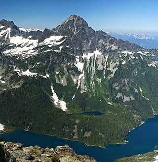
Alpha Mountain is a 2,302-metre (7,552-foot) summit located in the Tantalus Range, in Tantalus Provincial Park, in southwestern British Columbia, Canada. It is situated 14 km (8.7 mi) northwest of Squamish, and 4.6 km (2.9 mi) southeast of Mount Tantalus, which is the highest peak in the Tantalus Range. Its nearest higher peak is Serratus Mountain, 1.9 km (1.2 mi) to the west. The Serratus Glacier lies to the west of Alpha, unnamed glaciers lie on the northern and eastern slopes, and Lake Lovely Water lies below the south slope. Precipitation runoff from the peak drains into tributaries of the Squamish River.

Parkhurst Mountain is a 2,494-metre (8,182-foot) mountain summit located in the Garibaldi Ranges of the Coast Mountains, in northwestern Garibaldi Provincial Park of southwestern British Columbia, Canada. It is situated 11 km (7 mi) east-northeast of Whistler, south of Wedgemount Lake, and on the west side of Wedgemount Glacier. Parkhurst's nearest neighbor is Rethel Mountain, 0.89 km (1 mi) to the northwest, and its nearest higher peak is Wedge Mountain, 1.8 km (1 mi) to the southeast. Mount Weart, the second-highest peak in the park, rises 2.6 km (2 mi) northeast of Parkhurst. Precipitation runoff from the peak drains into Wedge Creek, Wedgemount Creek, and Rethel Creek, which are all tributaries of the Green River, which in turn is a tributary of the Lillooet River. The present day ghost town of Parkhurst was an old logging town in the 1920s and 1930s set on the edge of Green Lake, 9 km (6 mi) west of Parkhurst Mountain. The site was named for Mr. and Mrs. Parkhurst who preempted the land on Green Lake in 1902 and built a small house where they lived with their family. The mountain's name was officially adopted on June 25, 1975, by the Geographical Names Board of Canada.

Tremor Mountain is a prominent 2,691-metre (8,829-foot) summit located in the Garibaldi Ranges of the Coast Mountains, in Garibaldi Provincial Park of southwestern British Columbia, Canada. It is the highest point of the Spearhead Range, which is a subset of the Garibaldi Ranges. It is situated 13 km (8 mi) southeast of Whistler, and 8.7 km (5 mi) south of Wedge Mountain, its nearest higher peak. Precipitation runoff from the south side of the peak as well as meltwater from the Platform Glacier drains into Fitzsimmons Creek which is a tributary of the Green River. Meltwater from the Tremor Glacier on the northwestern slope drains to Wedge Creek, and meltwater from the Shudder Glacier on the northeast slope drains into Billygoat Creek, a tributary of the Lillooet River. Tremor Mountain is often climbed as part of the Spearhead Traverse. The first ascent of the mountain was made in 1928 by A.J. Campbell Garibaldi survey party. The mountain's name origin refers to unexplained earth tremors when the first ascent party was on the summit. The mountain's toponym was officially adopted on September 6, 1951, by the Geographical Names Board of Canada.
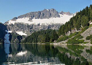
Lydia Mountain is a 2,100-metre (6,890-foot) summit located in the Tantalus Range, in Tantalus Provincial Park, in southwestern British Columbia, Canada. It is situated 14.5 km (9 mi) northwest of Squamish, and 5.46 km (3 mi) south-southeast of Mount Tantalus, which is the highest peak in the Tantalus Range. The nearest higher neighbor is The Red Tusk, 0.5 km (0 mi) to the west, and Mount Niobe lies 2.17 km (1 mi) to the east-southeast. Lake Lovely Water lies below the eastern slope of the peak and precipitation runoff from the peak drains east to the Squamish River, and west to the Clowhom River via Red Tusk Creek. Topographic relief is significant as Lydia Mountain rises 1,400 meters (4,600 feet) above Red Tusk Creek in approximately three kilometers (two miles). The mountain's name was officially adopted on June 6, 1957, by the Geographical Names Board of Canada. The mountain was named for mythic Lydia, of which Tantalus was a primordial ruler in Greek mythology. Several peaks in the Tantalus Range are named in association with Tantalus. The first ascent of Lydia Mountain was made in 1914 by Basil Darling and Allan Morkill.

Cathedral Mountain is a mountain summit located in British Columbia, Canada.
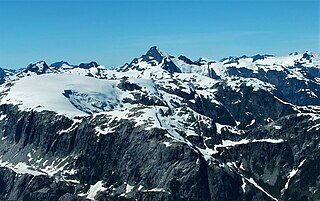
Mount Tinniswood is a 2,606-metre (8,550-foot) mountain summit located in British Columbia, Canada.
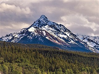
Blackhorn Mountain is a summit located in British Columbia, Canada.
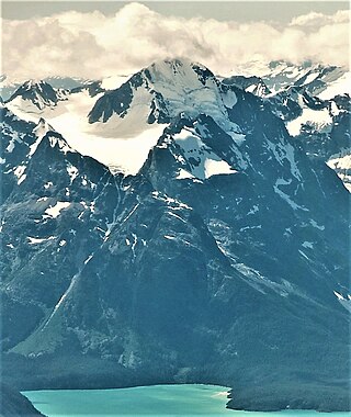
Mount Farrow is a mountain summit in British Columbia, Canada.
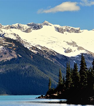
Mount Carr is a 2,590-metre (8,497-foot) mountain summit located in British Columbia, Canada.

Spire Peaks is a 2,279-metre (7,477-foot) mountain located in British Columbia, Canada.
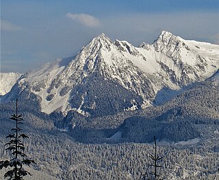
Pyramid Mountain is a 2,158-metre (7,080-foot) summit located in British Columbia, Canada.

Phyllis's Engine is a 2,517-metre (8,258-foot) granite pinnacle located in British Columbia, Canada.

Hour Peak is a 2,329-metre (7,641-foot) mountain summit located in British Columbia, Canada.

Gentian Peak is a 2,197-metre (7,208-foot) summit in British Columbia, Canada.

Deception Peak is a 2,233-metre (7,326-foot) summit in British Columbia, Canada.


