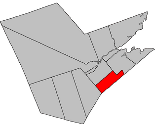
Derby | |
---|---|
Coordinates: 46°53′15″N65°39′18″W / 46.8875°N 65.655°W | |
Country | Canada |
Province | New Brunswick |
County | Northumberland |
Erected | 1859 |
Area | |
• Land | 61.00 km2 (23.55 sq mi) |
Population (2021) [1] | |
• Total | 938 |
• Density | 15.4/km2 (40/sq mi) |
• Change 2016-2021 | 3.9% |
• Dwellings | 450 |
Time zone | UTC-4 (AST) |
• Summer (DST) | UTC-3 (ADT) |
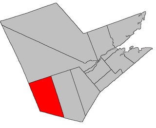
Derby is a geographic parish in Northumberland County, New Brunswick, Canada. [4]
For governance, it is entirely part of the incorporated rural community of Miramichi River Valley, [5] which is a member of the Greater Miramichi Regional Service Commission. [6]
Prior to the 2023 governance reform, the parish was divided between local service districts of Renous-Quarryville and the parish of Derby. [7]
The parish was named in honour of the Earl of Derby, [8] Prime Minister of the United Kingdom at the time of its erection. William F. Ganong notes that local legend states the parish took its name from horse races held in the area. [8]
Derby was erected in 1859 from all of Nelson Parish north of the Southwest Miramichi River [9] plus Beaubears Island.
Derby Parish is bounded: [2] [10] [11]
The original northern boundary of Derby was a straight line running south 68º west [lower-alpha 1] This put parts of modern Southesk in Derby and parts of Derby in Southesk.
In 1920 the boundary with Southesk Parish was changed to run along lot lines; [15] these lines were sometimes grant lines and sometimes property lines. Clarifications to the boundary of Southesk in 1953 [16] and 1954 [17] affected Derby, producing the modern boundary.
Communities at least partly within the parish. [10] [11] [18] italics indicate a name no longer in official use
Bodies of water [lower-alpha 2] at least partly within the parish. [10] [11] [18]
Parks, historic sites, and other noteworthy places at least partly within the parish. [10] [11] [18]
Highways and numbered routes that run through the parish, including external routes that start or finish at the parish limits: [23]
Queensbury is a geographic parish in York County, New Brunswick, Canada.
Ludlow is a geographic parish in Northumberland County, New Brunswick, Canada.
Lac Baker is a geographic parish in Madawaska County, New Brunswick, Canada.
Saint-Joseph is a geographic parish in Madawaska County, New Brunswick, Canada.
Saint-Basile is a geographic parish in Madawaska County, New Brunswick, Canada.
Rivière-Verte is a geographic parish in Madawaska County, New Brunswick, Canada.
Sainte-Anne is a geographic parish in Madawaska County, New Brunswick, Canada.
Notre-Dame-de-Lourdes is a geographic parish in Madawaska County, New Brunswick, Canada.
Saint-Léonard is a geographic parish in Madawaska County, New Brunswick, Canada.
Saint-André is a geographic parish in Madawaska County, New Brunswick, Canada.
Northesk is a geographic parish in Northumberland County, New Brunswick, Canada.
Southesk is a geographic parish in Northumberland County, New Brunswick, Canada.
Nelson is a geographic parish in Northumberland County, New Brunswick, Canada.
Glenelg is a geographic parish in Northumberland County, New Brunswick, Canada.
Rogersville is a geographic parish in Northumberland County, New Brunswick, Canada.
Blackville is a geographic parish in Northumberland County, New Brunswick, Canada.
Denmark is a geographic parish in Victoria County, New Brunswick, Canada.
Stanley is a geographic parish in York County, New Brunswick, Canada.
Hampton is a geographic parish in Kings County, New Brunswick, Canada.
Kingston is a geographic parish in Kings County, New Brunswick, Canada.