
The Fan is a district of Richmond, Virginia, so named because of the "fan" shape of the array of streets that extend west from Belvidere Street, on the eastern edge of Monroe Park, westward to Arthur Ashe Boulevard. However, the streets rapidly resemble a grid after they go through what is now Virginia Commonwealth University. The Fan is one of the easterly points of the city's West End section, and is bordered to the north by Broad Street and to the south by VA 195, although the Fan District Association considers the southern border to be the properties abutting the south side of Main Street. The western side is sometimes called the Upper Fan and the eastern side the Lower Fan, though confusingly the Uptown district is located near VCU in the Lower Fan. Many cafes and locally owned restaurants are located here, as well as historic Monument Avenue, a boulevard formerly featuring statuary of the Civil War's Confederate president and generals. The only current statue is a more modern one of tennis icon Arthur Ashe. Development of the Fan district was strongly influenced by the City Beautiful movement of the late 19th century.

The Branford Point Historic District is a historic district in Branford, Connecticut. It was listed on the National Register of Historic Places in 1988. It includes a significant portion of the Branford Point neighborhood, generally considered to be the area along the west side of the Branford Harbor to the Amtrak railroad tracks. It is bounded on the west by the Short Beach neighborhood, on the north by Branford Center, and on the east by the Branford River. Harbor Street, Maple Avenue, and Stannard Avenue are the main thoroughfares of the neighborhood. In the 2000 Census, Branford Point was included by the U.S. Census Bureau in the Branford Center census-designated place.

The Black Rock Gardens Historic District is a historic district in the Black Rock neighborhood of Bridgeport, Connecticut. It encompasses a small residential development built between 1916 and 1920 to provide housing for workers in war-related industries in the city. It is a well-preserved example of one of several such developments made in the city with funding by the United States Housing Corporation, a government agency. The district was listed on the National Register of Historic Places in 1990.

The Freeman's Grove Historic District is a residential historic district in North Adams, Massachusetts. It encompasses a neighborhood north of the city center that is a well-preserved instance of a working class area developed during its industrial heyday in the late 19th century. It includes the Chase Hill Estate as well as all the houses on Chase Avenue, Bracewell Street, Hall Street and several smaller streets adjacent to those. It is roughly bounded by Liberty Street, Eagle Street, Bracewell Avenues and Houghton Street. The district was listed on the National Register of Historic Places in 1985.

The Cass Farm MPS is a US multiple property submission to the National Register of Historic Places which was approved on December 1, 1997. The structures included are all located in Midtown, in the Cass Farm area in Detroit, Michigan, USA. The Cass Farm area is defined as occupying the space between Woodward Avenue on the east, the Lodge Freeway on the west, Warren Avenue on the north, and Martin Luther King Jr. Boulevard on the south.

The Dwight Street Historic District is an irregularly shaped 135-acre (55 ha) historic district in New Haven, Connecticut. The district is located immediately west of the center of Downtown New Haven and is generally bounded by Elm Street on the north, Park Street on the east, North Frontage Road on the south, and Sherman Avenue on the west. It contains one of the city's highest concentrations of well-preserved 19th and early 20th-century residential architecture, much of which was developed for the working classes in the city's factories. It was listed on the National Register of Historic Places in 1983. The historic district includes most of the Dwight neighborhood and several blocks of the northeast corner of the West River neighborhood.

The Main Street Historic District encompasses the historic civic, commercial, and residential center of Durham, Connecticut. The district is primarily linear and runs along Main Street from between Higganum Road and Town House Road in the south to Talcott Lane in the north, and along Maple Avenue, which parallels Main Street. The district includes most of its colonial architecture, as well as many of its civic buildings. It was listed on the National Register of Historic Places in 1986.
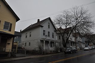
The Sterling Hill Historic District in Bridgeport, Connecticut is a historic district that was listed on the National Register of Historic Places in 1992. The district is a two-block area of 43 urban residential structures dating as far back as 1821. Most of the buildings are from later in the 19th century when the neighborhood was largely occupied by Irish working-class residents. Most of the early buildings are vernacular wood-frame structures with modest Federal, Greek Revival, or Gothic Revival details, while the later additions include multiunit tenement-style buildings. The area includes the oldest urbanized part of the city.

Bassickville Historic District is a historic district encompassing a well-preserved late 19th-century residential development on the west side of Bridgeport, Connecticut. Located on Bassick, Howard, and Fairview Avenues, the area was developed as a residential subdivision of worker housing by Edmund Bassick. The development is characterized by nearly identical 1-1/2 story frame cottages exhibiting the Stick style of architecture. The district was listed on the National Register of Historic Places in 1987.
Palliser, Palliser & Company was a Bridgeport, Connecticut, and New York City architectural firm and publisher of architectural pattern books.

The Barnum–Palliser Historic District is a 5.9-acre (2.4 ha) residential historic district in Bridgeport, Connecticut. The area, bounded roughly by Austin Street, Myrtle Avenue, Atlantic Street, and Park Avenue, was developed by P.T. Barnum to provide worker housing in the 1880s. Many of the houses were designed by Palliser, Palliser & Co., and are interesting examples of Italianate, Queen Anne, and Stick/Eastlake architecture. The district was listed on the National Register of Historic Places in 1982.

The William D. Bishop Cottage Development Historic District, also known as the Cottage Park Historic District, encompasses a historic planned working-class residential community in the South End of Bridgeport, Connecticut. The district most prominently includes 35 1+1⁄2-story wood-frame cottages with Carpenter Gothic styling, developed in 1880 and 1881 by the Bishop Realty Company and probably designed by Palliser, Palliser & Company. It was one of the first such planned developments in the city, and was listed on the National Register of Historic Places in 1982.

The Deacon's Point Historic District encompasses a historic 19th-century residential area of eastern Bridgeport, Connecticut. Roughly bounded by Seaview Avenue and Williston, Bunnell and Deacon Streets, the district was first laid out for development shortly after the American Civil War, and contains modest examples of residential architecture dating from 1866 to the early 20th century. The district was listed on the National Register of Historic Places in 1992.

The East Bridgeport Historic District encompasses one of the best-preserved 19th-century neighborhoods of Bridgeport, Connecticut. Bounded by Arctic Street, East Main Street, the railroad tracks, and the Pequonnock River, this area was a planned development of Bridgeport promoter P.T. Barnum and landowner William H. Noble. Its development prompted the significant growth of industry and economic activity east of the Pequonnock River. The district was listed on the National Register of Historic Places in 1979.

The East Main Street Historic District encompasses a well-preserved late 19th-century commercial area on the east side of Bridgeport, Connecticut. Extending along East Main Street from Interstate 95 to Crescent Place, the district arose as part of a major development push orchestrated by P.T. Barnum in the 1850s, and contains one of Connecticut's finest assemblages of late Victorian commercial architecture. The district was listed on the National Register of Historic Places in 1985.

The Gateway Village Historic District encompasses a World War I-era housing project on the east side of Bridgeport, Connecticut. Centered on Alanson Road, the project was developed in the later years of the war to provide emergency housing for workers in the city's munitions factories. It is a rare design attributed to the female-led architectural firm Mead & Schenk, led by Marcia Mead and Anna P. Schenk. Gateway Village is an early example of Garden City movement design. It was listed on the National Register of Historic Places in 1990.

The Marina Park Historic District encompasses the finest collection of high-style late 19th-century residential architecture in the city of Bridgeport, Connecticut. Extending along Park Avenue between Seaside Park and Atlantic Avenue, this area was home to Bridgeport's industrial and civic leaders, and was developed by city booster P.T. Barnum. The district was listed on the National Register of Historic Places in 1982.

The Remington City Historic District encompasses a World War I-era housing development in northeastern Bridgeport, Connecticut. Bounded by Stewart, Tudor, and Bond Streets, and Palisade Avenue, the area was developed by the Remington Arms company to attract workers to its nearby munitions factory. The complex is a well-preserved example of wartime housing in the city, and was listed on the National Register of Historic Places in 1990.

The Remington Village Historic District encompasses a World War I-era housing development in northeastern Bridgeport, Connecticut. Located on Willow Street and East Avenue between Boston and Barnum Avenues, the area was developed by the Remington Arms company to attract workers to its nearby munitions factory. The complex is a well-preserved example of wartime housing in the city, and was listed on the National Register of Historic Places in 1990.

The Stratfield Historic District is a historic residential area on the west side of Bridgeport, Connecticut. In the late 19th and early 20th century, it was one of the highest-status and most fashionable neighborhoods in the city. At more than 100 acres (40 ha) in size, it is one of the largest assemblages of high-status residential architecture in the state. It was listed on the National Register of Historic Places in 1980.


