Drummond, Wisconsin

Last updated

Town of Drummond, Wisconsin
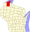
WIMap-doton-Drummond.png
Location of Drummond, Wisconsin
Coordinates: 46°19′40″N91°16′11″W / 46.32778°N 91.26972°W / 46.32778; -91.26972
Country Flag of the United States.svg  United States
State Flag of Wisconsin.svg  Wisconsin
County Bayfield
Area
  Total143.2 sq mi (370.8 km2)
  Land137.3 sq mi (355.7 km2)
  Water5.8 sq mi (15.0 km2)
Elevation
[1]
1,280 ft (390 m)
Population
 (2020)
  Total169
  Density1.2/sq mi (0.47/km2)
Time zone UTC-6 (Central (CST))
  Summer (DST) UTC-5 (CDT)
ZIP code
54832
Area code(s) 715 and 534
FIPS code 55-20887 [2]
GNIS feature ID1583102 [1]
Website www.drummondwi.com

Drummond is a town in Bayfield County, Wisconsin, United States. The population was 169 at the 2020 census, [3] down from 463 at the 2010 census. The census-designated place of Drummond is located in the town. The unincorporated community of Lake Owen is also located in the town.

Contents

Transportation

U.S. Highway 63 serves as a main highway in the town.

Geography

According to the United States Census Bureau, the town has a total area of 143.2 square miles (370.8 km2), of which 137.3 square miles (355.7 km2) is land and 5.8 square miles (15.0 km2), or 4.06%, is water. [4]

Climate

Climate data for Drummond, Wisconsin, 1991–2020 normals, 1962-2020 extremes: 1340ft (408m)
MonthJanFebMarAprMayJunJulAugSepOctNovDecYear
Record high °F (°C)54
(12)
61
(16)
73
(23)
90
(32)
92
(33)
98
(37)
100
(38)
96
(36)
91
(33)
86
(30)
71
(22)
59
(15)
100
(38)
Mean maximum °F (°C)41.6
(5.3)
48.8
(9.3)
58.7
(14.8)
77.3
(25.2)
83.4
(28.6)
88.9
(31.6)
90.2
(32.3)
89.8
(32.1)
83.2
(28.4)
75.3
(24.1)
56.6
(13.7)
42.3
(5.7)
93.0
(33.9)
Mean daily maximum °F (°C)19.1
(−7.2)
24.9
(−3.9)
36.8
(2.7)
50.2
(10.1)
63.8
(17.7)
72.9
(22.7)
76.5
(24.7)
75.3
(24.1)
67.5
(19.7)
53.3
(11.8)
36.3
(2.4)
23.9
(−4.5)
50.0
(10.0)
Daily mean °F (°C)10.9
(−11.7)
15.2
(−9.3)
27.3
(−2.6)
39.2
(4.0)
52.2
(11.2)
61.9
(16.6)
66.2
(19.0)
65.1
(18.4)
57.8
(14.3)
44.3
(6.8)
29.9
(−1.2)
17.4
(−8.1)
40.6
(4.8)
Mean daily minimum °F (°C)2.7
(−16.3)
5.6
(−14.7)
17.7
(−7.9)
28.3
(−2.1)
40.6
(4.8)
50.9
(10.5)
55.9
(13.3)
54.8
(12.7)
48.1
(8.9)
35.4
(1.9)
23.4
(−4.8)
10.9
(−11.7)
31.2
(−0.5)
Mean minimum °F (°C)−24.3
(−31.3)
−18.8
(−28.2)
−10.4
(−23.6)
11.2
(−11.6)
24.8
(−4.0)
34.2
(1.2)
42.4
(5.8)
42.4
(5.8)
30.4
(−0.9)
20.2
(−6.6)
3.0
(−16.1)
−17.5
(−27.5)
−26.7
(−32.6)
Record low °F (°C)−44
(−42)
−40
(−40)
−28
(−33)
−6
(−21)
17
(−8)
25
(−4)
29
(−2)
29
(−2)
18
(−8)
6
(−14)
−15
(−26)
−36
(−38)
−44
(−42)
Average precipitation inches (mm)1.21
(31)
1.13
(29)
2.06
(52)
3.20
(81)
4.06
(103)
3.73
(95)
5.15
(131)
3.52
(89)
3.82
(97)
3.18
(81)
2.06
(52)
1.62
(41)
34.74
(882)
Average snowfall inches (cm)15.50
(39.4)
12.10
(30.7)
12.50
(31.8)
6.50
(16.5)
0.10
(0.25)
0.00
(0.00)
0.00
(0.00)
0.00
(0.00)
0.00
(0.00)
1.20
(3.0)
12.90
(32.8)
13.40
(34.0)
74.2
(188.45)
Source 1: NOAA [5]
Source 2: XMACIS2 (temp records & 1981-2010 monthly max/mins) [6]

Demographics

As of the census [2] of 2000, there were 541 people, 231 households, and 155 families residing in the town. The population density was 3.9 people per square mile (1.5/km2). There were 645 housing units at an average density of 4.7 per square mile (1.8/km2). The racial makeup of the town was 98.34% White, 0.92% Native American, and 0.74% from two or more races. Hispanic or Latino of any race were 1.11% of the population.

There were 231 households, out of which 26.0% had children under the age of 18 living with them, 59.3% were married couples living together, 4.3% had a female householder with no husband present, and 32.5% were non-families. 28.6% of all households were made up of individuals, and 18.6% had someone living alone who was 65 years of age or older. The average household size was 2.34 and the average family size was 2.83.

In the town, the population was spread out, with 23.1% under the age of 18, 4.6% from 18 to 24, 24.0% from 25 to 44, 26.4% from 45 to 64, and 21.8% who were 65 years of age or older. The median age was 44 years. For every 100 females, there were 92.5 males. For every 100 females age 18 and over, there were 98.1 males.

The median income for a household in the town was $37,500, and the median income for a family was $41,544. Males had a median income of $31,827 versus $16,875 for females. The per capita income for the town was $16,773. About 8.3% of families and 12.4% of the population were below the poverty line, including 12.0% of those under age 18 and 18.2% of those age 65 or over.

Education

Related Research Articles

<span class="mw-page-title-main">Barnes, Wisconsin</span> Town in Wisconsin, United States

Barnes is a town in Bayfield County, Wisconsin, United States. The population was 769 at the 2010 census. The town was named for an early settler named George Sardis Barnes who opened the first hotel, saloon, and store north of the Eau Claire lakes in the late 1880s.

<span class="mw-page-title-main">Bayview, Wisconsin</span> Town in Wisconsin, United States

Bayview is a town in Bayfield County, Wisconsin, United States. The population was 487 at the 2010 census. The unincorporated community of Sioux is located in the town.

<span class="mw-page-title-main">Bell, Wisconsin</span> Town in Bayfield County, Wisconsin, United States

Bell is a town in Bayfield County, Wisconsin, United States. The population was 263 at the 2010 census. The unincorporated community of Cornucopia is located within the town.

<span class="mw-page-title-main">Clover, Wisconsin</span> Town in Wisconsin, United States

Clover is a town in Bayfield County, Wisconsin, United States. The population was 223 at the 2010 census. The unincorporated communities of Bark Point and Herbster are located in the town.

<span class="mw-page-title-main">Delta, Wisconsin</span> Town in Wisconsin, United States

Delta is a town in Bayfield County, Wisconsin, United States. The population was 273 at the 2010 census. The unincorporated communities of Delta and Pike River are located in the town. The unincorporated community of Sutherland is located partially in the town.

<span class="mw-page-title-main">Eileen, Wisconsin</span> Town in Wisconsin, United States

Eileen is a town in Bayfield County, Wisconsin, United States. The population was 681 at the 2010 census. The unincorporated community of Ashland Junction is located in the town.

<span class="mw-page-title-main">Grandview, Wisconsin</span> Town in Wisconsin, United States

Grandview is a town in Bayfield County, Wisconsin, United States. The population was 468 at the 2010 census. The unincorporated community of Grand View is located in the town of Grandview.

<span class="mw-page-title-main">Hughes, Wisconsin</span> Town in Wisconsin, United States

Hughes is a town in Bayfield County, Wisconsin, United States. The population was 383 at the 2010 census. The unincorporated communities of Muskeg and Wills are located in the town.

<span class="mw-page-title-main">Iron River, Wisconsin</span> Town in Wisconsin, United States

Iron River is a town in Bayfield County, Wisconsin, United States. The population was 1,123 at the 2010 census. The census-designated place of Iron River is located in the town. The unincorporated community of Topside is also located in the town.

<span class="mw-page-title-main">Kelly, Wisconsin</span> Town in Wisconsin, United States

Kelly is a town in Bayfield County, Wisconsin, United States. The population was 463 at the 2010 census.

<span class="mw-page-title-main">Keystone, Wisconsin</span> Town in Wisconsin, United States

Keystone is a town in Bayfield County, Wisconsin, United States. The population was 378 at the 2010 census. The unincorporated community of Ino is located in the town.

<span class="mw-page-title-main">Lincoln, Bayfield County, Wisconsin</span> Town in Wisconsin, United States

Lincoln is a town in Bayfield County, Wisconsin, United States. The population was 287 at the 2010 census.

<span class="mw-page-title-main">Namakagon, Wisconsin</span> Town in Wisconsin, United States

Namakagon is a town in Bayfield County, Wisconsin, United States. The population was 246 at the 2010 census.

<span class="mw-page-title-main">Orienta, Wisconsin</span> Town in Wisconsin, United States

Orienta is a town in Bayfield County, Wisconsin, United States. The population was 122 at the 2010 census.

<span class="mw-page-title-main">Pilsen, Wisconsin</span> Town in Wisconsin, United States

Pilsen is a town in Bayfield County, Wisconsin, United States. The population was 210 at the 2010 census. The unincorporated community of Moquah is located in the town.

<span class="mw-page-title-main">Port Wing (town), Wisconsin</span> Town in Wisconsin, United States

Port Wing is a town in Bayfield County, Wisconsin, United States. The population was 368 at the 2010 census. The unincorporated community of Port Wing is located in the town.

<span class="mw-page-title-main">Russell, Bayfield County, Wisconsin</span> Town in Wisconsin, United States

Russell is a town in Bayfield County, Wisconsin, United States. The population was 1,279 at the 2010 census. The unincorporated communities of Red Cliff and Sand Bay are located in Russell. Red Cliff is the administrative center of the Red Cliff Band of Lake Superior Chippewa. York Island and Raspberry Island are part of the town.

<span class="mw-page-title-main">Bayfield (town), Wisconsin</span> Town in Wisconsin, United States

Bayfield is a town in Bayfield County, Wisconsin, United States. The population was 680 at the 2010 census. The unincorporated communities of Pureair and Salmo are located in the town, as are Eagle Island and Sand Island of the Apostle Islands.

Washburn is a town in Bayfield County, Wisconsin, United States. The population was 530 at the 2010 census. The City of Washburn is located just east of and adjacent to the town.

<span class="mw-page-title-main">Bayfield, Wisconsin</span> City in Wisconsin, United States

Bayfield is a city in Bayfield County, Wisconsin, United States. The population was 584 at the 2020 census. This makes it the city with the smallest population in Wisconsin. In fact, for a new city to be incorporated today, state regulations require a population of at least 1,000 residents, so it would have to be incorporated as a village instead.

References

  1. 1 2 "US Board on Geographic Names". United States Geological Survey. October 25, 2007. Retrieved January 31, 2008.
  2. 1 2 "U.S. Census website". United States Census Bureau . Retrieved January 31, 2008.
  3. "Drummond CDP, Wisconsin". United States Census Bureau . Retrieved December 22, 2021.
  4. "Geographic Identifiers: 2010 Demographic Profile Data (G001): Drummond town, Bayfield County, Wisconsin". U.S. Census Bureau, American Factfinder. Archived from the original on February 12, 2020. Retrieved May 8, 2014.
  5. "Drummond, Wisconsin 1991-2020 Monthly Normals" . Retrieved January 28, 2024.
  6. "xmACIS". National Oceanic and Atmospheric Administration. Retrieved January 28, 2024.