Dryden, New York

Last updated

Dryden, New York
Dryden Historic District Jan 10.jpg
Homes in Dryden's historic district (2010)
USA New York location map.svg
Red pog.svg
Dryden, New York
Location of Dryden in Dryden
Coordinates: 42°29′21″N76°21′35″W / 42.48917°N 76.35972°W / 42.48917; -76.35972
CountryUnited States
State New York
County Tompkins
Area
[1]
  Total94.33 sq mi (244.31 km2)
  Land93.64 sq mi (242.53 km2)
  Water0.69 sq mi (1.79 km2)  0.31%
Population
 (2020) [2]
  Total14,029 Decrease2.svg
  Estimate 
(2021) [2]
13,841
  Density159.34/sq mi (61.52/km2)
Time zone UTC-5 (Eastern (EST))
  Summer (DST) UTC-4 (EDT)
FIPS code 36-109-20962
Website www.dryden.ny.us

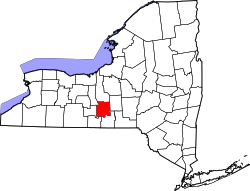
Dryden is a town in Tompkins County, New York, United States. The population was 14,435 at the 2010 census. [3] The town administers an area that includes two villages, one also named Dryden and one named Freeville, as well as a number of hamlets. The town is on the county's eastern border, east of Ithaca, in the Finger Lakes region.

Contents

History

The region was part of the Central New York Military Tract, land given as compensation to soldiers of the American Revolution. Robert Harpur, a Clerk in the office of the New York State Surveyor General who named numerous New York townships in 1790 based on his own classical studies, named Dryden for John Dryden [4] (1631–1700), the English poet and a translator of the classics (including the works of Virgil, with the town of Virgil being the next town east of Dryden). Dryden was also the translator of Plutarch's work Lives of the Noble Greeks and Romans, which Harpur likely sourced for many of the names in the Military Tract.

The first settler arrived around 1797. The town of Dryden was established in 1803 from the town of Ulysses. In 1856, some areas in the far southwest part of Dryden were ceded to the growing village of Caroline, New York, created from the Town of Spencer in 1811.

In 2009, Dryden's Southworth Library sold an original manuscript of an Abraham Lincoln speech that had been delivered at the White House after his re-election. The document had been in the library's possession since 1926. It sold for $3.44 million, a record-high selling price for an American historical document at an auction. [5]

The Dryden District School No. 5 was listed on the National Register of Historic Places in 1984, as was the Ellis Methodist Episcopal Church in 1993. [6] [7]

Geography

According to the United States Census Bureau, the town has a total area of 94.2 square miles (243.9 km2), of which, 93.9 square miles (243.1 km2) of it is land and 0.3 square miles (0.8 km2) of it (0.31%) is water.

The east town line is the border of Cortland County, where it borders Virgil, New York and Harford, New York. Continuing clockwise, bordering towns are Caroline, New York, Danby, New York, Ithaca (town), New York, Lansing (town), New York, and Groton (town), New York.

New York State Route 13 intersects New York State Route 38 at Dryden village. New York State Route 79 crosses the southwest part of the town, and New York State Route 366 crosses the central part and intersects NY-38 in Freeville. A small part of New York State Route 34B crosses the northwest corner of Dryden.

Cascadilla Creek flows out the west side of Dryden, as does Fall Creek and, in the far southwest corner of the town, Six Mile Creek. Virgil Creek is a major tributary of Fall Creek, entering it in Freeville after passing through the village of Dryden.

Demographics

Historical population
CensusPop.Note
1820 3,951
1830 5,20631.8%
1840 5,4464.6%
1850 5,122−5.9%
1860 4,962−3.1%
1870 4,818−2.9%
1880 4,805−0.3%
1890 4,043−15.9%
1900 3,785−6.4%
1910 3,590−5.2%
1920 3,186−11.3%
1930 3,53410.9%
1940 3,94711.7%
1950 5,00626.8%
1960 7,35346.9%
1970 9,77032.9%
1980 12,15624.4%
1990 13,2519.0%
2000 13,5322.1%
2010 14,4356.7%
2020 14,029−2.8%
2021 (est.)13,841 [2] −1.3%
U.S. Decennial Census [8]

As of the census [9] of 2010, there were 14,435 people, 6,016 households, and 3,555 families residing in the town. The population density was 153.9 inhabitants per square mile (59.4/km2). There were 6,418 housing units at an average density of 68.4 per square mile (26.4/km2). The racial makeup of the town was 93.7% White, 4.2% Black or African American, 1.2% Native American, 2.7% Asian, 0.1% Pacific Islander, and 1.2% from other races. Hispanic or Latino of any race were 3.1% of the population.

There were 6,016 households, out of which 26.0% had children under the age of 18 living with them, 44.5% were married couples living together, 10.1% had a female householder with no husband present, and 40.9% were non-families. 27.5% of all households were made up of individuals, and 6.9% had someone living alone who was 65 years of age or older. The average household size was 2.36 and the average family size was 2.85.

In the town, the population was spread out, with 28.3% under the age of 21, 7.6% from 20 to 24, 25.4% from 25 to 44, 29.0% from 45 to 64, and 11.3% who were 65 years of age or older. The median age was 37.6 years. For every 100 females, there were 100.0 males. For every 100 females age 18 and over, there were 95.6 males.

The median income for a household in the town was $60,514, and the median income for a family was $72,596. Males had a median income of $46,587 versus $45,200 for females. The per capita income for the town was $30,866. About 4.4% of families and 9.5% of the population were below the poverty line, including 11.3% of those under age 18 and 2.6% of those age 65 or over.

Of the population 25 years and over, 23.5% had a graduate or professional degree, 20.2% had a bachelor's degree, 9.1% had an associate's, 18.7% had matriculated at a college, 21.3% had a high-school diploma, and 7.2% had not graduated from high school.

More than half of all housing units in the town were built between 1970 and 2000. Of the total housing stock, the median value was $155,800, and the median monthly rent was $771.

Communities and locations in the town of Dryden

Notable people

Related Research Articles

Alma is a town in Allegany County, New York, United States. The population was 785 at the 2020 census. The source of the town name is uncertain. One source credits it to Charles Wyvell's interest in the Battle of the Alma, while another attributes it to Stephen O. Alma, first manager of the Newbold Lumber Company of Shongo.

<span class="mw-page-title-main">Machias, New York</span> Town in New York, United States

Machias is a town in Cattaraugus County, New York, United States. The population was 2,309 at the 2020 census. Machias is an interior town in the northeast quadrant of the county. It is northeast of the city of Salamanca.

<span class="mw-page-title-main">Villenova, New York</span> Town in New York, United States

Villenova is a town in Chautauqua County, New York, United States. The population was 1,053 at the 2020 census. The town is on the eastern border of the county and is southeast of Dunkirk.

<span class="mw-page-title-main">Cortlandville, New York</span> Town in New York, United States

Cortlandville is a town in Cortland County, New York, United States. The population was 8,509 at the 2010 census.

<span class="mw-page-title-main">Harford, New York</span> Town in New York, United States

Harford is a town in Cortland County, New York, United States. The population was 943 at the 2010 census. Harford is in the southwestern corner of Cortland County and is south of Cortland.

<span class="mw-page-title-main">Virgil, New York</span> Town in New York, United States

Virgil is a town in Cortland County, New York, United States. The population was 2,401 at the 2010 census. The name is from the Roman poet Virgil. The town is in the southwestern part of Cortland County and is south of the city of Cortland.

<span class="mw-page-title-main">Darien, New York</span> Town in Genesee County, New York

Darien is a town in Genesee County, New York, United States. The population was 3,010 at the 2020 census. Darien lies in the southwestern part of Genesee County, southwest of Batavia.

<span class="mw-page-title-main">Winfield (town), New York</span> Town in New York, United States

Winfield is a town in Herkimer County, New York, United States. The population was 2,086 at the 2010 census. The town is named after General Winfield Scott and is in the southwestern corner of the county, south of Utica.

<span class="mw-page-title-main">Charleston, New York</span> Town in Montgomery County, NY

Charleston is a town in Montgomery County, New York, United States. The population was 1,373 at the 2010 census. The town was named for Charles Van Epps, an early settler.

<span class="mw-page-title-main">Royalton, New York</span> Town in New York, United States

Royalton is a town in Niagara County, New York, United States. The population was 7,660 at the 2010 census.

<span class="mw-page-title-main">Verona, New York</span> Town in New York, United States

Verona is a town in southwestern Oneida County, New York, United States. The population was 6,293 at the 2010 census. The town was named after Verona, Italy.

<span class="mw-page-title-main">Spafford, New York</span> Town in New York, United States

Spafford is a town in Onondaga County, New York, United States. As of the 2020 Census, the population was 1,588. The town was named after Horatio Gates Spafford, a writer and founder of the local library. Spafford is in the southwestern corner of Onondaga County and is southwest of Syracuse.

South Bristol is a town in Ontario County, New York, United States. The population was 1,651 at the 2020 census. The name is derived from its separation from the Town of Bristol.

<span class="mw-page-title-main">Otsego, New York</span> Town in New York, United States

Otsego is a town in the north-central part of Otsego County, New York, United States. The population was 3,641 at the 2020 census. The town is named after Lake Otsego, which forms part of the town's eastern border.

<span class="mw-page-title-main">Roseboom, New York</span> Town in New York, United States

Roseboom is a town in Otsego County, New York, United States. The population was 711 at the 2010 census. The name of the town is taken from those of early landowners and settlers Abram and John Roseboom.

<span class="mw-page-title-main">De Kalb, New York</span> Town in New York, United States

DeKalb is a town in St. Lawrence County, New York, United States. The population was 2,434 at the 2010 census. The town is named after American general Baron de Kalb, a German officer serving under George Washington.

<span class="mw-page-title-main">Freeville, New York</span> Village in New York, United States

Freeville is a village in Tompkins County, New York, United States. The population was 520 at the 2010 census.

<span class="mw-page-title-main">Wilson, New York</span> Town in New York, United States

Wilson is a town in Niagara County, New York, United States. The population was 5,993 at the 2010 census. The town was named after an early settler, Reuben Wilson, who built and dwelt in a log cabin on the shore of Lake Ontario at the site of what would become the Village of Wilson.

<span class="mw-page-title-main">Milford, New York</span> Town in New York, United States

Milford is a town in Otsego County, New York, United States. The population was 3,044 at the 2010 census. Within town is the village of Milford. The town is northeast of the City of Oneonta.

Groton is a town in Tompkins County, New York, United States. The population was 5,950 at the 2010 census. The name is taken from Groton, Massachusetts.

References

  1. "2016 U.S. Gazetteer Files". United States Census Bureau. Retrieved July 5, 2017.
  2. 1 2 3 Bureau, US Census. "City and Town Population Totals: 2020—2021". Census.gov. US Census Bureau. Retrieved October 7, 2022.
  3. "U.S. Census website". United States Census Bureau . Retrieved May 14, 2011.
  4. Gannett, Henry (1905). The Origin of Certain Place Names in the United States. Govt. Print. Off. pp.  109.
  5. "Dryden library sells Lincoln manuscript for record-breaking $3.44 million". February 12, 2009.
  6. 1 2 3 "National Register Information System". National Register of Historic Places . National Park Service. March 13, 2009.
  7. "National Register of Historical Places - NEW YORK (NY), Tompkins County".
  8. "Census of Population and Housing". Census.gov. Retrieved June 4, 2015.
  9. "U.S. Census website". United States Census Bureau . Retrieved January 31, 2008.