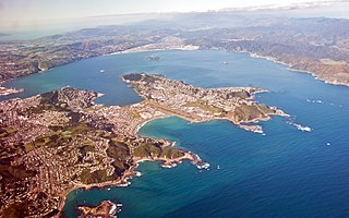
Eastbourne is a suburb of Lower Hutt, a part of Wellington, New Zealand. Lying beside the sea, it is a popular local tourist destination via car from Petone or from ferry crossings from central Wellington. An outer suburb, it lies on the eastern shore of Wellington Harbour, five kilometres south of the main Lower Hutt urban area and directly across the harbour from the Miramar Peninsula in Wellington city. A narrow exposed coastal road connects it with the rest of Lower Hutt via the Eastern Bays and the industrial suburb of Seaview. It is named for Eastbourne in England, another seaside town known as a destination for day-trips.
In the hills bordering Eastbourne there is mainly native bush and trees. With a locally administered possum-eradication programme, much of the native bush has regenerated, including red-flowering northern rātā trees. The bush has numerous tracks running to and from them, including a track along the entire bays hills ridge. With many settlers originating from Stromboli, an island near Sicily, the suburb has an Italian heritage similar to several other suburbs in Wellington; this is expressed particularly in its architecture.[4]
History
The suburb's origins lie in pre-colonial times, with local MāoriIwi having several Kāinga and Pā in the area for hundreds of years, in the bays and the raised headlands respectively. These settlements were located in the bays north of the suburb's centre, such as Point Howard and the Lowry, Rona and Days Bays. These settlements were essential, as they blocked out invasion from the neighbouring iwi in the Wairarapa, Ngāti Kahungunu. Raids were a common affair, and forced local Māori to always be vigilant.[5]
European settlement increased after the devastating 1855 Wairarapa earthquake, because the Waiwhetu river in Seaview was lowered, along with the raising of the shore of Wellington Harbour by 2 metres. Eastbourne's Italian heritage began with the settlement of Rona Bay (originally known as Brown's Bay) by Italians Bartolo and Italia Russo 1892. Renaming it after themselves as Russo Bay, the Russos, originally from Stromboli, they established a hotel and began horticultural and fishing industries. They prompted many relatives and friends to also emigrate, propelling Eastbourne into an elaborate little Italian New Zealander stronghold.[5]
Ballinger Gardens, Eastbourne, demonstrating pleasant garden scenes and older architecture in the suburb.
Prior to its amalgamation into Lower Hutt, the Borough of Eastbourne comprised a separate town, with its own council and civic administration. The Eastbourne Community Board[6], a remnant of the former town council, remains vocal on local issues. A local bus station still bears the "Borough of Eastbourne" name.
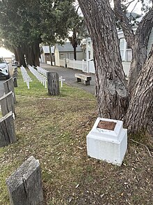
T.E.V. Wahine Foremast Memorial
The Wahine disaster was New Zealand's worst modern maritime disaster, occurring on 10 April 1968, when the ferry Wahine struck Barrett Reef in Wellington Harbour during a storm and capsized. 734 people were on board, and 53 died from drowning, injuries, or exposure to the elements. Eastbourne was cut off from the city by heavy seas which washed over Marine Drive. Passengers from the sinking vessel began to go towards Eastbourne and Seatoun. Residents took in survivors, Eastbourne's two hair-dressing salons emptied their establishments of towels and the local bakery delivered sandwiches, soup and trays piled with buns, scones, muffins, pies and cakes to the RSA.[7] Installed in 2010, there now lies a memorial opposite the bus barn for those who died in the disaster.[8]
Demographics
Eastbourne statistical area covers 1.93km2 (0.75sqmi).[2] It had an estimated population of 2,760 as of June 2024,[3] with a population density of 1,430 people per km2.
Eastbourne had a population of 2,709 at the 2018 New Zealand census, a decrease of 12 people (−0.4%) since the 2013 census, and an increase of 9 people (0.3%) since the 2006 census. There were 1,089 households, comprising 1,308 males and 1,401 females, giving a sex ratio of 0.93 males per female. The median age was 46.2 years (compared with 37.4 years nationally), with 534 people (19.7%) aged under 15 years, 324 (12.0%) aged 15 to 29, 1,317 (48.6%) aged 30 to 64, and 531 (19.6%) aged 65 or older.
Ethnicities were 95.3% European/Pākehā, 5.4% Māori, 1.6% Pasifika, 2.8% Asian, and 2.1% other ethnicities. People may identify with more than one ethnicity.
The percentage of people born overseas was 26.0, compared with 27.1% nationally.
Although some people chose not to answer the census's question about religious affiliation, 54.5% had no religion, 36.8% were Christian, 0.1% had Māori religious beliefs, 0.6% were Hindu, 0.1% were Muslim, 0.6% were Buddhist and 2.7% had other religions.
Of those at least 15 years old, 990 (45.5%) people had a bachelor's or higher degree, and 153 (7.0%) people had no formal qualifications. The median income was $45,600, compared with $31,800 nationally. 765 people (35.2%) earned over $70,000 compared to 17.2% nationally. The employment status of those at least 15 was that 1,074 (49.4%) people were employed full-time, 375 (17.2%) were part-time, and 69 (3.2%) were unemployed.[9]
Culture and features today
Eastbourne constitutes Point Howard, Sorrento Bay, Whiorau/Lowry Bay, York Bay, Mahina Bay, Sunshine Bay, Days Bay, Rona Bay, Robinson bay, and Camp Bay.
Eastbourne's culture involves its laid-back, sunny atmosphere, small restaurants, heritage homes and remoteness that invokes a curiosity among other Wellingtonians, who have flocked there for summer day trips since the 19th century.[10]
A regular trans-harbour ferry service connects Wellington's CBD and Eastbourne, docking at the Days Bay wharf in Eastbourne and at Queen's Wharf close to down-town Wellington. The ferry started in 1886, became daily in 1901, was bought by Eastbourne Borough Council in 1913 and stopped between 1948 and 1989.[11] The ferry service is now owned and operated by East by West Ferries who added services between Eastbourne and Seatoun (which ceased in 2021 due to the Seaton Wharf undergoing substantial repairs to maintain safety and preserve its heritage. However after its reopening in 2022, the company chose not to resume services) and services between Eastbourne and Mātiu / Somes Island.[12]
Eastbourne Borough Council Omnibus Service Garage 1939
The southern terminus of buses in Eastbourne is the Bus Barn,[13] or Eastbourne Borough Council Omnibus Service Garage, which was formally opened on 24 May 1939. It has had a Historic Place Category 2 listing (Number 7644) since 8 February 2006.[11] It was in the news in March 2022 when a double-deck bus tried to enter its low doorway.[14]
At the end of Eastbourne beyond Burdan's gate there is a pedestrian-only coastal road (unsealed) which extends out to the Wellington Harbour entrance heads, where there are three lighthouses including both the upper and lower now decommissioned Pencarrow Head Lighthouse which were then replaced in 1935 by the Baring Head Lighthouse. This area, popular with cyclists, provides access to East Harbour Regional Park.
Muritai School Field, Eastbourne
The hills surrounding Eastbourne provide an important habitat for indigenous biodiversity and contain some of New Zealand's rarest and most-endangered plant species.[15]
The Eastbourne banded dotterel colony is located along the eastern shores of Wellington Harbour in Lower Hutt, and is the only breeding site for this species inside Wellington Harbour. In 2020, volunteers monitoring the site noted that a lone cat had eaten eggs and killed chicks, decimating seven nests in one season.[16][17]
Eastbourne ANZAC memorial
Eastbourne has two ANZAC war memorials, one is located along the fencing of Muritai School installed in 1986,[18] and the second is a Pohutukawa (planted on 14 July 1915 by Eastbourne Mayor J P Kelly) together with its plaque forming the first ANZAC memorial erected in New Zealand.
Education
Current institutes
Muritai School is a co-educational state primary school for Year 1 to 8 students,[19][20] with a roll of 367 as of August 2024.[21]
Wellesley College is a boys-only independent primary school for Year 1 to 8 students, with a roll of 350 as of May 2014.[22]
East Harbour Kindergarten is a community-based kindergarten for children between 2 and 5 years.[23][24]
Barnardos Early Learning Centre Eastbourne for children between 0 and 6 years.[25]
Days Bay Playcentre is a community-based playcentre for children ages 0–5 years.[26]
Point Howard Playcentre is a community-based playcentre for children ages 0–5 years.[27]
Past institutes
Gollans Valley School was a school located in Gollans Valley and closed in 1898.[28]
San Antonio School was a co-educational state-integrated Catholic primary school for Year 1 to 8 students,[30][31] with a roll of .[32] Closed in 2022.[33]
Notable residents
Chris Bishop (1983–present), Minister of Housing of New Zealand
Ashley Bloomfield (1966–present), New Zealand public health official.
Ted Nightingale (unknown-unknown), Eastbourne builder and Resene Founder
Margaret Magill (1888–1962), teacher and school principal; served as deputy mayor of Eastbourne
Mimie Wood (1888–1979), secretary, accountant and librarian for the Royal Society of New Zealand; lived in Eastbourne from 1920
Past Mayors
Mayoral Chain for the Borough of Eastbourne, found in the Eastbourne community library foyer
Waipukurau is the largest town in the Central Hawke's Bay District on the east coast of the North Island of New Zealand. It is located on the banks of the Tukituki River, 7 kilometres south of Waipawa and 50 kilometres southwest of Hastings.
Wellington Harbour, officially called Wellington Harbour / Port Nicholson, is a large natural harbour on the southern tip of New Zealand's North Island. The harbour entrance is from Cook Strait. Central Wellington is located on parts of the western and southern sides of the harbour, and the suburban area of Lower Hutt is to the north and east.
Whitianga is a town on the Coromandel Peninsula, in the Waikato region of New Zealand's North Island. The town is located on Mercury Bay, on the northeastern coast of the peninsula. The town has a permanent population of 6,540 as of June 2024, making it the second-largest town on the Coromandel Peninsula behind Thames.
Seatoun is an eastern suburb of Wellington, the capital city of New Zealand and lies on the east coast of the Miramar Peninsula, close to the entrance to Wellington Harbour.
Viaduct Harbour, formerly known as Viaduct Basin, is a former commercial harbour on the Auckland waterfront that has been turned into a development of mostly upscale apartments, office space and restaurants. It is located on the site of a formerly run-down area of the Freemans Bay / Auckland CBD waterfront in Auckland, New Zealand. As a centre of activity of the 2000 America's Cup hosted by the Royal New Zealand Yacht Squadron, as well as the 2022 Rally New Zealand, the precinct enjoyed considerable popularity with locals and foreign visitors.
Ferries within Wellington's harbour carry commuters and tourists on Wellington Harbour and form a part of the Wellington public transport system. They operate between central Wellington, Days Bay, Seatoun, and Matiu/Somes Island. Until 2016, services also ran to Petone on weekends. Historically they also served Lowry Bay and Rona Bay—the ferries belonged to the Eastbourne Borough Council from 1913 to 1950—and briefly, until 1913, Miramar and Karaka Bay. The development of road connections around the harbour's edge, particularly once they were paved during the 1920s, reduced the importance of ferries to the city's transport network, but regular services still run.
Kaiwharawhara is an urban seaside suburb of Wellington in New Zealand's North Island. It is located north of the centre of the city on the western shore of Wellington Harbour, where the Kaiwharawhara Stream reaches the sea from its headwaters in Karori. It is a largely commercial and industrial area and thus has little residential population. A recent housing development up the hillside towards Te Kainga has increased the resident population.
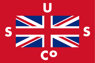
Union Steam Ship Company of New Zealand Limited was once the biggest shipping line in the southern hemisphere and New Zealand's largest private-sector employer. It was incorporated by James Mills in Dunedin in 1875 with the backing of a Scottish shipbuilder, Peter Denny. Bought by shipping giant P&O around the time of World War I it was sold in 1972 to an Australasian consortium and closed at the end of the twentieth century.
Karehana Bay is a bay and nearby residential area at the western end of Plimmerton, a northern coastal locality of Porirua. It is located near the entrance to the Porirua Harbour, to the south-east of Hongoeka. It is about 5 minutes drive to Karehana Bay from the State Highway 59 turnoff to Plimmerton. The area looks out towards Mana Island and across Cook Strait to the South Island.
State Highway 2 runs north–south through eastern parts of the North Island of New Zealand from the outskirts of Auckland to Wellington. It runs through Tauranga, Gisborne, Napier, Hastings and Masterton. It is the second-longest highway in the North Island, after State Highway 1, which runs the length of both of the country's main islands.
Normandale is a semi-rural suburb of Lower Hutt City, New Zealand, on the western hills of the Hutt Valley. It consists of two main roads – Normandale Road and Miromiro Road – and the hills between, and is a five minute drive from the Lower Hutt city centre.
Edmund Giblett Allen (1844–1909) was a Liberal Party Member of Parliament in New Zealand.
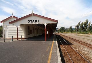
Ōtaki railway station is a station on the North Island Main Trunk railway line serving Ōtaki in the Kapiti Coast District of New Zealand. It is served by the Capital Connection long distance commuter train between Wellington and Palmerston North.
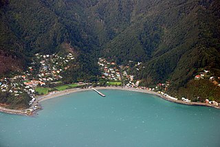
Days Bay is a residential area in Lower Hutt in the Wellington Region of the North Island of New Zealand. It is walled on three sides by steep bush-clad slopes. Most of its level land is occupied by Williams Park and an independent boys' primary school, originally a part of Williams Park. Wellington shipowner, J H Williams, bought land in Days Bay near the end of the 19th century to create custom for his smaller vessels, building a wharf and turning the bay into a sports and resort development for day-trippers and holiday-makers. Williams sold his interest in 1905 and the new owners split off building sites on unneeded land. The Eastbourne Borough Council bought the ferries in 1913 and the accommodation, Days Bay House, was sold to Wellington's Croydon School. The following year the Wellington City Council with central government support and public subscription bought the resort for the benefit of the public though without its accommodation and, in view of the large cash contribution by the founder's mother, named it Williams Park.
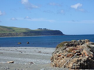
Pencarrow Head, also known as Pencarrow, is a headland in the Wellington Region of New Zealand and the name of the surrounding area, which was derived from Pencarrow, the family home of New Zealand Company director, Sir William Molesworth. The name is Cornish and formed from Pen which translates to English as head and Carrow which is a valley.
The Northern Steam Ship Company Ltd (NSS) served the northern half of the North Island of New Zealand from 1881 to 1974. Its headquarters, the Northern Steam Ship Company Building, remains in use on Quay Street, Auckland as a bar and is listed by Heritage New Zealand as a Category I Historic Place.
Fitzroy Bay is a bay close to the entrance of Wellington Harbour in New Zealand. It lies to the southeast of the entrance to the harbour, between Pencarrow Head and Baring Head. Lake Kohangatera drains into the bay through Gollans Stream.
Whitmore Street is at the boundary of the central business district and the government buildings area of Wellington, New Zealand's capital. The street runs almost north-south and is one of those linking Lambton Quay, Wellington's main shopping street, with Stout Street, Featherston Street and the harbourside at Customhouse/ Waterloo Quay. It is in the suburb of Pipitea.
Minerva was a 21-ton, kauri-built, steam passenger ferry, launched for Clevedon Steam Navigation Company Limited at the Freemans Bay yard of Charles Bailey on 10 December 1910, to link Auckland with Whitford and Howick. A social for the new ship was held at Whitford on 16 January 1911.
This page is based on this Wikipedia article Text is available under the CC BY-SA 4.0 license; additional terms may apply. Images, videos and audio are available under their respective licenses.


