
Bergen County is the most populous county in the U.S. state of New Jersey. As of the 2020 United States census, the county's population was 955,732, an increase of 50,616 (+5.6%) from the 2010 census count of 905,116, which in turn reflected an increase of 20,998 (2.4%) from the 884,118 counted in the 2000 census. Located in the northeastern corner of New Jersey and its Gateway Region, Bergen County and its many inner suburbs constitute a highly developed part of the New York City metropolitan area, bordering the Hudson River; the George Washington Bridge, which crosses the Hudson, connects Bergen County with Manhattan.

Route 4 is a state highway in Bergen County and Passaic County, New Jersey, United States. The highway stretches 10.83 mi (17.43 km) from Route 20 in Paterson east to an interchange with Interstate 95 (I-95), U.S. Route 1/9 (US 1/9), US 46, and US 9W at the George Washington Bridge approach in Fort Lee.

Route 17 is a state highway in Bergen County, New Jersey, United States, that provides a major route from the George Washington Bridge, Lincoln Tunnel and other northeast New Jersey points to the New York State Thruway at Suffern, New York. It runs 27.20 mi (43.77 km) from an intersection with Route 7 and County Route 507 (CR 507) in North Arlington north to the New York border along Interstate 287 (I-287) in Mahwah, where New York State Route 17 (NY 17) continues into New York. Between Route 7 and Route 3 in Rutherford, Route 17 serves as a local road. From Route 3 north to the junction with U.S. Route 46 (US 46) in Hasbrouck Heights, the road is a suburban arterial with jughandles. The portion of Route 17 from US 46 to I-287 near the state line in Mahwah is a limited-access road with all cross traffic handled by interchanges, and many driveways and side streets accessed from right-in/right-out ramps from the right lane. For three miles (5 km) north of Route 4, well over a hundred retail stores and several large shopping malls line the route in the borough of Paramus. The remainder of this portion of Route 17 features lighter suburban development. The northernmost portion of Route 17 in Mahwah runs concurrently with I-287 to the New York border.

Fair Lawn is a borough in Bergen County, in the U.S. state of New Jersey, and a bedroom suburb located 12 miles (19 km) northwest of New York City. As of the 2020 United States census, the borough's population was 34,927, an increase of 2,470 (+7.6%) from the 2010 census count of 32,457, which in turn reflected an increase of 820 (+2.6%) from the 31,637 counted at the 2000 census.

Paramus is a borough in the central portion of Bergen County, in the U.S. state of New Jersey. A suburb of New York City, Paramus is located 15 to 20 miles northwest of Midtown Manhattan and approximately 8 miles (13 km) west of Upper Manhattan. The Wall Street Journal characterized Paramus as "quintessentially suburban". The borough is a major commercial hub for North Jersey.

Ramsey is a borough in Bergen County, New Jersey, United States. It is a suburb of New York City, located 26 miles (42 km) northwest of Midtown Manhattan. As of the 2010 United States Census, the borough's population was 14,473, reflecting an increase of 122 (+0.9%) from the 14,351 counted in the 2000 Census, which had in turn increased by 1,123 (+8.5%) from the 13,228 counted in the 1990 Census.

Ridgewood is a village in Bergen County, in the U.S. state of New Jersey. As of the 2020 United States census, the village's population was 25,979, an increase of 1,021 (+4.1%) from the 2010 census count of 24,958, which in turn reflected an increase of 22 (+0.1%) from 24,936 in the 2000 census. Ridgewood is a suburban bedroom community of New York City, located approximately 20 miles (32 km) northwest of Midtown Manhattan.

Rochelle Park is a township in Bergen County, in the U.S. state of New Jersey. As of the 2020 United States census, the township's population was 5,814, an increase of 284 (+5.1%) from the 2010 census count of 5,530, which in turn reflected an increase of 2 (+0.0%) from the 5,528 counted in the 2000 census.

Saddle Brook is a township in Bergen County, New Jersey, United States. As of the 2010 United States Census, the township's population was 13,659, reflecting an increase of 504 (+3.8%) from the 13,155 counted in the 2000 Census, which had in turn declined by 141 (−1.1%) from the 13,296 counted in the 1990 Census.

Saddle River is a borough in Bergen County, in the U.S. state of New Jersey. It is a suburb of New York City, located just over 25 miles (40 km) northwest of Manhattan. The town is known for its natural fields, farmland, forests, and rivers, and has a bucolic atmosphere, in part due in part to a minimum zoning requirement of 2 acres (0.81 ha) for homes. The borough contains both stately historic homes and estates, as well as newer mansions. It is popular among residents seeking spacious properties in a countryside-like setting, while also having proximity to New York City.

Woodcliff Lake is a borough in Bergen County, in the U.S. state of New Jersey. As of the 2020 United States census, the borough's population was 6,128, an increase of 398 (+6.9%) from the 2010 census count of 5,730, which in turn reflected a decline of 15 (−0.3%) from the 5,745 counted at the 2000 census. Most of the borough mandates a minimum lot size of 22,500 square feet (2,090 m2) for single-family homes, with portions on the borough's east zoned for 15,000 square feet (1,400 m2) and portions of the borough's northwest and southwest zoned for 30,000 square feet (2,800 m2) lots.

Upper Saddle River is a borough in Bergen County, in the U.S. state of New Jersey. As of the 2020 United States census, the borough's population was 8,353, an increase of 145 (+1.8%) from the 2010 census count of 8,208, which in turn reflected an increase of 467 (+6.0%) from the 7,741 counted in the 2000 census.

The Garden State Parkway (GSP) is a controlled-access toll road that stretches the north–south length of eastern New Jersey from the state's southernmost tip near Cape May to the New York state line at Montvale. Its name refers to New Jersey's nickname, the "Garden State". The parkway is designated by the New Jersey Department of Transportation (NJDOT) as Route 444, although this designation is unsigned. At its north end, the road becomes the Garden State Parkway Connector, a component of the New York State Thruway system that connects to the Thruway mainline in Ramapo. The parkway is the longest highway in the state at approximately 172 miles (277 km), and, according to the International Bridge, Tunnel and Turnpike Association, was the busiest toll road in the United States in 2006. Most of the highway north of the Raritan River runs through heavily populated areas. Between the Raritan River and the township of Toms River, the highway passes through lighter suburban development, while south of Toms River, the road mostly runs through unspoiled wilderness in the Pine Barrens and swampland. The highway has a posted speed limit of 65 miles per hour (105 km/h) for most of its length and is primarily for passenger vehicle use; trucks weighing over 10,000 pounds (4,500 kg) are prohibited north of exit 105.

Garden State Plaza is a shopping mall located in Paramus, New Jersey, United States. It is owned and managed by Paris-based real estate management company Unibail-Rodamco-Westfield, and located at the intersection of Route 4 and Route 17 near the Garden State Parkway, about 15 miles (24 km) west of Manhattan. Opened in 1957 as the first suburban shopping mall in New Jersey, it has 2,118,718 sq ft (196,835.3 m2) of leasable space, and housing over 300 stores, it is the second-largest mall in New Jersey, the third-largest mall in the New York metropolitan area, and one of the highest-revenue producing malls in the United States.

The Saddle River flows south through much of Bergen County, New Jersey. The river runs through densely populated suburban areas for much of its course. The river takes its name from the river near Saddell in Argyll and Bute in Scotland.
New Jersey's 5th congressional district is represented by Democrat Josh Gottheimer, who has served in Congress since 2017. The district stretches across the entire northern border of the state and contains most of Bergen County, as well as parts of Passaic County and Sussex County.

Saddle River County Park is a 596-acre (2.41 km2) county park in Bergen County, New Jersey, United States, stretching from Ridgewood to Rochelle Park, and extends out to Glen Rock. The park is located along the Saddle River and consists of five sections, all of which are connected by a paved path that is open to both pedestrians and bicyclists.

Paramus Reformed Church Historic District is a historic district bounded by Franklin Turnpike, Route 17, Saddle River, south side of Valleau Cemetery, and E Glen Avenue in Ridgewood, Bergen County, New Jersey, United States.

The Albert J. Zabriskie Farmhouse is located at the current address of 7 East Ridgewood Avenue in Paramus, Bergen County, New Jersey, United States, just east of New Jersey Route 17. This is one of several Zabriskie historic sites associated with the descendants of prominent settler Albrycht Zaborowski (1638–1711). This stone house was built in 1805 by Albert Jacob Zabriskie (1760–1835) in the New Jersey Dutch style, owned by four generations of the family until 1924, and added to the National Register of Historic Places on November 7, 1977. Due to confusion from the street name and handwritten notes on one page of the NRHP nomination, the building is sometimes mistakenly listed as being in Ridgewood, New Jersey.
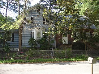
The Zabriskie Tenant House was a historic house of the American colonial architecture style called Dutch Colonial on Dunkerhook Road in Paramus, in Bergen County, New Jersey, United States, adjacent to the Saddle River County Park. The Zabriskie family, who farmed much of the area to the east of the Saddle River, built the home to house their domestic workers. It was one of the few structures left in New Jersey directly related to free African American communities in the state, and was a remnant of an African American Dunkerhook community that included several homes and an A.M.E. Church. The house was added to the National Register of Historic Places on July 24, 1984.

