
Riverside is a neighborhood in the city of East Providence in the U.S. state of Rhode Island. Despite not being an incorporated city, Riverside has its own zip code, 02915, and is an acceptable mailing address according to the United States Postal Service. Riverside has a population of approximately 20,000 people.

The Eleazer Arnold House is a historic house built for Eleazer Arnold in about 1693, and located in the Great Road Historic District at Lincoln, Rhode Island. It is now a National Historic Landmark owned by Historic New England, and open to the public on weekends.

Elmwood is a neighborhood in the South Side of Providence, Rhode Island. The triangular region is demarcated by Broad Street, Elmwood Avenue, and Interstate 95.
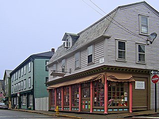
The Newport Historic District is a historic district that covers 250 acres in the center of Newport in the U.S. state of Rhode Island. It was designated a National Historic Landmark (NHL) in 1968 due to its extensive and well-preserved assortment of intact colonial buildings dating from the early and mid-18th century. Six of those buildings are themselves NHLs in their own right, including the city's oldest house and the former meeting place of the colonial and state legislatures. Newer and modern buildings coexist with the historic structures.

The Bicknell–Armington Lightning Splitter House is a historic house at 3591 Pawtucket Avenue in East Providence, Rhode Island. The house is of a distinctive type, a "Lightning Splitter", of which only a few instances exist in the Providence area. It is a wood-frame structure with a steep two-story gable roof. Records suggest that the house was constructed about 1827, but architectural evidence suggests it was extensively altered in the 1850s. The main entrance and the interior has a simplified Greek Revival styling. The house was listed on the National Register of Historic Places on November 28, 1980.

The Edgewood Historic District–Taft Estate Plat is a historic district in Cranston, Rhode Island that is bounded by Windsor Road, Narragansett Bay, Circuit Drive and Broad Street. The district represents the final subdivision of a country estate amassed by industrialist Orray Taft (1793-1865). It was laid out in 1904 and most of its residential stock was built between 1905 and 1930. The average size of the lots was 5400 square feet, although there was some variance in size, and a one-acre plot was reserved for the Taft mansion. The houses are architecturally heterogeneous, reflecting all of the major styles of the period; some properties were designed by Norman Isham.

The South Central Falls Historic District is a historic district in Central Falls, Rhode Island. It is a predominantly residential area, densely populated, which was developed most heavily in the late 19th century. It is bounded roughly by Broad Street to the east, the Pawtucket city line to the south, Dexter Street to the west, and Rand Street and Jenks Park to the north. It has 377 contributing buildings, most of which were built before 1920. The district was added to the National Register of Historic Places in 1991.
The Blackstone Boulevard Realty Plat Historic District is a historic district roughly bounded by Blackstone Blvd., Rochambeau Ave., Holly St. and Elmgrove Ave. in Providence, Rhode Island.

The Freeman Plat Historic District is a residential historic district on the East Side of Providence, Rhode Island. The district is a well-preserved example of an early-20th-century planned residential area, encompassing some 50 acres (20 ha). It is roughly bounded by Sessions Street, Morris Avenue, Laurel Avenue, and Wayland Avenue, and consists of a network of generously-landscaped winding roads, laid out in consultation with the Olmsted Brothers design firm. The houses built are generally of high quality, many of them architect-designed, with architecturally diverse revival styles popular at the time. The area was developed between 1916 and 1929 by John Freeman, who owned a country estate in the area, and sought a way to develop the largely swampy tract.
Grace Church is an historic Episcopal church at 300 Westminster Street at Mathewson Street in downtown Providence, Rhode Island. It was built in 1845-46 and was designed by Richard Upjohn in the Gothic Revival style.

The Hay and Owen Buildings are a pair of historic commercial buildings in Providence, Rhode Island.

The Providence Jewelry Manufacturing Historic District is a predominantly industrial historic district in Providence, Rhode Island. It covers a roughly 19-acre (7.7 ha) area in the city's Jewelry District, just south of Downtown Providence. While the area began as a residential neighborhood, it emerged in the late 19th and early 20th centuries as a center of Providence's jewelry manufacturing businesses. The oldest industrial building in the district is the 1848 Elm Street Machine Shop, a 2+1⁄2-story stone structure that now houses offices of Brown University.

The Summit Historic District is a residential historic district in northeastern Providence, Rhode Island. It is bounded on the east by Summit Avenue, the south by Rochambeau Avenue, the west by Camp Street, and the north by Memorial Road and Creston Way. It contains 155 houses, most of which were built between 1918 and 1938. The area was annexed by Providence in 1874 and platted out of farmland in 1916, and represents a typical suburban development of the period. Most of these houses are set on lots between 4,500 and 5,500 square feet in size, although there are some double lots. Single family homes predominate, with a number of two- and three-family houses present. Architecturally the houses are heterogeneous, with styles ranging from the late Queen Anne to the Colonial and Tudor Revivals. The only significant non-residential structure in the district is Temple Beth Shalom at 120 Rochambeau Avenue, which does not contribute to its significance.

The Wayland Historic District is a predominantly residential historic district on the east side of Providence, Rhode Island. It is a large area, covering about 122 acres (49 ha), bounded roughly on the north by Everett and Laurel Avenues, on the east by Blackstone Boulevard and Butler Avenue, on the west by Arlington Avenue, and on the south by Angell and South Angell Streets. This area, which was in the 19th century part of the Moses Brown farm, was platted for development in 1891, with most of the construction taking place in the early decades of the 20th century. Most of the residential properties in the district are single-family houses, typically built in revival styles popular at the time. They are set on similarly-sized lots with fairly uniform setbacks, and were typically built without garages. There are a number of two-family houses, and a small number of apartment buildings, most of which are found on the arterial roads of the area. There are several religious buildings, including several churches; the most architecturally distinctive religious building is the Jewish Temple Beth El, built 1951–54.

The Edgewood Historic District–Shaw Plat is a residential historic district in the Edgewood neighborhood of northeastern Cranston, Rhode Island. It is bounded by Broad Street on the west, Marion Avenue on the south, and Narragansett Bay on the east; it consists of the properties that line the parallel streets, Shaw and Marion Avenues, and the short section of Narragansett Boulevard that runs between Shaw and Marion Avenues. On the north, it abuts the separately-listed Edgewood Historic District–Arnold Farm Plat. The area was platted out between 1867 and 1895, with the construction of most of its housing taking place between 1867 and the start of World War II, with the most construction going on between 1895 and 1930. The district also includes the previously listed Edgewood Yacht Club. In 1853, the 25 acres of land that became the Shaw Plat was sold to Allen Shaw of Providence for $3,660.

The Edgewood Historic District–Arnold Farm Plat is a residential historic district in the Edgewood neighborhood of eastern Cranston, Rhode Island. It is bounded on the north by Albert Avenue, on the east by Narragansett Bay, on the south by Columbia Avenue, and on the west by Broad Street. The district was primarily built out as a streetcar suburb of Providence between 1890 and 1930, and feature styles from Queen Anne and Colonial Revival to Dutch Colonials and two- and three-decker multiunit houses. Prior to its development, the area had been farmed by several generations of the Arnold family.

The Edgewood Historic District–Anstis Greene Estate Plat is a residential historic district in the Edgewood neighborhood of eastern Cranston, Rhode Island. The 34-acre (14 ha) area is bounded on the west by Broad Street, the east by Narragansett Bay, the south by Rosewood Avenue, and on the north by Marion Avenue, where it abuts the Edgewood Historic District-Shaw Plat. The area, originally part of a much larger property belonging to Zachariah Rhodes in the 17th century, was platted for residential development in the decades following the arrival of the streetcar on Broad Street, providing commuter service to Providence. The land was willed by Anstis Rhodes Greene to a group of heirs, who progressively developed their individual portions. The only significant surviving elements that predate this development are two small family cemeteries.

The Rose Land Park Plat Historic District encompasses an early 20th-century neighborhood of East Providence, Rhode Island, most of which was built by a single development group. It is located on the west side of Willett Avenue, on Florence Street, Princeton and Dartmouth Avenues, and Roseland Court. The 7-acre (2.8 ha) district includes 38 residential buildings, and was mostly built between 1928 and 1939 as a streetcar suburb of Providence by Severin Carlson and Carl Johnson. The houses are mainly wood frame construction, and are stylistically English Revival, Colonial Revival, and traditional Cape Cod.

The Edgewood Historic District–Aberdeen Plat is a residential historic district in the Edgewood neighborhood of eastern Cranston, Rhode Island. Bounded by Berwick Lane and Sefton Drive to the north, Broad Street to the west, Chiswick Road to the south, and the Providence River to the east, this area was developed between 1901 and 1957 as a streetcar suburb for middle and upper middle class residents on what was once a country estate. The district was listed on the National Register of Historic Places in 2016.
The Edgewood Historic District–Sally Greene Homestead Plats is a residential historic district in the Edgewood neighborhood of eastern Cranston, Rhode Island. Bounded by Glen Avenue to the north, Broad Street to the west, Massasoit Street to the south, and the Providence River to the east, this area was developed between 1900 and 1963 as a streetcar suburb for middle and lower middle class residents on what was once a country estate. The district was listed on the National Register of Historic Places in 2016.


