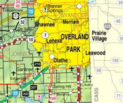
Fairway, Kansas | |
---|---|
Coordinates: 39°1′26″N94°37′45″W / 39.02389°N 94.62917°W [1] | |
Country | United States |
State | Kansas |
County | Johnson |
Founded | 1930s |
Incorporated | 1949 |
Government | |
• Mayor | Melanie Hepperley |
Area | |
• Total | 1.13 sq mi (2.92 km2) |
• Land | 1.13 sq mi (2.92 km2) |
• Water | 0.00 sq mi (0.00 km2) |
Elevation | 955 ft (291 m) |
Population | |
• Total | 4,170 |
• Density | 3,700/sq mi (1,400/km2) |
Time zone | UTC-6 (CST) |
• Summer (DST) | UTC-5 (CDT) |
ZIP code | 66205 |
Area code | 913 |
FIPS code | 20-22700 |
GNIS ID | 485573 [1] |
Website | fairwaykansas.org |
Fairway is a city in Johnson County, Kansas, United States. [1] It is included in the Kansas City metropolitan area census designation and the Shawnee Mission postal services designation. As of the 2020 United States census, the city population was 4,170. [3]
For millennia, the Great Plains of North America were inhabited by nomadic Native Americans. In the 1820s, the federal government reserved this area for use by the Shawnee people, who had ceded their lands east of the Mississippi River to the United States. In 1839, Methodists established the Shawnee Methodist Mission here to operate a school for the Shawnee and try to convert them to Christianity. Later it was named the Shawnee Indian Manual Labor School and also accepted Native American boarding students, then closed in 1862. The site is now owned by the Kansas Historical Society, designated as a National Historic Landmark, and is operated by the city of Fairway as a museum.
In the 1930s, as Kansas City suburbs were developing, a developer laid out a subdivision near a golf course. It was named Fairway from its proximity to several driving ranges. [4] Fairway was incorporated in 1949 and is known as "The City of Trees". [5]
Fairway formed its own police force in 1949 with the appointment of a town marshal. This position was succeeded by police chiefs. [6]
According to the United States Census Bureau, the city has a total area of 1.15 square miles (2.98 km2), all of it land. [7]
Census | Pop. | Note | %± |
---|---|---|---|
1950 | 1,816 | — | |
1960 | 5,398 | 197.2% | |
1970 | 5,227 | −3.2% | |
1980 | 4,619 | −11.6% | |
1990 | 4,173 | −9.7% | |
2000 | 3,952 | −5.3% | |
2010 | 3,882 | −1.8% | |
2020 | 4,170 | 7.4% | |
U.S. Decennial Census |
The 2020 United States census counted 4,170 people, 1,755 households, and 1,154 families in Fairway. [8] [9] The population density was 3,693.5 per square mile (1,426.1/km2). There were 1,822 housing units at an average density of 1,613.8 per square mile (623.1/km2). [9] [10] The racial makeup was 89.95% (3,751) white or European American (88.27% non-Hispanic white), 0.91% (38) black or African-American, 0.14% (6) Native American or Alaska Native, 2.01% (84) Asian, 0.02% (1) Pacific Islander or Native Hawaiian, 0.67% (28) from other races, and 6.28% (262) from two or more races. [11] Hispanic or Latino of any race was 4.51% (188) of the population. [12]
Of the 1,755 households, 32.2% had children under the age of 18; 57.1% were married couples living together; 24.4% had a female householder with no spouse or partner present. 28.1% of households consisted of individuals and 11.7% had someone living alone who was 65 years of age or older. [9] The average household size was 2.4 and the average family size was 3.2. [13] The percent of those with a bachelor's degree or higher was estimated to be 52.4% of the population. [14]
23.4% of the population was under the age of 18, 5.4% from 18 to 24, 30.1% from 25 to 44, 23.5% from 45 to 64, and 17.6% who were 65 years of age or older. The median age was 39.0 years. For every 100 females, there were 108.0 males. [9] For every 100 females ages 18 and older, there were 111.7 males. [9]
The 2016-2020 5-year American Community Survey estimates show that the median household income was $120,162 (with a margin of error of +/- $12,460) and the median family income was $174,543 (+/- $53,120). [15] Males had a median income of $78,487 (+/- $25,661) versus $56,063 (+/- $18,070) for females. The median income for those above 16 years old was $66,552 (+/- $10,056). [16] Approximately, 3.8% of families and 3.1% of the population were below the poverty line, including 0.0% of those under the age of 18 and 7.8% of those ages 65 or over. [17] [18]
As of the census [19] of 2010, there were 3,882 people, 1,749 households, and 1,062 families residing in the city. The population density was 3,375.7 inhabitants per square mile (1,303.4/km2). There were 1,833 housing units at an average density of 1,593.9 per square mile (615.4/km2). The racial makeup of the city was 95.3% White, 0.8% African American, 0.3% Native American, 1.4% Asian, 0.7% from other races, and 1.4% from two or more races. Hispanic or Latino of any race were 3.0% of the population.
There were 1,749 households, of which 27.0% had children under the age of 18 living with them, 52.0% were married couples living together, 6.8% had a female householder with no husband present, 1.9% had a male householder with no wife present, and 39.3% were non-families. 31.6% of all households were made up of individuals, and 9.8% had someone living alone who was 65 years of age or older. The average household size was 2.22 and the average family size was 2.83.
The median age in the city was 41.4 years. 21.8% of residents were under the age of 18; 4.5% were between the ages of 18 and 24; 28.4% were from 25 to 44; 30.6% were from 45 to 64; and 14.8% were 65 years of age or older. The gender makeup of the city was 47.0% male and 53.0% female.
As of the census [20] of 2000, there were 3,952 people, 1,781 households, and 1,102 families residing in the city. The population density was 3,468.8 inhabitants per square mile (1,339.3/km2). There were 1,842 housing units at an average density of 1,616.8 per square mile (624.2/km2). The racial makeup of the city was 96.18% White, 0.40% African American, 0.35% Native American, 1.24% Asian, 0.76% from other races, and 1.06% from two or more races. Hispanic or Latino of any race were 2.23% of the population. 22.4% were of German, 18.3% English and 16.3% Irish ancestry according to Census 2000.
There were 1,781 households, out of which 26.9% had children under the age of 18 living with them, 53.8% were married couples living together, 6.9% had a female householder with no husband present, and 38.1% were non-families. 31.4% of all households were made up of individuals, and 10.6% had someone living alone who was 65 years of age or older. The average household size was 2.21 and the average family size was 2.81.
In the city, the population was spread out, with 21.9% under the age of 18, 3.9% from 18 to 24, 32.7% from 25 to 44, 26.1% from 45 to 64, and 15.5% who were 65 years of age or older. The median age was 40 years. For every 100 females, there were 86.9 males. For every 100 females age 18 and over, there were 84.2 males.
The median income for a household in the city was $68,125, and the median income for a family was $97,163. Males had a median income of $72,350 versus $37,538 for females. The per capita income for the city was $45,456. About 0.5% of families and 1.3% of the population were below the poverty line, including none of those under age 18 and 6.3% of those age 65 or over.
The Johnson County Library services Fairway. The library has 13 locations in Johnson County.
Notable individuals who were born in or have lived in Fairway include:
Augusta is a city in Butler County, Kansas, United States. As of the 2020 census, the population of the city was 9,256. It is located east of Wichita along U.S. Route 54 / 400 highway.
Hepler is a city in Crawford County, Kansas, United States. As of the 2020 census, the population of the city was 90.
Mulberry is a city in Crawford County, Kansas, United States. As of the 2020 census, the population of the city was 409.
Norcatur is a city in Decatur County, Kansas, United States. As of the 2020 census, the population of the city was 159.
Eudora is a city in Douglas County, Kansas, United States, along the Kansas and Wakarusa rivers. As of the 2020 census, the population of the city was 6,408.
Gove City, more commonly known as Gove, is a city in and the county seat of Gove County, Kansas, United States. As of the 2020 census, the population of the city was 80.
Edgerton is a city in Johnson County, Kansas, United States, and part of the Kansas City metropolitan area. As of the 2020 census, the population of the city was 1,748. It is home to a large BNSF intermodal train facility named Logistics Park Kansas City.
Merriam is a city in Johnson County, Kansas, United States, and part of the Kansas City Metropolitan Area. As of the 2020 census, the population of the city was 11,098. Merriam is included in the Shawnee Mission postal designation. It is also the headquarters of Seaboard Corporation.
Mission is a city in Johnson County, Kansas, United States, and part of the Kansas City Metropolitan Area. As of the 2020 census, the population of the city was 9,954.
Prairie Village is a city in Johnson County, Kansas, United States, and located within the Kansas City Metropolitan Area. As of the 2020 census, the population of the city was 22,957.
Shawnee is a city in Johnson County, Kansas, United States. It is the seventh-most populous municipality in the Kansas City metropolitan area. As of the 2020 census, the population of the city was 67,311.
Kingman is a city in and the county seat of Kingman County, Kansas, United States. As of the 2020 census, the population of the city was 3,105.
Meade is a city in and the county seat of Meade County, Kansas, United States. As of the 2020 census, the population of the city was 1,505.
Ness City is a city in and the county seat of Ness County, Kansas, United States. As of the 2020 census, the population of the city was 1,329. Ness City is famous for its four-story Old Ness County Bank Building located downtown and nicknamed Skyscraper of the Plains.
Lyndon is a city in and the county seat of Osage County, Kansas, United States. As of the 2020 census, the population of the city was 1,037.
Belleville is a city in and the county seat of Republic County, Kansas, United States. As of the 2020 census, the population of the city was 2,007.
Andale is a city in Sedgwick County, Kansas, United States. As of the 2020 census, the population of the city was 941.
Mount Hope is a city in Sedgwick County, Kansas, United States. As of the 2020 census, the population of the city was 806.
Auburn is a city in Shawnee County, Kansas, United States. As of the 2020 census, the population of the city was 1,273.
Alma is a city in and the county seat of Wabaunsee County, Kansas, United States. As of the 2020 census, the population of the city was 802.