| Fan Island | |
|---|---|
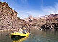
 Southeast aspect, from Colorado River | |
| Highest point | |
| Elevation | 5,092 ft (1,552 m) [1] |
| Prominence | 452 ft (138 m) [1] |
| Parent peak | Powell Plateau (7,661 ft) [2] |
| Isolation | 2.33 mi (3.75 km) [2] |
| Coordinates | 36°15′27″N112°21′52″W / 36.2575440°N 112.3643134°W [3] |
| Geography | |
 Fan Island Location in Arizona  Fan Island Fan Island (the United States) | |
| Country | United States |
| State | Arizona |
| County | Coconino |
| Protected area | Grand Canyon National Park |
| Parent range | Kaibab Plateau [1] Colorado Plateau |
| Topo map | USGS King Arthur Castle |
| Geology | |
| Rock type(s) | Redwall Limestone Tonto Group |
| Climbing | |
| First ascent | Jim Ohlman, Jim Kirschvink [4] |
| Easiest route | class 5.4 climbing [2] |
Fan Island is a 5,092-foot-elevation (1,552-meter) summit located in the Grand Canyon, in Coconino County of northern Arizona, US. [3] It is situated two miles south of Dutton Point, 2.5 miles west-northwest of Dox Castle, and 1.6 miles south-southwest of Masonic Temple. Topographic relief is significant as it rises 2,900 feet (880 meters) above the Colorado River in one mile (1.6 km). Fan Island was so named because the flat top resembles an unfolded hand fan. [5] According to the Köppen climate classification system, Fan Island is located in a cold semi-arid climate zone, with precipitation runoff draining south to the Colorado River via Hakatai Canyon from the west aspect, and Burro Canyon from the east aspect. [6] This butte is an erosional remnant composed of Redwall Limestone overlaying the Tonto Group. [7]