
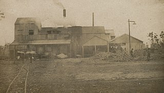
Woodgate is a coastal locality in the Bundaberg Region, Queensland, Australia. In the 2021 census, Woodgate had a population of 1,521 people.
McIlwraith is a rural locality in the Bundaberg Region, Queensland, Australia. In the 2021 census, McIlwraith had a population of 202 people.
Horton is a rural town and locality in the Bundaberg Region, Queensland, Australia. In the 2021 census, the locality of Horton had a population of 205 people.
Booyal is a town and a locality in the Bundaberg Region, Queensland, Australia. In the 2021 census, the locality of Booyal had a population of 285 people.
Winfield is a rural locality in the Bundaberg Region, Queensland, Australia. In the 2021 census, Winfield had a population of 154 people.
Gooburrum is a rural locality in the Bundaberg Region, Queensland, Australia. In the 2021 census, Gooburrum had a population of 1,518 people. The neighbourhood of Tantitha is within the locality.
Rubyanna is a rural locality in the Bundaberg Region, Queensland, Australia. In the 2021 census, Rubyanna had a population of 257 people.
Bungadoo is a rural locality in the Bundaberg Region, Queensland, Australia. The area was formerly known as Albionville. In the 2021 census, Bungadoo had a population of 342 people.
Tirroan is a rural town and a locality in the Bundaberg Region, Queensland, Australia. In the 2021 census, the locality of Tirroan had a population of 150 people.
Damascus is a locality in the Bundaberg Region, Queensland, Australia. In the 2021 census, Damascus had a population of 96 people.
Miara is a rural town and coastal locality in the Bundaberg Region, Queensland, Australia. In the 2021 census, the locality of Miara had a population of 28 people.
Redridge is a locality in the Bundaberg Region, Queensland, Australia. In the 2021 census, Redridge had a population of 711 people.
North Gregory is a rural locality in the Bundaberg Region, Queensland, Australia. In the 2021 census, North Gregory had a population of 89 people.
South Isis is a rural locality in the Bundaberg Region, Queensland, Australia. In the 2021 census, South Isis had a population of 381 people.
Walkers Point is a rural locality in the Fraser Coast Region, Queensland, Australia. In the 2021 census, Walkers Point had a population of 75 people.
Cherwell is a rural locality in the Fraser Coast Region, Queensland, Australia. In the 2021 census, Cherwell had a population of 10 people.
Prawle is a rural locality in the Fraser Coast Region, Queensland, Australia. In the 2021 census, Prawle had a population of 34 people.
Tandora is a rural locality in the Fraser Coast Region, Queensland, Australia. In the 2021 census, Tandora had "no people or a very low population".
Nahrunda is a rural locality in the Gympie Region, Queensland, Australia. In the 2021 census, Nahrunda had a population of 192 people.
Kalunga is a rural locality in the Tablelands Region, Queensland, Australia. In the 2021 census, Kalunga had a population of 103 people.
