
Forest Lake is an outer south-western suburb of the City of Brisbane, Queensland, Australia. In the 2021 census, Forest Lake had a population of 22,676 people.

Middle Park is a residential south-western suburb in the Centenary Suburbs in the City of Brisbane, Queensland, Australia. In the 2021 census, Middle Park had a population of 3,845 people.

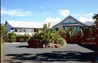
Burnett Heads is a coastal town and locality in the Bundaberg Region, Queensland, Australia. In the 2021 census, the locality of Burnett Heads had a population of 2,908 people.

East Ipswich is a residential inner-city suburb of Ipswich in the City of Ipswich, Queensland, Australia. In the 2021 census, East Ipswich had a population of 2,321 people.

Moore Park Beach is a coastal rural locality in the Bundaberg Region, Queensland, Australia. The coastal town of Moore Park is within the locality.

Bundaberg Central is the central suburb and central business district of Bundaberg in the Bundaberg Region, Queensland, Australia. In the 2021 census, Bundaberg Central had a population of 162 people.

South Kolan is a rural locality in the Bundaberg Region, Queensland, Australia. In the 2021 census, the locality of South Kolan had a population of 1,258 people.
Kepnock is a suburb of Bundaberg in the Bundaberg Region, Queensland, Australia. In the 2021 census, Kepnock had a population of 4,501 people.
Avoca is a south-western suburb of Bundaberg in the Bundaberg Region, Queensland, Australia. In the 2021 census, Avoca had a population of 4,912 people.

Bundaberg North is a suburb of Bundaberg in the Bundaberg Region, Queensland, Australia. It occupies the developed area north of the Burnett River, opposite the Bundaberg CBD. In the 2021 census, Bundaberg North had a population of 5,563 people.

Bundaberg East is a suburb of Bundaberg in the Bundaberg Region, Queensland, Australia. In the 2021 census, Bundaberg East had a population of 2,839 people.
Kalkie is a suburb of Bundaberg in the Bundaberg Region, Queensland, Australia. In the 2021 census, Kalkie had a population of 2,968 people.
Sharon is a rural locality in the Bundaberg Region, Queensland, Australia. In the 2021 census, Sharon had a population of 1,209 people.
Bundaberg South is a suburb of Bundaberg in the Bundaberg Region, Queensland, Australia. In the 2021 census, Bundaberg South had a population of 3,494 people.
Norville is a suburb of Bundaberg in the Bundaberg Region, Queensland, Australia. In the 2021 census, Norville had a population of 2,476 people.
Walkervale is a suburb of Bundaberg in the Bundaberg Region, Queensland, Australia. In the 2021 census, Walkervale had a population of 2,981 people.
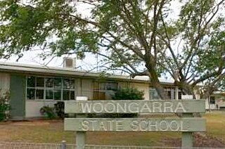
Woongarra is a rural locality in the Bundaberg Region, Queensland, Australia. In the 2021 census, Woongarra had a population of 585 people.

Rubyanna is a rural locality in the Bundaberg Region, Queensland, Australia. In the 2021 census, Rubyanna had a population of 257 people.
Avenell Heights is a southern suburb of Bundaberg in the Bundaberg Region, Queensland, Australia. In the 2021 census, Avenell Heights had a population of 5,028 people.
Ashfield is a mixed residential and rural locality in the Bundaberg Region, Queensland, Australia. In the 2021 census, Ashfield had a population of 1,152 people.

