Buxton is a rural locality in the Bundaberg Region, Queensland, Australia. In the 2016 census, Buxton had a population of 430 people.

Woodgate is a coastal locality in the Bundaberg Region, Queensland, Australia. In the 2016 census Woodgate had a population of 1,165 people.

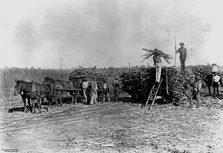
Apple Tree Creek is a rural town and locality in the Bundaberg Region, Queensland, Australia. It was formerly known as Bodalla, the Dundaburra people of the Northern Kabi group name from the Gregory River Plum which to first Europeans looked like an apple. Prior to settlement of the Isis District which includes Apple tree Creek - the area was called Buth'arth translating to scrub. The town was renamed in 1962. In the 2016 census, Apple Tree Creek had a population of 639 people.
Avoca is a south-western suburb of Bundaberg in the Bundaberg Region, Queensland, Australia. In the 2021 census, Avoca had a population of 4,912 people.
South Bingera is a rural residential locality in the Bundaberg Region, Queensland, Australia. In the 2016 census South Bingera had a population of 661 people.

Doolbi is a rural locality in the Bundaberg Region, Queensland, Australia. In the 2021 census, Doolbi had a population of 101 people.
Booyal is a town and a locality in the Bundaberg Region, Queensland, Australia. In the 2016 census, Booyal had a population of 275 people.
Elliott is a rural locality in the Bundaberg Region, Queensland, Australia. In the 2021 census, Elliott had a population of 156 people.
Good Night is a rural locality split between the Bundaberg Region and the North Burnett Region, Queensland, Australia. It is also written as Goodnight. In the 2021 census, Good Night had a population of 151 people.
Calavos is a rural locality in the Bundaberg Region, Queensland, Australia. In the 2021 census, Calavos had a population of 359 people.
Duingal is a locality in the Bundaberg Region, Queensland, Australia. In the 2021 census, Duingal had a population of 70 people.

Isis Central is a rural locality in the Bundaberg Region, Queensland, Australia. In the 2021 census, Isis Central had a population of 205 people.
Dalga is a locality in the Bundaberg Region, Queensland, Australia. In the 2021 census, Dalga had a population of 6 people.
Redridge is a locality in the Bundaberg Region, Queensland, Australia. In the 2016 census, Redridge had a population of 628 people.
Farnsfield is a rural locality in the Bundaberg Region, Queensland, Australia. In the 2021 census, Farnsfield had a population of 95 people.
Eureka is a rural locality in the Bundaberg Region, Queensland, Australia. In the 2021 census, Eureka had a population of 223 people.
Kullogum is a rural locality in the Bundaberg Region, Queensland, Australia. In the 2021 census, Kullogum had a population of 120 people.
South Isis is a rural locality in the Bundaberg Region, Queensland, Australia. In the 2021 census, South Isis had a population of 381 people.
Cherwell is a rural locality in the Fraser Coast Region, Queensland, Australia. In the 2021 census, Cherwell had a population of 10 people.
Gregory River is a rural locality in the Bundaberg Region, Queensland, Australia. In the 2021 census, Gregory River had a population of 65 people.
