
Burnett Heads is a coastal town and locality in the Bundaberg Region, Queensland, Australia. In the 2021 census, the locality of Burnett Heads had a population of 2,908 people.
Innes Park is a coastal town and locality in the Bundaberg Region, Queensland, Australia. The town is 367 kilometres (228 mi) north of the state capital, Brisbane. In the 2021 census, the locality of Innes Park had a population of 2,653 people.

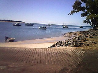
Moore Park Beach is a coastal rural locality in the Bundaberg Region, Queensland, Australia. The coastal town of Moore Park is within the locality.
Buxton is a rural locality in the Bundaberg Region, Queensland, Australia. In the 2021 census, the locality of Buxton had a population of 507 people.

Brooloo is a rural town and locality in the Gympie Region, Queensland, Australia. In the 2021 census, the locality of Brooloo had a population of 369 people.

Woodgate is a coastal locality in the Bundaberg Region, Queensland, Australia. In the 2021 census, Woodgate had a population of 1,521 people.

Curra is a rural residential locality in the Gympie Region, Queensland, Australia. In the 2021 census, Curra had a population of 2,104 people.

South Kolan is a rural locality in the Bundaberg Region, Queensland, Australia. In the 2021 census, the locality of South Kolan had a population of 1,258 people.
Burrum Heads is a coastal town and locality in the Fraser Coast Region, Queensland, Australia. In the 2021 census, the locality of Burrum Heads had a population of 2,538 people.

Alloway is a rural locality in the Bundaberg Region, Queensland, Australia. In the 2021 census, Alloway had a population of 488 people.
Goodwood is a rural locality in the Bundaberg Region, Queensland, Australia. In the 2021 census, Goodwood had a population of 155 people.
Bungadoo is a rural locality in the Bundaberg Region, Queensland, Australia. The area was formerly known as Albionville. In the 2021 census, Bungadoo had a population of 342 people.
Avenell Heights is a southern suburb of Bundaberg in the Bundaberg Region, Queensland, Australia. In the 2021 census, Avenell Heights had a population of 5,028 people.
Elliott is a rural locality in the Bundaberg Region, Queensland, Australia. In the 2021 census, Elliott had a population of 156 people.

Goomburra is a rural town and locality in the Southern Downs Region, Queensland, Australia. In the 2021 census, the locality of Goomburra had a population of 256 people.

Bucca is a rural locality in the Bundaberg Region, Queensland, Australia. In the 2021 census, Bucca had a population of 1,063 people.
Welcome Creek is a rural locality in the Bundaberg Region, Queensland, Australia. In the 2021 census, Welcome Creek had a population of 421 people.

Kensington is a mixed-use locality in the Bundaberg Region, Queensland, Australia. Traditionally a rural area on the south-western outskirts of Bundaberg, there is increasing commercial and residential development within the locality. In the 2021 census, Kensington had a population of 722 people.
Calavos is a rural locality in the Bundaberg Region, Queensland, Australia. In the 2021 census, Calavos had a population of 359 people.

Silverwood is a rural locality in the Southern Downs Region, Queensland, Australia. In the 2021 census, Silverwood had a population of 58 people.
