Faxon, Oklahoma

Last updated

Faxon, Oklahoma
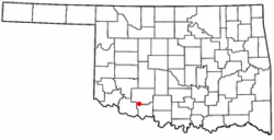
OKMap-doton-Faxon.PNG
Location of Faxon, Oklahoma
Coordinates: 34°27′37″N98°34′46″W / 34.46028°N 98.57944°W / 34.46028; -98.57944
Country United States
State Oklahoma
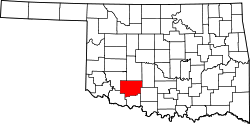
County Comanche
Area
[1]
  Total0.26 sq mi (0.67 km2)
  Land0.26 sq mi (0.67 km2)
  Water0.00 sq mi (0.00 km2)
Elevation
[2]
1,083 ft (330 m)
Population
 (2020)
  Total114
  Density443.58/sq mi (171.32/km2)
Time zone UTC-6 (Central (CST))
  Summer (DST) UTC-5 (CDT)
ZIP code
73540
Area code 580
FIPS code 40-25650 [3]
GNIS feature ID2412623 [2]

Faxon is a town in Comanche County, Oklahoma, United States. It is located on Oklahoma State Highway 36 about 18.3 driving miles southwest of Lawton. [4] The population was 136 at the 2010 census. It is included in the Lawton, Oklahoma Metropolitan Statistical Area.

Contents

Geography

According to the United States Census Bureau, the town has a total area of 0.3 square miles (0.78 km2), all land.

Climate

Climate data for Faxon, Oklahoma
MonthJanFebMarAprMayJunJulAugSepOctNovDecYear
Mean daily maximum °F (°C)51.8
(11.0)
57.5
(14.2)
67.3
(19.6)
76.7
(24.8)
84.5
(29.2)
92.7
(33.7)
98.2
(36.8)
97.1
(36.2)
88.3
(31.3)
78.1
(25.6)
64.4
(18.0)
54.1
(12.3)
75.9
(24.4)
Mean daily minimum °F (°C)25.5
(−3.6)
30.0
(−1.1)
38.6
(3.7)
48.7
(9.3)
57.6
(14.2)
66.1
(18.9)
70.3
(21.3)
69.0
(20.6)
62.3
(16.8)
50.4
(10.2)
38.9
(3.8)
28.8
(−1.8)
48.9
(9.4)
Average precipitation inches (mm)1.0
(25)
1.4
(36)
2.1
(53)
2.5
(64)
4.5
(110)
3.4
(86)
2.1
(53)
2.7
(69)
3.7
(94)
2.7
(69)
1.5
(38)
1.2
(30)
28.8
(730)
Source 1: weather.com
Source 2: Weatherbase.com [5]

Demographics

Historical population
CensusPop.Note
1910 215
1920 163−24.2%
1930 21230.1%
1940 178−16.0%
1950 135−24.2%
1960 1371.5%
1970 121−11.7%
1980 14015.7%
1990 127−9.3%
2000 1345.5%
2010 1361.5%
2020 114−16.2%
U.S. Decennial Census [6]

As of the census of 2010, there were 136 people, 55 households, and 39 families residing in the town. The population density was 532.4 inhabitants per square mile (205.6/km2). There were 66 housing units at an average density of 258.3 per square mile (99.7/km2). The racial makeup of the town was 89.7% White, 0.7% African American, 4.4% Native American, 0.7% Asian, 0.0% from other races, and 4.4% from two or more races. Hispanic or Latino of any race were 3.7% of the population.

There were 55 households, out of which 34.5% had children under the age of 18 living with them, 50.9% were married couples living together, 14.5% had a female householder with no husband present, and 29.1% were non-families. 29.1% of all households were made up of individuals, and 18.2% had someone living alone who was 65 years of age or older. The average household size was 2.47 and the average family size was 2.82.

In the town, the population was spread out, with 28.7% under the age of 18, 2.9% from 18 to 24, 19.1% from 25 to 44, 31.6% from 45 to 64, and 17.6% who were 65 years of age or older. The median age was 44.5 years. For every 100 females, there were 83.8 males. For every 100 females age 18 and over, there were 73.2 males.

According to the 2000 census, the median income for a household in the town was $25,000, and the median income for a family was $31,250. Males had a median income of $30,833 versus $21,250 for females. The per capita income for the town was $13,630. There were 15.4% of families and 13.8% of the population living below the poverty line, including 13.2% of under eighteens and 5.9% of those over 64.

Related Research Articles

<span class="mw-page-title-main">Lawton, North Dakota</span> City in North Dakota, United States

Lawton is a city in Ramsey County, North Dakota, United States. The population was 15 at the 2020 census. Lawton was founded in 1902.

<span class="mw-page-title-main">Apache, Oklahoma</span> Town in Oklahoma, United States

Apache is a town in Caddo County, Oklahoma, United States. The population was 1,444 at the 2010 census.

<span class="mw-page-title-main">Cement, Oklahoma</span> Town in Oklahoma, United States

Cement is a town in Caddo County, Oklahoma, United States. The population was 436 as of the 2020 United States census.

<span class="mw-page-title-main">Etowah, Oklahoma</span> Town in Oklahoma, United States

Etowah is a town in Cleveland County, Oklahoma, United States. The population was 159 at the 2020 census, a 72.8% increase from 2010.

<span class="mw-page-title-main">Elgin, Oklahoma</span> City in Oklahoma, United States

Elgin is a city in northeastern Comanche County, Oklahoma, United States. The population was 2,156 at the 2010 census, a 78 percent increase from 1,210 at the 2000 census. It is included in the Lawton, Oklahoma Metropolitan Statistical Area. It is the site of Fort Sill National Cemetery.

<span class="mw-page-title-main">Fletcher, Oklahoma</span> Town in Oklahoma, United States

Fletcher is a town in Comanche County, Oklahoma, United States. The population was 1,177 at the 2010 census. It is included in the Lawton, Oklahoma Metropolitan Statistical Area.

<span class="mw-page-title-main">Geronimo, Oklahoma</span> Town in Oklahoma, United States

Geronimo is a town in Comanche County, Oklahoma, United States. The population was 1,268 at the 2010 census. It is included in the Lawton, Oklahoma Metropolitan Statistical Area.

<span class="mw-page-title-main">Indiahoma, Oklahoma</span> Town in Oklahoma, United States

Indiahoma is a town in Comanche County, Oklahoma, United States. It is located just south of US Route 62, about 24.4 driving miles west of Lawton.

<span class="mw-page-title-main">Medicine Park, Oklahoma</span> Town in Oklahoma, United States

Medicine Park is a town in Comanche County, Oklahoma, United States, situated in the Wichita Mountains near the entrance to the 60,000-acre (240 km2) Wichita Mountain Wildlife Refuge. Medicine Park has a long history as a vintage cobblestone resort town. Medicine Park is located near the city of Lawton and Fort Sill. It is an exurb, part of the Lawton Metropolitan Statistical Area. Many of the original structures are constructed of naturally formed cobblestones—these red granite cobblestones are unique to the Wichita Mountains. The population was 382 at the 2010 census.

<span class="mw-page-title-main">Sterling, Oklahoma</span> Town in Oklahoma, United States

Sterling is a town in Comanche County, Oklahoma, United States. The population was 793 at the 2010 census. It is part of the Lawton Metropolitan Statistical Area.

<span class="mw-page-title-main">Norge, Oklahoma</span> Town in Oklahoma, United States

Norge is a town in Grady County, Oklahoma, United States. The population was 129 at the 2020 census, a 11% decrease from 2010.

<span class="mw-page-title-main">Ringling, Oklahoma</span> Town in Oklahoma, United States

Ringling is a town in Jefferson County, Oklahoma, United States. Its population was 869 as of the 2020 United States census. It was named for John Ringling, the founder of the Ringling Brothers Circus.

<span class="mw-page-title-main">Gotebo, Oklahoma</span> Town in Oklahoma, United States

Gotebo is a town in Kiowa County, Oklahoma, United States. The population was 174 at the 2020 Census.

<span class="mw-page-title-main">Lake Aluma, Oklahoma</span> Town in Oklahoma, United States

Lake Aluma is a town in Oklahoma County, Oklahoma, United States, and a part of the Oklahoma City Metropolitan Area. The population was 88 at the 2010 census.

<span class="mw-page-title-main">Tribbey, Oklahoma</span> Town in Oklahoma, United States

Tribbey is a town in Pottawatomie County, Oklahoma, United States.The community was named for Alpheus M. Tribbey, landowner. The population was 337 by the 2020 United States census.

<span class="mw-page-title-main">Central High, Oklahoma</span> Town in Oklahoma, United States

Central High is a town in Stephens County, Oklahoma, United States. The population was 1,181 at the time of the 2020 Census.

<span class="mw-page-title-main">Loveland, Oklahoma</span> Town in Oklahoma, United States

Loveland is a town in Tillman County, Oklahoma, United States. It is located about 38 miles southwest of Lawton, Oklahoma. The population was 13 at the 2020 Census. Loveland once had a post office that has since closed. The post office was popular around Valentine's Day, when people often drove many miles to have their valentines postmarked "Loveland".

<span class="mw-page-title-main">Manitou, Oklahoma</span> Town in Oklahoma, United States

Manitou is a town in Tillman County, Oklahoma, United States. The population was 171 as of the 2020 United States census. It includes the former town of Siboney, absorbed on January 28, 1907.

<span class="mw-page-title-main">Chattanooga, Oklahoma</span> Town in Oklahoma, United States

Chattanooga is a town in Comanche and Tillman counties in the U.S. state of Oklahoma. It is located on Oklahoma State Highway 36 about 23.7 driving miles southwest of Lawton. The population was 400 at the 2020 census. The Comanche County portion of Chattanooga is included in the Lawton, Oklahoma Metropolitan Statistical Area.

Ellsworth is a town in Pierce County, Wisconsin, United States. The population was 1,064 at the 2000 census. The Village of Ellsworth is located within the town. The unincorporated community of Lawton is also located partially in the town.

References

  1. "ArcGIS REST Services Directory". United States Census Bureau. Retrieved September 20, 2022.
  2. 1 2 U.S. Geological Survey Geographic Names Information System: Faxon, Oklahoma
  3. "U.S. Census website". United States Census Bureau . Retrieved January 31, 2008.
  4. "Lawton, Oklahoma to Faxon, Oklahoma". Google Maps. Retrieved December 9, 2020.
  5. "Historical Weather for Faxon, Oklahoma, United States".
  6. "Census of Population and Housing". Census.gov. Retrieved June 4, 2015.