Exeter is a town in Washington County, Rhode Island, United States. Exeter extends east from the Connecticut border to the town of North Kingstown. It is bordered to the north by West Greenwich and East Greenwich, and to the south by Hopkinton, Richmond, and South Kingstown. Exeter's postal code is 02822, although small parts of the town have the mailing address West Kingston (02892) or Saunderstown (02874). The population was 6,460 at the 2020 census.

This is a list of properties and districts in Illinois that are on the National Register of Historic Places. There are over 1,900 in total. Of these, 85 are National Historic Landmarks. There are listings in all of the state's 102 counties.
This National Park Service list is complete through NPS recent listings posted July 28, 2023.

Oakland is a village in Burrillville, Providence County, Rhode Island, United States. It was developed in the 19th century at the site of a stone mill near the confluence of the Chepachet and Clear Rivers. It is one of the few remaining stone mills in this state. Most of the village is included in the Oakland Historic District, a historic district listed on the National Register of Historic Places. Most of the housing in the village was originally built to house mill workers, although there are several more elaborate houses built for mill executives.

Allenville Mill Storehouse is a historic mill storehouse at 5 Esmond Street in Esmond, Rhode Island within the town of Smithfield, Rhode Island. The exact date of construction is unknown, but it was built with rubble masonry construction which was typical of mill construction during and after the War of 1812. In 1813, Phillip Allen purchased 4.5 acres of land and constructed a mill on the site, but the first record to specifically refer to the storehouse was an insurance policy from 1836. Allen sold the property in 1857 and it changed ownership several times before it became Esmond Mills in 1906. In 1937, the building was used as a post office and described erroneously as the "Old Allenville Mill". The building has had some alterations to the front door and possibly the addition of a side door, but the interior of the structure was not detailed in the National Register of Historic Places nomination. The Allenville Mill Storehouse was added to the National Register of Historic Places in 1972.

The Furnace Hill Brook Historic and Archeological District in a historic district in Cranston, Rhode Island.

The Elmwood Historic District encompasses two large residential sections of the Elmwood neighborhood of Providence, Rhode Island. The Elmwood area was mainly farmland until the mid-19th century, when its development as a residential area began, and these two sections represents well-preserved neighborhoods developed between about 1850 and 1920. The district was listed on the National Register of Historic Places in 1980.

The Wanskuck Historic District is a historic district in the city of Providence, Rhode Island encompassing a mill village with more than two hundred years of history. As early as the mid-18th century, mills stood on the West River in northern Providence, a development which continued with the rise of industrialization in the 19th century. The mill village of Wanskuck is organized around three thoroughfares: Branch Street, Veazie Street, and Woodward Road, and is roughly bounded on the east by Louisquisset Pike and to the northwest by the city line with North Providence. The West River runs through the district, with its banks lined by two late-19th-century mill complexes. The village area includes a variety of examples of mill worker housing, from duplexes to rowhouses, as well as two church complexes and a community hall built in 1884 by the Wanskuck Company.

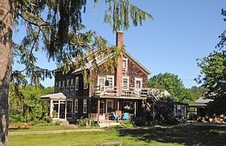
The Austin Farm Road Agricultural Area is a rural historic district in Exeter, Rhode Island. The district is bounded on the east by Interstate 95, on the north by the town line, on the south by Austin Farm Road, and on the west by a north-south line through Austin Farm Pond. This agricultural area is relatively little altered since the late 19th century, despite the proximity of the interstate. It includes the farm complex built up by John Austin in the 19th century, which continues to see active use, and the site of an older farm complex, reduced to just the farmhouse, which predates Austin's acquisition of the property. In addition to the farm buildings, it includes a chapel and school house built or maintained by Austin.

The District Schoolhouse No. 2 is a historic school building on Old Post Road in the Cross Mills section of Charlestown, Rhode Island. The single-story Greek Revival structure was built c. 1838, and originally stood in the Quonochontaug area, before being moved to its present location in 1973. The schoolhouse is the best-preserved of Charlestown's eight 19th-century schoolhouses, and is now maintained by the Charlestown Historical Society.

Hallville Historic and Archaeological District is a historic district in Exeter, Rhode Island.

Hillsdale Historic and Archeological District is a historic district in Richmond, Rhode Island. The district was added to the National Register of Historic Places in 1980. It represents the site of the former textile mill village of Hillsdale.

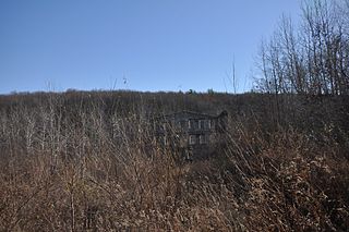
Lawton's Mill is a historic mill located on Ten Rod Road in Exeter, Rhode Island. The mill property includes an 18th-century house, an early 19th-century wood-frame mill building, and a 19th-century barn with early 20th-century additions. Also surviving from the period of the mill's activity are dams and waterways associated with it, including a dam and raceway extending several hundred feet north of the mill building. The mill building, which was built c. 1820, is one of a very small number of mill buildings to survive from the period in Rhode Island.

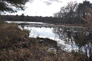
Parris Brook Historic and Archeological District is a historic district in Exeter, Rhode Island. The area includes remains of 18th- and 19th-century mill complexes, as well as prehistoric Native American rock shelters. It is mostly located in the Arcadia Management Area, a natural preserve managed by the state, and on adjacent private land.
Sodom Mill Historic and Archeological District is a historic district in Exeter, Rhode Island. It includes the foundational remnants of a small early-19th century mill complex, including a dam and raceway, as well as the ruins of several 19th-century dwellings. The oldest mill on the site was built in 1814.
The Meadows Archeological District is a complex of four prehistoric archaeological sites in Warwick, Rhode Island. Discovered in 1980, the sites exhibit properties associated with the procurement and processing of stone tools. Three of the four sites include evidence of short-term habitation, and all four have shell middens. Occupation periods from the Archaic to the Woodland Period have been assigned to them. The district was added to the National Register of Historic Places in 1982, cited for its potential to yield new information about prehistoric Native patterns of living.

Tillinghast Road Historic District is a historic district encompassing a rural landscape in East Greenwich, Rhode Island. Extending along Tillinghast Road, a winding two-lane road, southward from its junction with Frenchtown Road, it includes seven farm complexes dating back to the late 18th and early 19th centuries. One of them, the Thomas Tillinghast Farm, located at the above-named junction, is the site of the New England Wireless and Steam Museum, some of whose buildings contribute to the district's significance.

The Exeter Waterfront Commercial Historic District encompasses the historic commercial and residential waterfront areas of Exeter, New Hampshire. The district extends along the north side of Water Street, roughly from Main Street to Front Street, and then along both sides of Water and High streets to the latter's junction with Portsmouth Street. It also includes properties on Chestnut Street on the north side of the Squamscott River. This area was where the early settlement of Exeter took place in 1638, and soon developed as a shipbuilding center. The district was listed on the National Register of Historic Places in 1980. It was enlarged in 1986 to include the mill complex of the Exeter Manufacturing Company on Chestnut Street.
This is a list of Registered Historic Places in Exeter, Rhode Island.


