
The Barre Downtown Historic District encompasses the historic commercial and civic heart of the city of Barre, Vermont. Extending along Main Street from City Park to Depot Square, this area was developed quite rapidly in the 1880s and 1890s, when the area experienced rapid growth due to the expansion of the nearby granite quarries. It was listed on the National Register of Historic Places in 1979.

The Downtown Concord Historic District encompasses most of the commercial heart of downtown Concord, New Hampshire, United States. Incorporated in 1734, Concord became the state capital in 1808 and the seat of Merrimack County in 1823. Economic growth followed, due in part to these government institutions and also to the rise of industry along the Merrimack River, which flows through the city east of the downtown area, and the arrival in the 1840s of the railroad. The New Hampshire State House was built in 1819 south of the traditional center of the city, and the commercial heart of the city began to take shape along the First New Hampshire Turnpike south of the State House. The district was listed on the National Register of Historic Places in 2000.
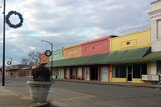
The Lake Village Commercial Historic District encompasses the historic commercial heart of Lake Village, Arkansas, the county seat of Chicot County in the Mississippi River delta region of southeastern Arkansas. The district covers about six square blocks of downtown Lake Village, bounded roughly by Jackson Street to the north, Lakeshore Drive to the east, Church Street to the south, and Chicot Street to the west. This area represents the growth of Lake Village during its period of greatest prosperity, between 1906 and 1960. The city's growth was spurred by the arrival of the railroad in 1903, and most of the district's buildings were built between 1900 and 1930. Most of the buildings are vernacular commercial buildings; the John Tushek Building at 202 Main Street is one interesting example of Beaux Arts styling, and 218–222 Main Street has some Italianate styling. The district includes the Lake Village Confederate Monument, which has been a local landmark since 1910.

The El Dorado Commercial Historic District encompasses the historic commercial heart of downtown El Dorado, Arkansas. The city serves as the seat of Union County, and experienced a significant boom in growth during the 1920s, after oil was discovered in the area. The business district that grew in this time is anchored by the Union County Courthouse, at the corner of Main and Washington Streets, where the Confederate memorial is also located. The historic district listed on the National Register of Historic Places in 2003 includes the city blocks surrounding the courthouse, as well as several blocks extending east along Main Street and south along Washington Street. Most of the commercial buildings are one and two stories in height and are built of brick. Notable exceptions include the Exchange Bank building, which was, at nine stories, the county's first skyscraper, and the eight-story Murphy Oil building. There are more than forty contributing properties in the district.

The Charlotte Street Historic District encompasses a historic residential subdivision in Fordyce, Arkansas. The district extends along Charlotte Street between Holmes and East 4th Streets, and includes a few properties on Broadway, as well as the remaining grounds of the estate of A. B. Banks, an insurance company owner who oversaw the area's development in the 1920s. The area originally consisted of a large tract of land outside the city, which was annexed to it in 1906. Charlotte Street was named for Banks' wife, and he had a handsome estate house built on this land which was designed by Charles L. Thompson, which burned in 1964. Many features of the estate, located between Broadway and East 4th, have been retained, including an inground swimming pool that was supposedly the first private pool in the state.

The Cotton Belt Railroad Depot is a historic railroad station at the junction of Main and 1st Streets in downtown Fordyce, Arkansas. The single-story brick building was built c. 1925 by the St. Louis Southwestern Railway, also commonly known as the Cotton Belt Railroad. The building is predominantly Craftsman in its styling, with extended eaves that have elaborately styled brackets.

The Nutt–Trussell Building is a historic commercial building at 202 North Main Street in downtown Fordyce, Arkansas, USA. Built in 1883, this two-story structure was the first brick building erected in Fordyce, a railroad town in southwestern Arkansas. Its exterior was covered in stucco c. 1920. It was built by Robert Nutt, who operated a dry goods shop on the premises. It later housed the Bank of Fordyce, and its upper floor has a long history of use for social club meetings, and also housed the city's first telephone exchange. The descendants of L. L. Trussell, a later owner, gave the building to the city in 2000 for use as a local history museum.
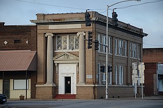
The Prescott Commercial Historic District encompasses the historic commercial core of Prescott, Arkansas, the county seat of Nevada County. Prescott was laid out in 1873, after the railroad was built through the area that is now Nevada County, and the railroad has played a significant role in the city's development. The railroad today bisects the commercial core of the city, which extends for several city blocks away from the railroad. The historic district includes all of the major civic buildings of the city, including the courthouse, post office, and the old Prescott City Jail.

The Hope Historic Commercial District encompasses a two-block area of downtown Hope, Arkansas. The 18-acre (7.3 ha) district is bounded on the north by the railroad tracks, on the east by Walnut Street, the west by Elm Street, and the south by 3rd Street. The area consists for the most part of commercial brick buildings one or two stories in height, with relatively plain styling. Most of these were built between 1880 and 1945, the major period of Hope's development. The most architecturally significant buildings in the district are the Brundidge Building, an 1893 Romanesque Revival structure, and the Renaissance Revival former post office building.

The Nashville Commercial Historic District encompasses much of the historic downtown commercial area of Nashville, Arkansas, and the major commercial center in Howard County. It is centered at the junction of Main and Howard Streets, extending eastward along East Howard, and north and south along Main Street for about one block. Most of the buildings in the district are tall single-story brick structures, some covered in stucco. They were built between about 1895 and the 1930s, with a smaller number appearing later. The area's economic activity was driven first by the arrival of the railroad, which defined the layout of the town, and then by the growth of lumber and agriculture in the region. The oldest building in the district is 203 North Main, built c. 1895 with modest Romanesque Revival styling.

The DeWitt Commercial Historic District encompasses part of the historic downtown of De Witt, Arkansas, the seat of the southern district of Arkansas County. It consists of roughly six square blocks, focused on Courthouse Square, location of the Southern District Courthouse. This area was platted out when De Witt was established as the new county seat of Arkansas County in 1854, replacing the Arkansas Post, which was not centrally located within the county after numerous other counties had been carved out of its territory. The city's growth remained modest until the arrival of the railroad in the 1890s, and saw most of its civic growth between then and the 1920s. The district includes 54 historically significant buildings, 32 of which face Courthouse Square. The oldest buildings in the district lie just north of Courthouse Square, either facing the square or in North Main or Gibson Streets.

The Paragould Downtown Commercial Historic District encompasses the historic central business district of Paragould, Arkansas. The city was organized in 1882 around the intersection of two railroad lines, which lies in the southwestern portion of this district. The main axes of the district are Court and Pruett Streets, extending along Court from 3½ Street to 3rd Avenue, and along Court from King's Highway to Highland Street, with properties also on adjacent streets. Prominent in the district are the 1888 Greene County Courthouse, built during the city's first major growth spurt. Most of the district's buildings are one and two stories in height, and of masonry construction. The National Bank of Commerce Building at 200 S. Pruett is a notable example of limestone construction, and of Classical Revival styling found in some of the buildings put up during the city's second major growth period in the 1920s.

The Walnut Ridge Commercial Historic District encompasses the historic town center of Walnut Ridge, Arkansas, the county seat of Lawrence County. The district includes a four-block stretch of Main Street on the northwest side of the railroad tracks, and extends for one and sometimes two blocks on either side. Walnut Ridge was founded as a railroad town in 1875, and soon became a leading economic center in the county. Most of its historic downtown consists of vernacular commercial architecture dating to the late 19th and early 20th centuries, built of masonry and brick, and one or two stories in height. Notable buildings include the 1924 Swan Theatre at 222 West Main Street, the 1935 Old Walnut Ridge Post Office at 225 West Main, and the 1965 Lawrence County Courthouse at 315 West Main, which replaced a c. 1900 structure.

The Cotton Plant Commercial Historic District encompasses the historic civic and commercial center of the city of Cotton Plant, Arkansas. It includes about two blocks of Main Street, between Elm and Ash on the south side, and between Pine and just short of Vine on the north side. The district includes 19 historically significant buildings dating, most of which were built between about 1900 and 1930. The town grew as a railroad shipping center for cotton beginning in the 1880s, but major fires in 1901 and 1924 devastated parts of its downtown, resulting in a large number of early 20th-century commercial brick buildings.

The Batesville Commercial Historic District encompasses about four city blocks of the historic downtown of Batesville, Arkansas. This area's current appearance is largely the result of development between about 1880 and the 1940s, although it includes a portion of Arkansas' oldest platted Main Street, dating to 1821. When originally listed on the National Register of Historic Places in 1982, the district included 25 historic properties on two blocks of Main Street, on either side of Central Avenue, as well as a few properties on Central. In 1990 the size of the district was more than doubled, adding two more city blocks on Main Street and 36 buildings. Most of the buildings are brick and masonry commercial structures, two stories in height, with party walls joining them at the sides.
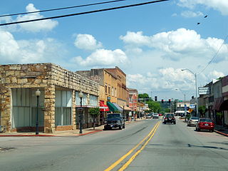
The Ozark Courthouse Square Historic District encompasses the historic late 19th-century center of Ozark, Arkansas. It includes an area two blocks by two blocks in area, bounded on the west by 4th Street, the north by West Commercial Street, the east by 2nd Street, and the south by West Main Street. Most of the buildings in the district were built between about 1890 and 1930, a period of significant growth occasioned by the arrival of the railroad, and are built either out of brick or locally quarried stone. Prominent buildings include the Franklin County Courthouse and the Bristow Hotel.
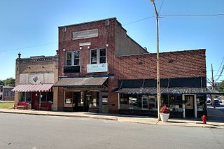
The Lonoke Downtown Historic District encompasses a portion of the central business district of Lonoke, Arkansas. It extends south along Center Street, from the Lonoke County Courthouse to Front Street, and then one block east and west on both sides of Front Street. It extends eastward on the south side of Front Street another 1-1/2 blocks. Lonoke was founded as a railroad community in 1862, and this area represents the core of its downtown area for the period 1900–1945. Most of the district's 23 buildings are commercial structures, one to two stories in height, with brick facades.

The Russellville Downtown Historic District encompasses an eight-block area of downtown Russellville, Arkansas. This area, developed primarily between 1875 and 1930, includes the city's highest concentration of period commercial architecture, a total of 34 buildings. Most of them are brick, one or two stories in height, and in a variety of styles. The district is roughly bounded by Arkansas and West 2nd Streets, El Paso Avenue, and the Missouri-Pacific Railroad tracks.

The Waterville Main Street Historic District encompasses the best-preserved portions of the historical commercial downtown area of Waterville, Maine. Developed most intensively in the late 19th and early 20th centuries, this area was the center of commerce for Waterville and the surrounding rural communities. It encompasses 25 properties on Main and Common Streets, including the Waterville Opera House and City Hall. It was listed on the National Register of Historic Places in 2012, and was slightly enlarged in 2016.
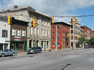
The St. Albans Historic District encompasses most of the historic commercial core of the city of St. Albans, Vermont. The district includes the historic town common, which acts as its focal center, and commercial and civic architecture dating from the early 19th to early 20th centuries. The district was listed on the National Register of Historic Places in 1980.


