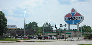
LaSalle Park is an integral part of the three-neighborhood "Old Frenchtown" area—LaSalle Park, Lafayette Square and Soulard—bordering the southern edge of downtown St. Louis. It was formed as a "new" neighborhood, legally distinct from the larger Soulard district, through the efforts of local company Ralston Purina, which has its world headquarters in LaSalle Park, and the city of St. Louis, Missouri.
Wydown/Skinker is a neighborhood in St. Louis, Missouri. Washington University in St. Louis is located just north of this neighborhood. The neighborhood is bounded by the city limits on the west, Forsyth Boulevard on the north, Forest Park on the east, and Clayton Avenue on the south. The Missouri Historical Society Library & Research Center is located in the Wydown/Skinker neighborhood.

Clifton Heights is a neighborhood of St. Louis, Missouri, US, located along the southwest border of the city and highlighted by a park — Clifton Park (38.6143°N 90.2916°W) — with a playground and a lake.

Dutchtown is a neighborhood of St. Louis, Missouri. It is called "Dutch" from Deutsch, i.e., "German", as it was the southern center of German-American settlement in St. Louis in the early 19th century. It was the original site of Concordia Seminary, Concordia Publishing House, Lutheran Hospital, and other German community organizations. The German Cultural Society still has its headquarters there. St Anthony of Padua Catholic Church towers over the neighborhood and is a symbol of the neighborhood.

Forest Park Southeast (FPSE) is a neighborhood of St. Louis, Missouri. It is bordered by Interstate 64 to the north, Vandeventer Avenue to the east, Interstate 44 to the south, and Kingshighway Boulevard and Forest Park to the west. Adjoining neighborhoods include Kings Oak and The Hill to the west, Southwest Garden to the south, Botanical Heights to the southeast, Midtown to the east, and the Central West End to the north.

Fountain Park is a neighborhood of St. Louis, Missouri. Originally the Aubert Place subdivision, it was laid out by John Lay in 1857. The Fountain Park neighborhood is located in north St. Louis with Martin Luther King Drive on the north, Delmar Boulevard on the south, Walton Avenue on the east, and Kingshighway Boulevard on the west. It is just two blocks north of the Central West End (CWE) of the city. The Fountain Park neighborhood is named after Fountain Park, a small oval shaped city park near its center. A Martin Luther King Jr. statue sculpted by Rudolph Edward Torrini is situated on the west side of the park.
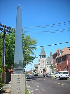
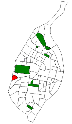
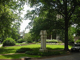
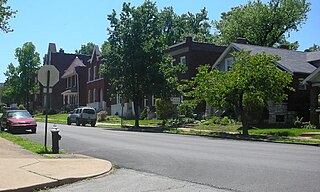
The Gate District is a neighborhood of St. Louis, Missouri. The Gate District is defined as the area between Chouteau Avenue and Interstate 44 on the north and south and between South Jefferson Avenue and South Grand Boulevard on the east and west. This area is just south of the central corridor and west of Lafayette Square. The term Gate was added to define this neighborhood due to the number of ironclad gates lining the streets. Today, the neighborhood is the subject of increased gentrification.
Gravois Park is a historic neighborhood of St. Louis, Missouri. Roughly bounded by Jefferson Avenue, Chippewa Street, Grand Boulevard and Cherokee Street, the Gravois Park neighborhood is a diverse mix of homeowners, renters and businesses. The area's architecture reflects its settlement at the turn of the 20th century. The park itself dates from 1812, and was praised for its beauty in the nineteenth century already, and in 1914 was part of a walking tour of the city meant to show off the City Plan Commission's "idealized view of the shape of the city."
Hi-Pointe is a neighborhood of St. Louis, Missouri, within a section known as Dogtown. It is bounded by Clayton Avenue and Oakland Avenue on the north, City Limits on the west, Dale Avenue on the south, and Louisville Avenue on the east. It is bordered by the Skinker-DeBaliviere neighborhood and Forest Park on the north, the Clayton-Tamm neighborhood on the east, the Franz Park neighborhood on the south and the city of Richmond Heights, part of St. Louis County on the west.

Holly Hills is a neighborhood located in South St. Louis, Missouri, near the intersection of I-55 and Loughborough Avenue. The neighborhood is defined by Bates and Walsh on the Northeast, Holly Hills on the Southwest, Morganford St on the Northwest and Grand Boulevard on the Southeast. It is surrounded by Carondelet Park and the Boulevard Heights, Bevo Mill, Dutchtown and Carondelet neighborhoods.

Skinker DeBaliviere is a neighborhood of St. Louis, Missouri located directly north of Forest Park. In addition to the park, its boundaries are Delmar Boulevard to the north, DeBaliviere Avenue to the east, and the western city limits. It is home to The Pageant, Pin-up Bowl, and all the other establishments of the Delmar Loop east of University City. It also includes the Delmar Loop, Forest Park – DeBaliviere, and Skinker MetroLink stations. In 1978, it was designated a Local Historic District by the City of St. Louis, and the private subdivision of Parkview is listed in the National Register of Historic Places.

Kings Oak is a neighborhood of St. Louis, Missouri. The neighborhood is named for two of its streets that make up the neighborhood's boundaries. "Kings" comes from Kingshighway Blvd., the neighborhood's eastern border and "Oak" comes from Oakland Ave., the neighborhood's northern border. The neighborhood has a relatively low population and population density because Saint Louis University High School and the Saint Louis Science Center are located in this very small neighborhood. There are also some industrial businesses along Manchester Ave., the neighborhood's southern border. This leaves little room for houses, most of which are located on the neighborhood's eastern edge.

Botanical Heights is a neighborhood of St. Louis, Missouri. Its former name was McRee Town. The Botanical Heights neighborhood is defined by Chouteau Avenue on the North, Interstate 44 on the South, 39th Street on the East and Vandeventer Avenue on the West. This near Southside neighborhood is located just north of the Shaw neighborhood.
Mount Pleasant is a neighborhood of St. Louis, Missouri. The neighborhood's boundaries are defined by Compton Avenue on the west, the Mississippi River on the east, Meramec Street on the north, and Eichelberger Street on the south. The Mount Pleasant neighborhood is home to several landmarks, most notably St. Anthony of Padua Church and Mount Pleasant Park. Mount Pleasant Park is a major attraction to the neighborhood. It features a unique outdoor roller hockey rink in the southwest corner in addition to various standard playground equipment.

North Hampton is a neighborhood of St. Louis, Missouri. Located in Southwest City, North Hampton is bounded by Scanlan and Connecticut to the north, South Kingshighway Boulevard to the east, Chippewa Street to the south, and Hampton Avenue to the west.

Patch is a neighborhood of St. Louis, Missouri. The Patch neighborhood forms the southern tip of the Carondelet neighborhood. It is defined by Robert Avenue on the north, the City Limits to the south, Alabama Avenue to the west, and by the Mississippi river to the east.

Penrose is a neighborhood of St. Louis, Missouri. The Penrose neighborhood is split with half of it in the city's 21st Ward. and the other half in the city's 1st Ward. The neighborhood is located on the north side of the city just south of Interstate 70 and west of O’Fallon Park. It is bounded by Florissant Avenue and I-70 on the north, Natural Bridge on the south, North Newstead and Pope Avenue on the east, and Kingshighway Boulevard on the west.

Tiffany is a neighborhood of St. Louis, Missouri. It is located on the western side of Grand Boulevard along the section containing St. Louis University's Medical Complex. The neighborhood is defined by Chouteau Avenue on the North, Interstate 44 on the South, Grand Boulevard on the East, and 39th Street on the West.

Visitation Park is a neighborhood of St. Louis, Missouri. The neighborhood is defined by Maple Avenue on the North, Delmar Boulevard on the South, Union Boulevard on the East, and Belt Avenue on the West. Visitation Park is a small neighborhood nestled southeast of the West End neighborhood, just north of DeBaliviere Place.

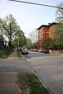
Clayton-Tamm, also known as Dogtown, is a historic St Louis neighborhood and once an Irish-American enclave located near the western border of St. Louis, Missouri, USA, just south of Forest Park.